So you wonder what I'm doing now? A small sampling of what I've done this winter:
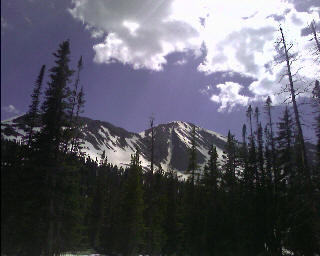
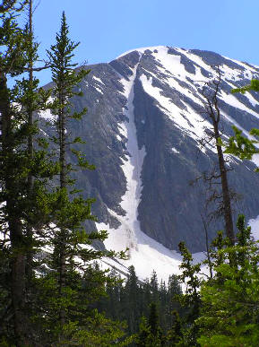
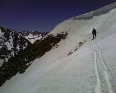
Savage Peak couloir climb. It's not really winter—actually, it's the last weekend of June,
but it feels great to still be able to
play in the snow.
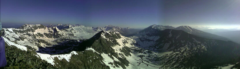 |
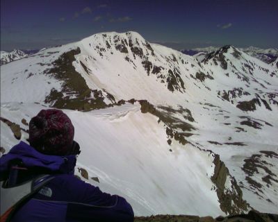
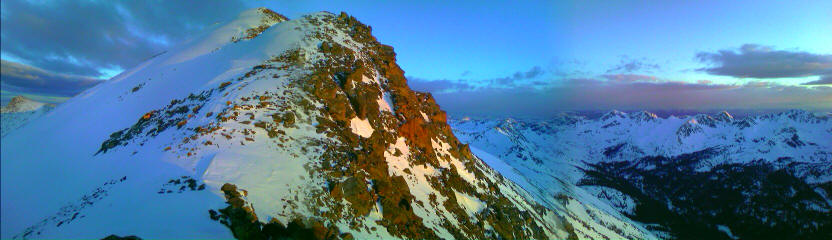
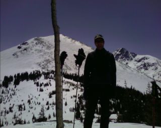
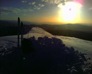
| The view north from the summit (Avon's back there about 17 miles away). From the left there's Fool's Peak, Charles Peak, New York Mtn, Mt Jackson, Middle Mtn, Grouse Mtn, Mt. Holy Cross, and Mt. Whitney. |
Journey to the Northwest Sky - June
2008
Well, it all started out at the Eharmony dating site. After viewing a description of her a couple months back, she seemed a little different. I realized she wasn't your typical Sally Suburban or Samantha Shopaholic type. We started the emails, the phone conversations, planned an overnight backpacking trip or two, a couple days along the Oregon Coast, and even a snow climb she was interested in. My airline tickets to Portland were soon in hand, and I was ready for a week of adventure and romance. With a week left until my departure from one adventure oriented town to another, I called her to plan some last minute details. I was headed to the great Northwest for the first time, to gaze upon the spectacular snow covered volcanic peaks, experience the infamous unsettled weather, and see the Mighty Columbia work its way to the sea. I hadn't gotten very far with the dating
website before, so this was exciting. She was really looking forward to expanding her comfort level and hiking some of the trails she'd drive by every day, but never did venture much further than the end of the parking lot. After a couple days of leaving messages, I tried her again. She answered the phone with a nervous tension in her voice I hadn't heard before. There was the stuttering of a few words, and a long pause. Something obviously isn't right. "What, you met another guy at a local hangout after I booked my flight? I'm supposed to be out there in a week!" I blurted out with disappointment. The conversation didn't last much longer, and I knew this was one of those risks associated with dating someone over the phone. Well, I could get upset, or angry; I could make a call and make the two of us miserable. But what would that really accomplish? I now have these airline tickets in hand, and time off work. I could simply stay here in our happy valley and pretend this never happened, but I wouldn't do that if my life depended on it. I'm outta here.
I've never been to the Northwest before, and they have record snowfall. My life is controlled by an incurable, powerful addictive drug. It's torn me away from the mainstream, destroyed my capability of ever living a normal life, and is seldom understood outside of ski towns. It consists of two parts hydrogen and one part oxygen—the drug is known as snow. Alright, this is going to be great! The closest I've been to a volcano is the Dotsero Crater. After removing some clothing and adding some climbing gear to my bag, I was off to Denver. As the plane started its descent into Portland, I could see the colossal Mt. Hood shining sentinel over a mile above the surrounding landscape. I didn't bother with the hassle or expense of renting a car. After almost five months thru-hiking Continental Divide Trail last summer, and hitching a ride to get into towns along the way for resupply, putting my thumb out to get somewhere was in my blood. From the snow-choked western flank of Mt. Hood to the coast, the weather was grim. There were low clouds and fog spitting out a steady mist into the murky grey air as the plane landed. Surprisingly, this supposed date of mine still offered to pick me up at the airport, and I happily accepted. We stopped for lunch to have a discussion, and then continued on to the town of Hood River. The clouds slowly thinned as we followed the snaking highway stretched out ahead of us, and the sparkle of the mighty Columbia River glimmered to our left. She pointed out a few landmarks I needed to visit in town, let me store my luggage in her garage, and dropped me off at some intersection at the end of town.
Some years ago, I read an article on a few websites dedicated to helping people find locals from around the world with a place to stay—better known as couchsurfing. After getting the bad news a week ago, I started my online search of where to stay, and posted my battery of questions on what to do in town. A day or two before my departure, I had a general idea, but not much more; except for a place to stay the first few nights. And it looks like I'm hitching a ride to Government Camp.
Not more than fifteen minutes later with my thumb out, I had a ride. After a few bends on the winding highway, there she was, in all her bright glory.
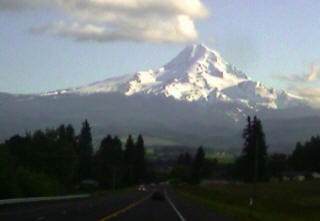 Mt. Hood |
I gave Jeff, my couchsurfing connection, a call, and tromped over to the local bar he worked at as the sun dipped behind Mt. Hood. He had used the couchsurfing website recently to find housing connections on his travels through New Zealand a while back. The small bar also had Wi-Fi access, and I used it to pull up the aviation forecast for 9,000ft. on my phone. There was an upper level low off the West Coast with strong winds, but fortunately it showed no sign of doing any damage around here. Jeff took me to his place; a three story house, two roommates, and several small remodel projects here and there. The garage was full of one housemate's belongings, draped about as it dried from a two and a half week river trip. He showed me my "room", a loft with a mattress, looking out into the yard with over three feet of snow still on the ground (the town, aptly named "The Govy" sits at an elevation of 3,000ft). I emptied out my pack and excitedly sorted my gear for tomorrow's climb of Oregon's highest point.
I left Government Camp in the morning and put my thumb out for a ride to the Timberline Lodge Ski Area. By the time I arrived at the ski area, the temperature was very warm, and I didn't feel like climbing seven thousand feet in the hot sun. I checked out the day lodge, full of ski teams from around the country training for next season's races. I walked over to the historic Timberline Lodge and took a guided tour from some Forest Service volunteers.
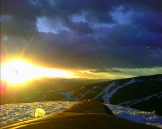
At 3pm, I figured this was a good time to head up the mountain a little ways. I threw my skis on the snow, and started the long slog up to the lava dome. I passed a snowcat, busily spreading salt on the slopes to preserve the snow. The summit slowly grew larger as I inched my way closer to the lava dome. The snow held clues to other adventurer's routes with an old skin track, several snowshoe tracks, and the occasional animal track slowly succumbing to the effects of new snow and wind. I took a few compass bearings of my route down—knowing full well a small cloud cap could turn the straightforward climb into a frightening struggle to find the base area as it's sheathed in a white ribbon of fog. As I approached the Hogback, Illumination rock and the entire crater rim were draped in a brilliant alpenglow as I plodded my way up. I paused at Devil's Kitchen, a fumarole with a kaleidoscope of colored dirt, as it sputtered sulfur and steam into the cool air. There was the constant crackle of rime ice as it plunged into the adjacent White River Glacier from the vertical cliffs that form the crater walls of the inactive volcano. I reached the base of the Hogback and adjusted the heel lift on my skis. I slowly switchbacked up to the ridge and traded my skis for crampons. The lava dome was belching an occasional puff of sulfur as I booted along the knife edge ridge. The usually well traveled Pearly Gates route was impassable—sealed shut with dozens of feet of snow from this winter's assault. I followed the bootpack route that scurried up below and around the rim and through the steep West Gates. The bootpack created by the other climbers made the seemingly vertical plunge-step ascent uncomplicated and hasty. The last of the sun's rays slowly sank behind the horizon as I started the climb up to the summit bench. The wind was still near calm, and the lights of Portland twinkled out on the horizon. I built a snow wall just below the summit to shield me from the relentless winds that can scour the area at a moments notice. I was awakened in the middle of the night from a strong gust of wind that sent a dull roar echoing through my camp. The skyglow from Portland, and the endless stars splashed above me vanished as a cloud cap wrapped itself around the summit. I became concerned as the thick blanket of fog hung over me like a damp towel, dabbing me with a wet wind. The moderate breeze slowly melted away to nothing as the eastern horizon erupted into a firey, red glow. I gazed at the rising sun in one direction, and in the other the distinct, looming shadow cast by the volcano onto the valley floor below.
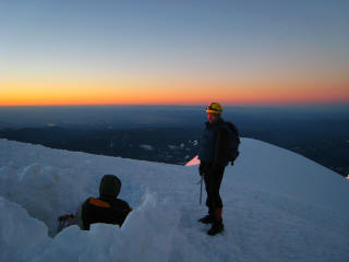  |
| Camping on the summit of Mt. Hood |
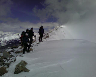
I listened to the faint crunch of footsteps slowly growing louder from behind, like the approach of a train from many miles away, as two climbers approached the summit. They gave me a brief blank stare when they peered over the wall and saw my camp. We took some photos of each other, shared congratulations, and I watched them as they began their almost eight thousand foot descent into the abyss. I met several others as they completed their summit climb that started in the wee hours in the morning. I packed up my gear, knocked down my snow walls, donned my skis and kicked and glided my way down to the top of the crater rim. I peered over what looked like a near-vertical wall as I locked my heel down. I slowly sidestepped my way down the rough, steep West Gate, with my ice axe ready at a moments notice. Below the Gate, the terrain seemed to become ever steeper. The snow at 9am was as smooth and firm as steel. I carefully kick turned towards the Hogback and sidestepped down toward the bergschrund that lay down below me as a gaping hole in the snow. If it wasn't for Beaver Creek's World Cup Course I volunteer on every year, with its steep slopes groomed, shoveled, watered, and sideslipped to a frighteningly icy mirrorlike shine, I can't even imagine what would be going through my mind right now. I approached the bootpack trail and decided I had enough excitement on the cold, hard, shaded slopes. I downclimbed the hundred feet or so to the Hogback and peered over the edge. The snow was steep, but the early morning sun had warmed the surface, making for a delightful descent to Devil's Kitchen. I had a grin on my face that stretched from ear to ear. Despite being early morning, the descent to Timberline Lodge quickly turned into a slushy quagmire as I approached the ski lifts. I reached the lodge, grabbed my shoes, and quickly devised a plan for my next adventure. A couple locals mentioned a route from the base area to the town of Government Camp. The bottom portion of the mountain is closed for the season, and they weren't sure what the snow was like, or if there was even snow all the way to the bottom. I saw a rough idea of the route on a trail map, and asked a lift-op for advice. With a general idea of the way down, I decided to go for it. The snow was still plentiful, despite being at an elevation of less than four thousand feet in late June. As I neared the town, I found myself at another smaller ski area and skied to the side of the road. There were a couple people readying their skis with skins for a few turns in the wet snow. After a 7,745 foot descent on my skis, I put my shoes back on and hiked the half mile or so to the bar Jeff was working at. I received a few congratulations from the locals, and immediately started to plan the next day's ramblings. Will it be Mt. Adams, St. Helens, or maybe just enjoy the day windsurfing? I still have a four days, the snow conditions are amazing, and I have other peaks staring me in the face. I'm going to see what I can do.
I spent the following day planning a climb of Mt. Adams, which rises to lofty heights above the fertile farm lands of Washington State. I arrived in the evening and climbed until dusk as I reached timberline. I trudged on the next morning chatting with several others from around the country as the sun reached higher into the sky. It was another amazing climb, with crystal blue skies, and a warm sun beating down on me from ninety million miles away. I met a couple climbers from Denver near Lunch Counter, and we gazed at the endless horizon and started the long ski down. We celebrated our success at one of the many microbrews in Hood River, and parted our ways the next day. I tried some windsurfing the next two days, mountain biked some incredible trails with a local, and eventually returned to Portland. My "date" gave me a ride back to the airport, and the plan "B" I ended up with was spectacular. I felt like I was back on the CDT again; the people I met, landscapes I got to see, and terrain I was able to travel through. As I write this last paragraph almost a year later, I plan on returning to the area. This time I will start in Southern California, and slowly walk my way to the Columbia. Life is what you make of it, and that line is always ringing in the back of my mind. Amount spent on $4.50 a gallon gas: ziltch.
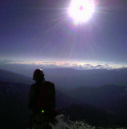
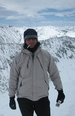
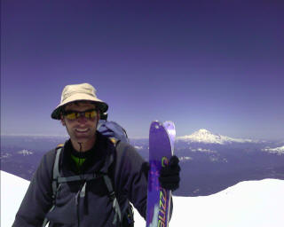 That's Rainier behind me (Mt. Saint Helens and Baker are calling. Darn, I wish I had a few more days!). |
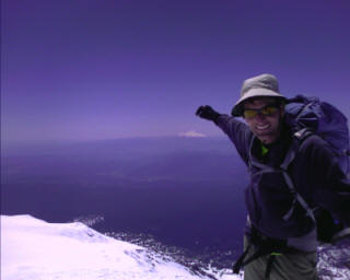 Pointing to Mt. Hood from the summit of Mt. Adams. |
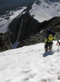
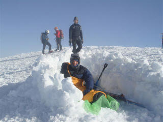
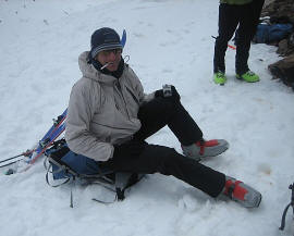
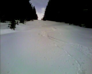
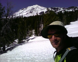 7,000 feet below the summit of Adams. |

 Epic mountain biking. Nope, I didn't ride the elevated features--I want to go home
in one piece.
Epic mountain biking. Nope, I didn't ride the elevated features--I want to go home
in one piece.
Skiing Independence Pass
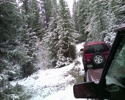 Torrey Peak via NW Couloir - the mid June epic trailhead access adventure

 Left/below-Memorial
Day Weekend - Mt. Jackson (camped on the summit at 13,670ft Saturday night) adventure; and
watched the sun rise above Beaver Creek Monday morning.
Left/below-Memorial
Day Weekend - Mt. Jackson (camped on the summit at 13,670ft Saturday night) adventure; and
watched the sun rise above Beaver Creek Monday morning.
 "Smoking"
a bubble gum cigarette near the top of Quandary Peak (it took me a little while
to look cool while doing it).
"Smoking"
a bubble gum cigarette near the top of Quandary Peak (it took me a little while
to look cool while doing it).
 Left-First weekend of
May. I was buried twice; six feet under for a avalanche dog certification on
Vail Pass. Skied to Vail the next day with 1.5-2 feet new snow. Right-May 10
powder day! I'm skiing the Commando Run again (I've lost count to how many times
I've skied it this season)
Left-First weekend of
May. I was buried twice; six feet under for a avalanche dog certification on
Vail Pass. Skied to Vail the next day with 1.5-2 feet new snow. Right-May 10
powder day! I'm skiing the Commando Run again (I've lost count to how many times
I've skied it this season)
Tigiwon Road to Notch Mtn. adventure
 Left-atop Bald Mtn. overlooking the Vail/Gore
Creek Valley Right-Vail Pass to Edwards via Commando Run, Battle
Mtn., Pipeline trail, Minturn, Meadow Mtn, Stone Creek, Beaver Creek, McCoy
Park, Edwards Water Tank, and finally, Edwards
Left-atop Bald Mtn. overlooking the Vail/Gore
Creek Valley Right-Vail Pass to Edwards via Commando Run, Battle
Mtn., Pipeline trail, Minturn, Meadow Mtn, Stone Creek, Beaver Creek, McCoy
Park, Edwards Water Tank, and finally, Edwards
I reached the top of Vail Pass before 6pm, with a light wind and fair skies. A
gust of wind would blast me in the face every now and then. I topped my way out
onto Shrine Pass. I skied a short downhill to Lime Creek Road and began the long
uphill to the top of Battle Mountain—which stretches from here to Highway
24. I reached a saddle above Commando Bowl, with strong winds whipping the
treetops around like a rag doll. As darkness approached, I continued up the
untracked road just shy of the top of the ridge and camped in the dense trees.
There was light snow falling, and swirling masses of snow blowing around from
the intense winds.
<p>Wit
destination: the Pipeline Road. I've heard about it, but never skied it; and
now's my chance. It's a narrow clearcut for a natural gas line that snakes its
way above the valley floor. The snow was smooth and soft for the first two
hundred feet of vertical, and then conditions turned for the worse. From here
down, it was like skiing through wet concrete—impossible to turn with my
straight-no-sidecut-skis, I had to jump turn my way down the several mile long
run to Two Elk Creek. Now beat up from the survival skiing, I had several more
miles to travel along the railroad grade to Minturn. The snow was wet, and
packed down by snowmobiles. My kick and glide was fast and smooth, allowing me
to reach the Saloon restaurant rather quickly. I stepped inside, with the usual
crowd of skiers celebrating their completion of the Minturn Mile off Vail
Mountain. I lead this trip for the Colorado Mountain Club each year, and because
of the winter camping part, don't receive any interest. So, I'm at it solo,
going at my own pace, stopping when and where I want, and enjoying the sounds of
nature all around me. The group I was talking to offered to take me to the
Ranger Station at the base of Meadow Mountain a few miles away. The thought of
not having to ski along the boring railroad tracks was a welcome thought.
Here
we go again, a long climb
to the top of Meadow Mountain. The skies were still overcast, with a light
breeze dancing around me. For the next couple hours the skies slowly darkened
and the winds grew in intensity as I reached the ridge. I darted for the trees
as the winds blew me around like a cork. <p>
OK, here we go again.
 It's the weekend again, and as usual, I want to go big,
and I don't want to sleep in a warm comfortable bed. On Friday, I received a
call from a friend eager to do a ski tour up in the Camp Hale area. "Of course
I'm interested" I replied. I spent the weekend before Christmas touring Wurtz
Ditch road from Crane Park to Yoder Gulch, now I want to finish off that road to
the end.
It's the weekend again, and as usual, I want to go big,
and I don't want to sleep in a warm comfortable bed. On Friday, I received a
call from a friend eager to do a ski tour up in the Camp Hale area. "Of course
I'm interested" I replied. I spent the weekend before Christmas touring Wurtz
Ditch road from Crane Park to Yoder Gulch, now I want to finish off that road to
the end.
We parked on the plowed, widened shoulder and climbed up the steep snowbank,
past the buried stop sign, and onto No Name Road. There was bright sun beating
down on us, and the occasional cloud rolling in from time to time. The road had
a few inches of new snow on the snowmobile tracks, giving us a smooth surface to
glide along as we wound our way towards the top of the ridge. We descended down
into the Homestake Valley, with a strong sun beating down on us. What was new
snow several hours ago was now a sticky glop cementing itself to our waxless ski
bases. the gentle downhill required considerable effort, and we stopped
frequently to knock several inches of sticky snow off our bases. The road took
an abrupt left, and we avoided skins and instead used the snow stuck to our
bases for traction. The road seemed to go on forever, wrapping around drainages,
and climbing up steep slopes as it reached the top of Yoder Gulch. We said our
goodbyes to each other, and I continued up through the dense forest into the
Holy Cross Wilderness. The clouds started to thicken as the sky grew dim. I
found a relatively sheltered place to camp among the krummholz at 11,600 feet. I
removed a little snow here, and added a little there to form a nice, flat spot.
My watch read -1°F at 11pm, but the winds died
down to zero, with a starry sky painted across the endless sky. The calm winds
the next morning quickly gave way to a steady breeze by early afternoon. I had
to remove my skis and climb up the rocky slope towards the summit of Homestake
Peak (13,209ft) in strong, gusty winds. Every now and then I would get tossed
around like a cork in the open ocean, struggling to stay upright. After a couple
false summits, I was there! I could see Homestake dam to the right, and the
mighty Sawatch Range all around me. Ok, time to get down. I skied the ridge down
to treeline, had a snack, and kicked and glided out to the highway. I threw my
thumb out to hitch a ride, and after a good half hour of waiting, I was on my
way back to my car in West Vail.
Left-Mt Guyot. Right-the Rockies Ruck
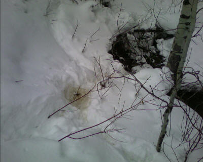

Avon to Davos/Lindholm Hill and back adventure via powerline road--and my first mountain lion sighting! As we laid eyes on each other, it slowly walked
away. It was hunched down in the brown spot in the snow.
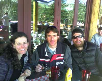
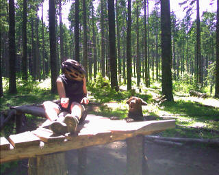
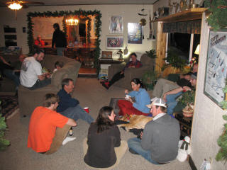
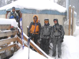
Hey,
it's NEMO and Pouch
(from the CDT)
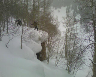
on their way back to Denver from Crested Butte! Oh yeah, and some idiot
friends debating whether to get some air.
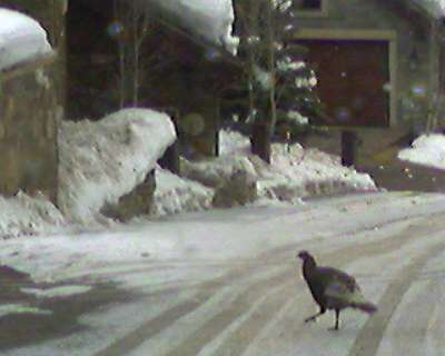 Wild
turkey in Beaver Creek!
Wild
turkey in Beaver Creek!
| I don't subscribe to stereotypes of snowboarders as disrespectful, but there's no question that they use a mountain's terrain differently." "If you've never seen a snowboarder wipe a steep, narrow chute clean of snow, kneel underneath a blind rollover or lay waste to a powder field that could have housed the untracked turns of a dozen skier, the you haven't spend much time in the mountains." —Michael Pearlman, sports editor of the Jackson Hole News & Guide |
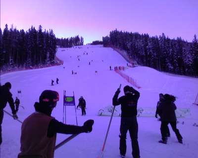 Beaver
Creek World Cup
Beaver
Creek World Cup