Ashland, OR
I end up at the old Highway 99 and follow the pavement towards the Interstate 5 onramp. As I approach the overpass, a pickup pulls over, and Norm offers me a ride to town. Not quite knowing where to go, I stop at the first fast food joint. I Spy and Booty! They're headed next door for breakfast, and I join them, enjoying a gigantic
omelet at the busy breakfast place. I take a quick shower at their place—fully clothed—and now look and feel somewhat presentable as I begin my travels through town. They head out to hitch a ride back to the trail, and... there's Mike and Naomi! I take the extra bed in their room, and we head out—in her parent's car— to the center of town. I enjoy an all-you-can-eat lunch at an Indian restaurant with Bams and Man Down, and limp my way to the creekside park nearby. It's quite warm out today, and I find a shady place on a park bench, take off the shoes and socks, and type away, catching up on journals with the roar of traffic on the busy viaduct above. I head over to meet Norm, the computer consultant who gave me the ride to town, at work, and spend time on a spare computer checking emails and uploading my journals to my website. I meet Mike and Naomi, and her parents, for dinner a bit later as the sky starts to spit out some wind and rain. We get back to the room and I nervously check out my right foot. For the first time on the trail, the area around my navicular bone is swollen.
Stage I may respond to rest, such as a walking cast. Pain and inflammation may be controlled with anti-inflammatory medications. It is important to be sure that Stage I patients realize that the use of shoes with additional arch support and heel elevation, for the rest of their lives, is imperative. Arch support, whether built into the shoe or added as an orthotic, helps support the posterior tibial tendon and decrease its' work. Elevation of the heel, reduces equinus, one of the most significant contributing factors to PTTD. If Stage I patients return to low heels without arch support, PTTD will recur. —Myfootshop.com |
I head down to the motel's laundry room to pick up my clothes, and... hmmm, there's a couple pair of disgusting, smelly shoes outside that room; covered in an inordinate amount of dirt, soles are probably full of poison oak, holes worn on the sides from detrition, punishing trail abuse, and expanding feet. I pass by the door, crowded with four hikers. Blackfoot, Trainwreck, Moneyshot, and Vagisil all stare over at me, noticing an absence of the frowzy, unkempt beard that I've finally whacked off. They're all smiles as they arrive, and start settling in as the unsettled, angry sky decides what kind of weather to dish out. Blackfoot and I break out in a brief laugh as we see each other clean shaven for the first time—which I won't do again until the Washington State Line. I give my pack a quick wash in the shower, and it's time for lunch. I see Bams, Bob Dole, and Ido in town, and we enjoy some filling pitas as the skies outside grow ever darker. I sit down at a bench on main street and start to build my own orthotic from an inexpensive drugstore bought brand, some moleskin, actually a lot of moleskin, an extra pair of stock insoles from a running shoe store nearby, and some cheap gel arches.
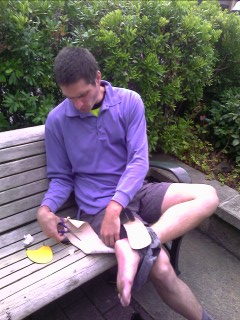 Building my own orthotics |
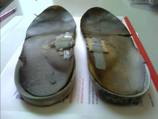 The old, tired ComfortFit orthotics with over 1,730 miles that have outlasted almost three pair of shoes |
The ground is wet from last night's rain, and the sky is filled with a thick blanket of dull clouds hovering over the rolling landscape. He drops me off at the trail on the way to work, and I head up through the soggy landscape. Tired and groggy eyed, like I usually am first thing in the morning, I sleepwalk the first several miles along the trail. Before I know it, I've done ten miles; another great reason I don't drink coffee. The wind is blowing through the treetops, absorbing water out of the fog like a sponge. I'm coated with a cool layer of water as I travel through the wispy clouds.
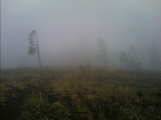 Good training for northern Oregon and Washington State |
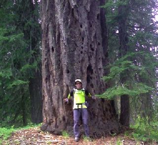 |
As late morning arrives, I see a hiker taking a break on a log. It's not a dayhiker, not a fellow northbounder I've seen before. Is it a southbound thruhiker? It is—the first southbound thru I've seen. Nomap started in mid June at Manning Park, BC, and he's working his way south to the Mexican Border. A few hours ago I was asking myself when I'm going to run into the first southbound thru hiker. It usually happens around Crater Lake, a few days north of here. As afternoon arrives, and the sun bumps its way to the top of the sky, my pace starts to slow considerably. I take a long break, typing away my journals, glancing at my handbook and maps, and getting water out of the well at Brown Mountain Shelter. I start along the trail again, moving with a slow gait and a limp as my legs warm up. The next ten miles still seem to go on forever as I follow the narrow, pumice rock covered trail surrounded by soccer ball sized rocks dotting the talus slopes. I find a flat, grassy spot in the trees, with the faint white noise of traffic headed down the highway to my north. I've already noticed several changes since I stepped into Oregon a few days ago. The twilight that used to hover over camp well past 9pm has disappeared. Now it's dark at nine. The bugs—mosquitoes, no seeums, flies, and gnats—they're gone too, unfortunately they'll probably be back in no time. The big ants that like to crawl over my belongings, my food, and me—no, they're still here. The ninety degree days and seventy degree nights? I'm glad it's almost mid August, those are disappearing too. The forest canopy has grown denser, and the shade feels great, but the I've hard the panoramic views will soon become few and far between.
I cross the highway near Fish Lake and continue through dense treecover. Without looking at my map, it's difficult to tell whether I'm on a high, broad ridge, or traversing along a plain; except for the fact that water sources are about every ten miles. I originally planned on hiking the scenic Sky Lakes Trail, but I'm trying to meet a lady I met back in Idyllwild who's a firefighter in Crater Lake NP. Also, it's a bit buggy out here today, and the mosquitoes in the Sky Lakes area would ruin that hike for me. As tempted as I am to slop this not-so-safe DEET stuff all over me, having it ooze through my skin into the bloodstream for the next several days doesn't appeal to me. I continue the usual swatting of my shoulders as the buzz-turn-bite of the noisy bugs continues. Okay, so I was wrong about the lack of views today as I wind my way over Devils Peak. The horizon is dotted with farms spread out like scattered confetti. As the western horizon turns into a subdued sunset, I see the first other people today, eating at camp, or noisily expressing their frustration with their stove. I find a small flat spot just off the trail as the sky turns dark.
My diet the last few days has been pretty simple; a small box of granola bars, a few packets of salmon and tuna, a couple small bags of cereal, 8,360 calories of a 3.5 pound bag of M&Ms, and 9,600 calories from 4 pounds of gorp/trail mix. Mike and Naomi have become tired of those last two items in every preplanned maildrop, so I gladly accept when offered the almost eight pounds of unopened food. Today I curse it. This stuff is starting to taste like rabbit dung. I'm out of everything else, and the repetitive, monotone flavor and texture has put me into a serious state of mind—a food mood state! I cruise the twenty miles with my less than three quarts of water to Crater Lake's Mazama Village for their all-you-can-eat (AYCE) lunch buffet by 1pm. On the way, I traverse a noisy mountainside filled with the raspy bark of a coyote echoing through the fire burned forest.
Crater Lake National Park
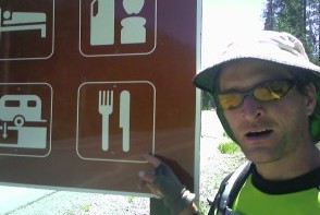 Food mood is setting in |
 Coyote and Chuck Norris |
I stop back into Annie Creek for breakfast, excited about the opportunity to load up on another AYCE buffet. There's a family at the adjacent table asking me the usual questions, and I find out they're from Denver—and even stayed in a vacation rental property I deal with at work, back in Vail, CO! As I start to work on replenishing my depleted energy reserves with heaping plates of eggs, sausage, bacon, and pancakes, I see Too Obtuse, and Mike and Naomi headed in my direction. We stumble out a while later, and return to the picnic tables outside the Mazama Campground Store. My goal today is to hike twenty miles to highway 138 near the north end of the Park, and hitch a ride back. As we lazily sit here enjoying each other's company, and watching tourists shuffle in and out of the store, exhausted after their long drive around the Rim, afternoon rolls around, and I think I'll do fifteen miles. Alright, I'm going to hike ten. It's evening now, and maybe hiking the four miles to the Rim will work. Forget it, I'm doing another AYCE dinner.
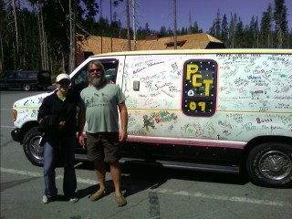
After almost killing myself with excessive food intake last night, I did it again for breakfast this morning. A van shows up later in the day, with the names of hikers scribbled all over the exterior—some simply write their trailnames on the side, most leave colorful signatures or elaborate drawings.
Well over a dozen other hikers roll in today, and some of us decide to hike the four miles to the Rim, and then hitch a ride back. Twelve Percent, Moneyshot, Chop Chop and I approach the Rim Road, and peer over the stone guardrail at the intense blue body of water a thousand feet below.
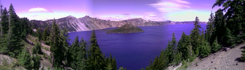 Crater Lake |
The grey, cloudy sky is upon us this morning, and fog occasionally darts over the Rim, sprinkling me with cold water as the wind whips the treetops around. Blackfoot spots a Bald Eagle I fail to find before it disappears behind a cliff.
 |
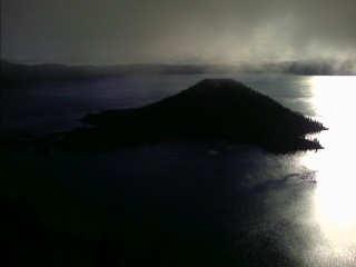 Wizard Island |
Blackfoot built a fire last night, the first time since the High Sierras almost two months ago. I struggle to break camp as my fingers numb in the 35° air. I struggle to keep up with my journals again as several of us stop for breaks during the last several days. I stop in a sunny spot near the Oregon/Washington high point this morning, and reminisce about the last several days as I warm my chilled fingers in the bright sun. It's 57° at 1pm, and never gets much warmer, perfect for hiking.
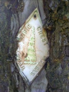 The old PCT diamonds |
I gaze at the brightly colored eastern horizon with Cowhorn Mountain and the distant Mt. Thielsen drenched in a spectacular kaleidoscope of alpenglow. There is thick frost covering the toe of my bag as last night's lows dipped below freezing. Later in the day, I gaze back towards Cowhorn Mountain and Thielsen Peak, tracing the route I've taken over the last three days.
 |
I'm up at the crack of 9:30 on this bright, sunny morning. I hear the high pitched cry of a bald eagle as gather my belongings and head the mile to highway 58. I head up the road to Willamette Pass and climb the stairs at the ski area lodge to the cafeteria.
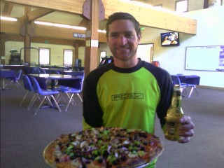 Breakfast of champions (or Sunday brunch) |
So what happened today? Hmmm... I passed one small creek today flowing out of a lake. Every other water source has been small lakes, actually most are more like ponds, with the trail zigzagging around on the gently rolling terrain. I listen to the whistling of the wind as it blows through a burn area I pass this morning. Today was thick forest with almost no views, but I still managed to get a quick glimpse of The Sisters on the northern horizon. I'm camped up on a ridge just over a mile high at 5,300ft. The mosquitoes are an absolute nightmare. I don't know where they're coming from, but I'm being wildly attacked from all directions. Dozens of them lie dead all around me as I add to the pile every few seconds. I have a nice bug net at home, but decided to tough it out, thinking they'd be gone in early August. For the most part, the last few weeks have been somewhat tolerable, with the occasional swarm buzzing around me when they have a chance to find out where I am, or the pack chasing me along the trail every now and then when I take a break. It's 9:30pm, and the dull, noisy buzz is still in the air, but waning fast. I'll see what kind of blood loss I suffer when I get up tomorrow.
I'm still alive, but the skeeters were around all night long. I began my trek by passing the last few ponds before entering the Three Sisters Wilderness. The terrain opened up with views stretching from horizon to horizon, with small, deep glaciers hanging tightly to the vertical walled peaks.
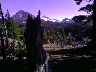 The Three Sisters |
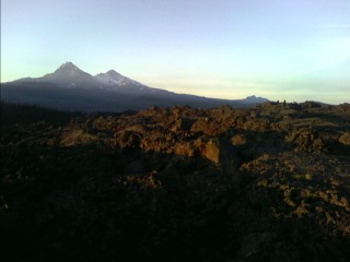 Hiking through the lava fields with The Sisters in the background |
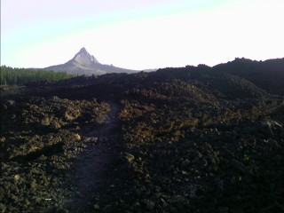 Mt. Washington |