Intro
Southern New Mexico - Mexican border to
Pie Town
Alright, so tomorrow's the big day, the day I've been planning on for what seems like eternity. Man, I'm really doing this! However, I have nothing but questions going through my mind right now, and I can feel the tension flowing through my body.
Two days before leaving on my hike, I rented out my condo. The day before my
hike, I found a summer home for my dog. Whew (I'm wiping sweat off my forehead
as I write this)! It's taken a long time to prepare, and starting to pay
off. I'm not worried or anxious anymore; now I can start to think about my hike. Today I was in the snow, and tomorrow I will be in 80-90 degree heat with nothing but barely operable windmills and stock tanks with green water for drinking. How am I going to feel after almost 100 miles of hiking through the Chihuahuan Desert without a town stop? I haven't even had a chance to try my new pack or trail shoes for anything other than a 30 minute walk. Should I use my trailname Skygod (most long distance hikers have trailnames). Will the desert give me blisters? Will the scant hipbelt padding on my pack rub my hips raw? (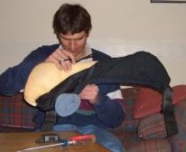 Left Inset: Taking my 10 year old Jansport hipbelt apart for extra padding. I hope this works.) From now on, I'll be typing my journals on my little UT Starcom XV6700 PDA/PocketPC device. Is this really going to work? As for my dog, I hope he enjoys his stay for the next several months. (
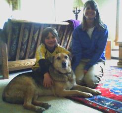 Right Inset: Shep enjoying his new home for the summer.) So many questions to ask myself, but on a four to six month journey, that should be expected. So many unanswered questions. I guess this is just one of those many twists and turns that will accompany me along the way. I can't even imagine what I'll be thinking on the drive down to the Border tomorrow. See you later, I'm going hiking (click here for advice on thru-hiking).
April 22, 2007
Well, today's it; I'm off to southern New Mexico somewhere. I've never been to this state before (or to Idaho, Montana, or north of I-80 in Wyoming for that matter). At 8am in Avon, there was several inches of new snow on the ground. By the time we reached Alamosa, temperatures were in the 50s. As we approached southern New Mexico, it started to hit me. My pulse rate started to go up, my adrenaline levels were being excited, and my head was full of thoughts. After wanting to do this for ten years, I was almost there, only another hour to go. As we turned up the dirt road that passes around the Big Hatchet Mountains, Hector asked me how many more miles. "About twenty" I responded. As the sun slipped behind the Little Hatchet Mountains, I could see a look of nervousness in his face. He still had to travel two hundred miles to El Paso, and didn't want to drive on a little traveled dirt road in the dark with no spare tire. "How about I drop you off here?" That's not exactly what I wanted to hear twenty miles from the trailhead, but I understood. I threw my pack onto the dirt road and watched the truck disappear into darkness.
Oh great, now what do I do? Where am I? There was a quarter moon casting a dim glow onto the road ahead of me. For the next several hours, I shuffled along towards the Mexican Border. I crossed
several foot deep creekbed washes hours later, and I arrived at one that would make a good place to camp, sheltered from the wind. My first night on the trail (although I haven't even officially started yet), and I spent half the night keeping a mouse out of my food bag. I threw rocks at it, I yelled at it, I even thought about moving camp. After an hour or so of keeping this animal at bay, the rustling sounds disappeared, and I fell asleep.
As the sun topped out above the horizon, the 40 degree temps quickly rose, allowing me to slip out of my sleeping bag. I packed up my gear, and noticed a small hole in my food bag. After all that work to keep the little critter away, it managed to accomplish its goal. It was only a small hole, with a pea sized chunk of bagel missing. I discarded part of the bagel, and then noticed a zipper pull chewed apart. I quickly gave my pack check for holes in the fabric. None. Good. As I finished packing, I noticed something else. My sunglass case was empty. I tore everything out of my pack, hoping it was put somewhere else during the mad dash to get out of the car. Nope, not here, not in that bag either. Oh *&%#! I'm in the completely treeless desert, not a single cloud in the sky, and I have no eye protection. Great. At least cataract surgery is a pretty straight forward process nowadays if I go blind. Despite looking under the back seat of the car before they left, the glasses are probably still there, camouflaged by the dark colored carpet.
About an hour into the hike along the dusty road that wound its way along the Big Hatchets, I saw a trail of dust rising from the road. Is it a border patrol, maybe a drug smuggler from Mexico? As the truck pulled up, I noticed Colorado plates, and they stopped. "Hi," said the two fine young ladies. "Are you just finishing your thru-hike?" "What?", I asked myself. I'm clean shaven, not a speck of dirt on me, almost all of my clothing is brand new, and my new backpack shines brightly in the sun. "Yes." I say with a grin. They smile back, noting my obvious lie. "Why don't you have any sunglasses?" they blurted out. I told them the story about the mad dash to get going so Hector could get back to pavement before darkness. They briefly looked at each other, and handed me a slightly scratched up, but very wearable sunglasses. Wow, that really made my day. These people are known on the trail as "Trail Angels", and I'm sure you can figure out why. I now had something to protect my eyes for the next ninety miles.
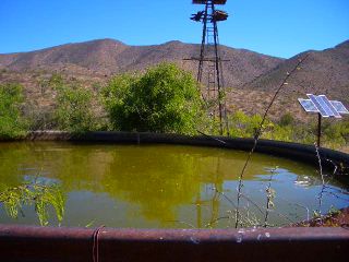
Several miles later, with strong winds blowing about, I found shelter from the relentless sun and wind behind a large open water tank. ( Inset: The road I was walking down the "wrong way last night") The creaky windmill above me churned out water into the several hundred gallon water source for the cattle grazing about. About a half hour later I could see the dust rising from an approaching vehicle. Who was it this time? As they passed by, I saw four people in a newer model SUV. No ratty clothes, no beards. These were either hikers getting a ride to the border, or they were seriously lost. I flagged them down, we all filled water bottles from the rusty pipe leading from the well, and I found a little more Trail Magic—I got a ride to the trailhead. Today has definitely been a day of mixed emotions. I got a ride from Peace Gypsy and Len the Wanderer, who were taking Randy and Kurt, a.k.a. Hannas & Stretch. They were also planning on thru hiking the trail this summer. They were each equipped with GPS units and detailed maps. Their mission was to map a segment of the trail for Backpacker magazine. I've heard of this plan circulating around a few times now. It's nice to see people involved in volunteering their time to map out most of the trail for the purpose of completing it. However, I'm glad I am doing the trail now, before there's accurate guidebooks, detailed sources of data on town stops, and information on everything else that turns this into a trail that requires minimal planning and preparation. Part of the allure of this trail is the adventure and excitement of spending many months ahead of time planning routes, water sources, foul weather detours, and resupply locations.
Mexican Border
A good half hour later, we were at the official International Border, nothing more than a basic barbed wire fence. We all stepped out of the car and gave the area a good look around. Just to our east was dry, dusty farmland of Mexico, and to our west lie the Big Hatchet Mountains we will be entering today. ( Inset:
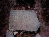
"Tierra Commun" or "Crazy Cook" southern terminus of the CDT.)
Inset:
"Tierra Commun" or "Crazy Cook" southern terminus of the CDT.)
My pack weighs 11.5 pounds, with another 16 worth of food, and 9 in water, for a grand total of 36 pounds. No stove, no GPS, no MP3 player, one aspirin in the first aid kit—only the very basics. With my frameless GoLite backpack, I'm going to need to be careful how I pack it, or the entire thing will slump down and put all if its weight onto my shoulders. After twenty miles, that would really start to bother me.
( Right
Inset: The "Crazy Cook" monument.)
Right
Inset: The "Crazy Cook" monument.)
After snapping a few photos, and stepping foot into Mexico for the first time
ever, we were on our way. The steady brisk breeze kept the temperatures comfortable, and my full brimmed Sunday Afternoons sun hat kept the relentless sun off my face. Later in the day, I worked my way ahead of Kurt and Randy and reached our first water source: Sheridan Tank. After filtering my two hydration bladders, I noticed more and more resistance in the pump handle. By the time I finished the second 1.75 liter container, the pump was very difficult to operate. (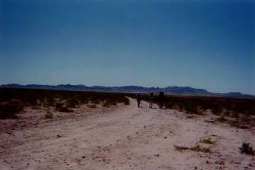 Inset:
We're outta here—into the Big Hatchets.) Oh great, my brand new filter that can pump 200 gallons before needing replacement is now completely clogged after less than a gallon of water. I'll deal with this one later. As the sun started its slow dip behind the mountain, I tossed my ground cloth down, and threw my pack on top of it to keep the wind from blowing it away.
(
Inset:
We're outta here—into the Big Hatchets.) Oh great, my brand new filter that can pump 200 gallons before needing replacement is now completely clogged after less than a gallon of water. I'll deal with this one later. As the sun started its slow dip behind the mountain, I tossed my ground cloth down, and threw my pack on top of it to keep the wind from blowing it away.
( Right Inset:
The algae filled waters of Sheridan Tank.)
Right Inset:
The algae filled waters of Sheridan Tank.)
The next morning as I headed down from the windmill, I ran into Hannas & Stretch, who were a little dehydrated from the dry water tank they camped at last night. As they headed up to get water, I followed my way down the dry creekbed. I noticed something wasn't quite right with my feet. I had placed some molefoam
under my two toes on my left foot yesterday after feeling the onset of a
hotspot. Now it's back, and a little worse. I also have a hotspot forming on my
heel spur (a small bony protrusion I've developed from wearing ski boots over
the last decade). Towards the end of the day, I could really start to feel those
foot problems. Despite stopping every two to three hours to apply or move around padding and bandages, the fix didn't seem to last very long. I've never had these problems to this degree before. On my Appalachian Trail thru-hike ten years ago, I started with eight to twelve mile days, stopping when I felt the slightest sign of a foot problem. Maybe it was a hotspot on one of my toes, or a pressure point on my instep. Whatever it was, I was always able to take care of it.
( Inset: The problematic bone spur.) As the day passed on, Hannas & Stretch caught up to me. Hannas was exhausted, and I wasn't looking forward to seeing what my feet looked like. We reached a windmill serving as our water source, and spent the night.
As we hiked up the dirt road the next day, a plane was flying low ahead of us, traveling back and fourth over the hills in front of us. "Probably border patrol" I blurted out. A little while later, a pickup truck carrying four people in camouflage passed us. It was towing what looked like a sophisticated camera. "Probably infrared", remarked Stretch. As we ducked under a lone shrub to hide from the sun, an ICE agent pulled up to check us out. "The plane pilot reported three individuals up the road" said the agent. "Yes, that's us; we're American." He let out a laugh, asked us about our hike, and turned around. I felt strong for about an hour or so, but then the persistent soreness on my right heel spur started to get me down. I tried every sort of bandage I had to fill up the surrounding space and take pressure off the forming blister. Now I'm starting to run out of first aid supplies. I've used close to a dozen adhesive bandages, a sheet of molefoam padding, and plenty of 1st aid tape. I'm starting to wonder if I'm going to lose just my toenail, or my toe. Our next resupply town is Lordsberg, and it's still almost a week out. I stopped about every two hours to change the bandage arrangement and escape from the hot sun under a large bush or small tree found in a few of the many dry creekbeds. After not having any luck padding the heel spur, I removed my sock and stuffed it behind my heel. The liner sock I was now wearing is very thin, but it will have to do. I wrapped my shoelaces around my heel and pulled it tight. It took pressure off the back of my foot, and I think that's temporarily done the job. Actually, it's done a great job. Now I'm ready to start movin'. After twelve miles a little while later, I reached the windmill/electric pump for the local ranch that will serve as my water source. The other two hadn't shown up yet. Are they far behind? The next morning as I was getting ready to leave camp, I saw two silhouetted figures slowly approaching. Several minutes later, they reached my camp with solemn looks on their faces. "Our GPS coordinates took us to the mine. We've been out of water for a while now." they disappointingly responded.
The next day we actually crossed the Continental Divide for the first time. (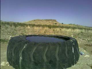 Inset: Today's delicious water source!) Without looking at a map, it isn't even noticeable, just a small bump gently rising from the surrounding desert terrain. The new trail now winds it way through the Coyote Hills. The old route simply paralleled the highway. I glance over my map, and try to figure out which way I want to head. A while later, I reach the top of a saddle with a fiberglass tank and water spigot. It amazes me how they get water to these middle of nowhere sites. Sometimes it's trucked in, other times it travels through a system of pipes snaking underground for several miles—and it's all done for the sole purpose of raising cattle. I'll remember that when I have a fast food burger (I'll probably actually have several) in Lordsberg.
No! It's got me! What is it? Help! I've been bit. I'm bleeding, I can feel the pain... Wait a minute, that's not scorpion, It's not even a snake bite. It's a burr, and they're all over me! I can hike ten feet from the nearest plant, and they still get all over me. These things don't stick onto you, they stick into you! The route around here goes cross country through mostly sandy terrain with your usual yuccas, mesquite plants, and creosote bushes. Every now and then, a desert cottontail or jackrabbit—or even a nesting morning dove—will dart away from its shady hiding place as I approach. As it runs off into the distance, I'm asking myself how these things find water. (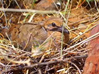 Inset: one of a few bird nests I have passed today.) I won't find my first naturally flowing water source for another week. I'll be dependent on windmills, cattle troughs, old tires holding rainwater, you name it. And I'll need to figure out how to do this with a clogged water filter. The midday heat is really something out here. I don't have a chance to sweat much with the humidity so low, and I had to keep moving until I found water, which I did several miles later. I came across local rancher Butch who operates many thousands of acres of land out here. I apologized for crossing so close to his ranch house, but showed him my maps and sketched in line of the new CDT route. Most of the trail around here was either signed, flagged, or built only in the last year or so. Some of the areas with orange survey flagging have blown away, or disintegrated from the relentless sun. At the last such spot, I set my compass for a certain bearing, and followed that until I reached the sole hill poking itself up above the valley floor shown on the map. Butch was from the ranching business in Colorado, and moved here for economic reasons. Land prices, development, I'm sure there are many more. We talked a while, he filled up my water bottles, and let me spend some time at a picnic table next to his home. It was sheltered from the intense sun by cottonwood trees, and was blowing about from the winds that constantly batter the area. It felt really good. My peanut butter had the consistency of mustard, and I drank my chocolate covered raisins like chocolate milk. As I lie here tonight typing up the last few days of journals, I can hear the coyotes that surround me yipping and howling away under the nearly full moon. As I type this, I click the date icon. It's April 27, my birthday! No celebrations today, just the nearing of another town.
Today is a really cool day! (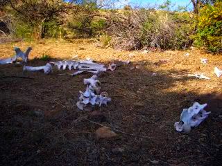 Inset: No! That's not me after countless miles without water, or snakes or the scorpions!) It was sunny this morning, and thunderstorms cooled everything down by early afternoon. The route follows the Pyramid Mountains, and then drops into Lordsberg. The sun thrust beams of light through the clouds onto the valley below like a framed patchwork of colors. Negrohead Mountain glowed brightly while the surrounding terrain was cloaked in grey. As I
bushwhacked cross country through the rolling desert, I hiked around Rimrock Mountain, and followed a jeep road from there. I approached some ranchers finishing up their day before the next wave of thunderstorms hit. Like everyone I've met around here, they're very friendly. They offered me a quart of water, and some Gatorade. Although I was carrying close to a gallon already, I accepted. This is not the place to turn down water! With the dark, ominous skies overhead, they offered to drive me into Lordsberg. I politely declined, explaining that I was going to hike every inch to Canada. Looks of disbelief showed in their faces, but we shook hands, and they wished me the best of luck. A brief but intense thundershower rolled its way over me as the evening progressed. As the terrain started to dip its way to Lordsberg, I set up my shelter behind a small bush to protect it from the wind that may blow its way through the area tonight. Sure enough, it rained all night, and the strong, gusty winds blew my tent about. To make matters worse, the inside of the single walled tent was full of condensation, despite being more than adequately ventilated. As it flapped about during the night, water started raining onto my down sleeping bag. I covered it with my fleece top and hoped for the best. (
Inset: No! That's not me after countless miles without water, or snakes or the scorpions!) It was sunny this morning, and thunderstorms cooled everything down by early afternoon. The route follows the Pyramid Mountains, and then drops into Lordsberg. The sun thrust beams of light through the clouds onto the valley below like a framed patchwork of colors. Negrohead Mountain glowed brightly while the surrounding terrain was cloaked in grey. As I
bushwhacked cross country through the rolling desert, I hiked around Rimrock Mountain, and followed a jeep road from there. I approached some ranchers finishing up their day before the next wave of thunderstorms hit. Like everyone I've met around here, they're very friendly. They offered me a quart of water, and some Gatorade. Although I was carrying close to a gallon already, I accepted. This is not the place to turn down water! With the dark, ominous skies overhead, they offered to drive me into Lordsberg. I politely declined, explaining that I was going to hike every inch to Canada. Looks of disbelief showed in their faces, but we shook hands, and they wished me the best of luck. A brief but intense thundershower rolled its way over me as the evening progressed. As the terrain started to dip its way to Lordsberg, I set up my shelter behind a small bush to protect it from the wind that may blow its way through the area tonight. Sure enough, it rained all night, and the strong, gusty winds blew my tent about. To make matters worse, the inside of the single walled tent was full of condensation, despite being more than adequately ventilated. As it flapped about during the night, water started raining onto my down sleeping bag. I covered it with my fleece top and hoped for the best. (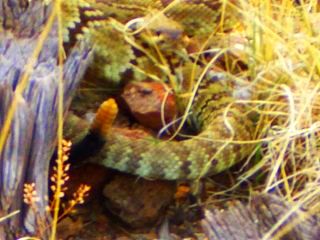 Inset: Watch out for those rattlesnakes!)
Lordsberg
I arrived in Lordsberg that morning, with the click and clack of my trekking poles drowned out by the noise of the tractor trailers barreling down the highway and frequent, noisy freight train traffic in their frantic pace to satisfy our constant need for material goods. As you can probably imagine, my very first stop in town was one of the fast food joints. I ordered two large chocolate shakes, and a Big Mac. As I gazed out the window, I noticed three men in their 40s/50s dismounting their bikes loaded with gear. They slowly waddled in and ordered some food. I introduced myself, and asked them where they were headed. "Florida" one responded. "We started in California." They went on to explain the snow in the Sierras they encountered, the desert heat, and last night's intense storms. I told them my story, and heard the familiar "do it while you're still single" routine. "Our wives will only let us out of the house for a few weeks a time." With the amount of women I meet in Vail, I'll be able to do this kind of thing for quite some time. I told them I needed to hit the grocery store before they closed for the rest of the weekend. Then they told me today was Sunday. "Sunday?" I responded. Ok, that changes things a little. I can head to the library tomorrow and check email, and today I will get a room. Yes, I broke down and got a room. I'm not going anywhere today. If I don't take my time through this state, I'll miss the best parts of the San Juans in Colorado as I detour around all the snow, which is peaking right about now (it's hard for me to imagine snow right now). It's not about the mileage, it's about the journey. I cleaned my clogged water filter, and restored some functionality. Most importantly, I needed to give my torn up feet a break. After we all stuffed ourselves to the point of internal explosion, we headed our separate ways. My first shower in a week felt great, and for dinner, I headed next door to the Pizza King—one of two restaurants in town that isn't fast food. "Hi, what's your largest pizza?" I asked. "That would be our 18 inch extra large." the manager responded. "I'll take it!" I said with a big grin on my face. I told him what I was doing, and he gave me a surprised look. "You're doing the whole thing?" "Yes," and told him where the trail heads from here. He told me a little about the area, and places to see if I had the time. Fifteen minutes later, my pizza was ready. Although it took a while, I finished the whole thing. I slowly waddled back to my room and dried out all my rainsoaked gear from last night.
Before I left the motel that morning, there was one other thing I needed to take care of. Those bone spurs I have on the heels of my feet need attention. Like my ski boots, I need to have the plastic shell accommodated so they fit properly. I'll do the same with my shoes. At the grocery, I picked up an extra lighter. I took the metal tip of my trekking pole, and held the lighter underneath it for a minute or two. I quickly pressed the hot metal hard against the plastic heel cup of my Montrails. I felt the inside of the shoe, and could feel the extra space I created. You know what, I think this is going to work. I melted the foam, but I can easily rebuild that with some molefoam. I'll find out soon whether this works. ( Inset: Did I mention it can get windy around here?) On the way out of town, I stopped at the library to check emails and wait for the midday heat to subside. They weren't open yet, so I tried something with my solar panel. I draped it across the side of the building under bright sun, plugged in this PDA, and turned it on with the dead battery. So far so good, I think this will work! But this only solves half my problem. I still can't charge the battery. Oh well, when I get into Silver City, I'll call the manufacturers, and see what I can do. At 4pm, I finally had the will to leave town. This is a great example of what a thru hiker will call "Town Suck". This whole resupply trip into town easily should have taken a few hours, but no, it's taken me thirty. Hey, I needed it.
I had my first roadwalk today out of Lordsberg. I headed north out of town, through the rail yards, and to the edge of town. I glanced at the map and saw my destination on the horizon. It was the largest gap in the mountain range. That must be it—Engineer Canyon. My compass bearing matched, and I hopped the fence along the highway, and started my cross country jaunt across the desert. A few hours later, I was starting to wonder if I was heading in the right direction. "That windmill should be around here somewhere." I murmured to myself. I didn't see any islands of green anywhere out on the horizon, which is usually a good sign of water. I started to become a little worried. I felt like I was looking for a needle in a haystack. Should I have brought my GPS on this trip? A mere five minutes later I spotted a shimmer of light reflecting off a metal object. Is it a powerline. No. You know what, I think that's it! I could see the rotation of the blades as I got closer. I'm happy now.
As darkness approached, the full moon stared at me with a certain brilliance, and I decided to head on. The wind quietly let its guard down, and the temps in the 60s made for perfect hiking weather. No UV rays to worry about, no scalding heat. This is great. The mouth of the canyon seemed to take forever to get closer. As the evening wore on, I started to get tired, my feet were starting to feel like they were in cheese graters instead of shoes, and with the moon now overhead, it was getting late. I threw my camp together right off the jeep road I had been on for the last few miles. As a gust of wind blasted the slope above me, I heard the creaky groan of metal. I looked in that direction and saw exactly what I was looking for—a windmill. This one will be my last water source for the next eighteen hot, dusty miles. I'm tired. Goodnight.
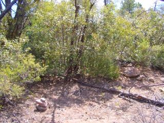
Today is a special day. I saw an amazing transformation of plant species in such a short distance. Up until today, everything consisted of short, thorny don't-get-near-me-or-I'll-bite-you plants. The creosote bushes, yuccas, mesquite plants, and everything else out there had thorns, and lots of them. I had to watch every step, watch what I touched, And god forbid, didn't sit in the wrong place. As I climbed the canyon, it opened into a wide valley, and I started to see something different. I saw trees. Lots of trees. (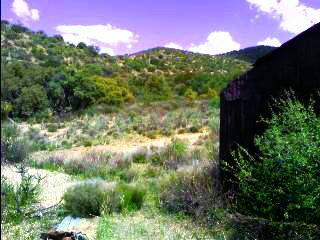 Inset: I feel like I'm in an enchanted forest.) I didn't have to hike for several miles to find shade any more. As I climbed further, they grew denser, and I saw more varieties. Wow, this is really something! The feelings of joy ended quickly—where am I? The map doesn't show half the roads I'm on, and I don't see the trail on a road any more. So why am I still on a road? Oh well, I'll deal with it when I reach the top of this ridge. I reached the ridgetop, and had no idea where I was. My map was
shrunk down to fit an 8.5 x 11 sheet of paper giving me a scale 1:60000. With all the small peaks uniform in size,
how in the heck am I supposed to triangulate my location? Ugh. I saw some powerlines heading in a generally north direction (which aren't on the map of course), and knew I could follow these if I needed to. As the road twisted and turned up the ridgeline like a spiral staircase, it became rough and started to head in a westerly direction. My map shows it should be going north. I saw a few sandy washes that beelined in the right direction. If I follow one of these, I'll eventually reach the highway. I wanted to see where this road eventually headed but it probably continued on the ridge for miles. Just as I told myself I'm taking the next drainage, and following the powerlines out, I saw a rock cairn up ahead. That's funny, why is there a pile of rocks up here? I got closer, and all I could say was... Wow. It was a brand spanking new carsonite post, those flexible fiberglass or plastic posts seen on Forest Service roads.(
Inset: I feel like I'm in an enchanted forest.) I didn't have to hike for several miles to find shade any more. As I climbed further, they grew denser, and I saw more varieties. Wow, this is really something! The feelings of joy ended quickly—where am I? The map doesn't show half the roads I'm on, and I don't see the trail on a road any more. So why am I still on a road? Oh well, I'll deal with it when I reach the top of this ridge. I reached the ridgetop, and had no idea where I was. My map was
shrunk down to fit an 8.5 x 11 sheet of paper giving me a scale 1:60000. With all the small peaks uniform in size,
how in the heck am I supposed to triangulate my location? Ugh. I saw some powerlines heading in a generally north direction (which aren't on the map of course), and knew I could follow these if I needed to. As the road twisted and turned up the ridgeline like a spiral staircase, it became rough and started to head in a westerly direction. My map shows it should be going north. I saw a few sandy washes that beelined in the right direction. If I follow one of these, I'll eventually reach the highway. I wanted to see where this road eventually headed but it probably continued on the ridge for miles. Just as I told myself I'm taking the next drainage, and following the powerlines out, I saw a rock cairn up ahead. That's funny, why is there a pile of rocks up here? I got closer, and all I could say was... Wow. It was a brand spanking new carsonite post, those flexible fiberglass or plastic posts seen on Forest Service roads.(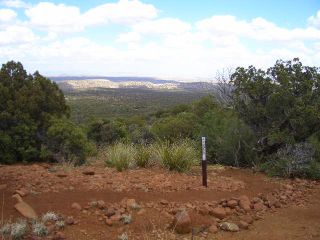 Inset: Brand new tread.) And, it had a CDT sticker on it. I feel much better. The tread was new, complete with waterbars. This was the first time I've been on a trail! I passed Pinion trees, and I even saw a pine tree! Everything else has been jeep road, or cross country. After several miles, I was at the highway. I took a right, and followed the shoulder of the paved road for the next 4.5 miles. I turned off at a gravel road, and saw the trailhead that takes me into the Big Burro Mountains. I met local rancher Raymond, who gave me the all too familiar "Why?" when I told him how far I was going. He gave me some water, wished me luck, and I took off into the Big Burros. As nightfall approached, I found a rocky outcrop and called it a night, watching lightning light up the sky out on the horizon as it pierced the ground below.
Life is so simple out here. No set work schedule, no appointments to meet, no deadlines. I go to sleep whenever I want, wake up whenever I want, and go for a hike. That is what my daily life consists of this summer. It feels good, and today I'm doing it again. By the end of the day, I'll be a little further north, and in a little different terrain.
(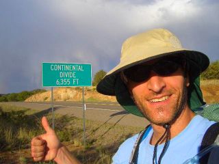 Left Inset: Blah, I'm crossing the Divide again. I had to show this dumb tourist shot.)
(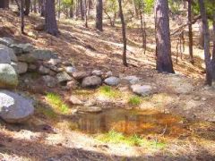 Right
Inset: Mud Spring - my first natural, non livestock water source!)
Right
Inset: Mud Spring - my first natural, non livestock water source!)
Now that I'm in Sliver City, it's time to solve another one of those little problems that's popped up—solar charging the batteries in this PDA. As I write this using my backup battery, the little exclamation point has reared its ugly head, telling me to plug it in to the nearest power outlet and charge the battery. Maybe the nearest power outlet is fifty miles away. Now what? Why won't my solar panel charge the battery? Is the problem the voltage regulator in the DC car charger, does the PDA require a full 12 volts to charge the battery? In Lordsberg, I figured out I can run the device forever with the solar panel, I just can't get the darn battery to take a charge. Using any sort of color LCD display in bright daylight is a pain. Trying to review the pictures I took is especially daunting. Maybe I can toss a black garbage bag over this thing so I can see the display. Today I'll call Brunton and UT Starcom and hopefully fix the problem.
Silver City
After I descended the Big Burros, I was on a fifteen mile roadwalk. The first five took me around the Phelps Dodge copper mine, and the other ten took me down the shoulder of the paved highway into town. The famous Tour of the Gila bike race was in full swing today, with cyclists wearing their aerodynamic helmets and carbon fiber wheels. I took shelter from the sun behind a tree along the highway. I heard the constant woosh as they rode by every few seconds in their own coned off highway lane. As nightfall approached, I camped in a well hidden ditch off the side of the road.
I was up early to get into Silver City. My first stop was the RV park in town for a shower and laundry. I hit the Post Office to pick my first maildrop, which was nothing more than some sandals for the Gila River trail—which will hopefully survive the next week—and some iodine solution for water treatment. I headed to Western NM University up the street to take care of some pressing issues—charge the two dead batteries for my PDA, check email, make some calls, and the most important of all: the all-you-can-eat buffet at the dining hall (better known in thru-hiking circles as AYCE). No, it's not the most exciting way to dine, but it does the job. I had three gigantic salads to get some vegetables inside me, a couple pulled pork sandwiches, a half dozen glasses of milk, and several different sides to go with it. I was probably there for three hours. I ran a few more errands that afternoon, and pored over my maps to see what route I wanted to take out of town. I took the Bear Mountain road route. I learned about it from an old guidebook months ago and sketched it onto my map. It was a several mile roadwalk, and took me through the downtown, a residential development or two, and old trailer homes and rickety farm houses. As I passed through the countryside, the road turned to dirt, I walked past a horse breeding farm, a kennel boarding property, and finally, nothing. As the sun set and the curtain of blackness doused the skies, I decided to head on. I had a few townsfolk tell me there were great trails up here. Little did I know they meant jeep trails. I was expecting a simple trailhead sign at the Silver City Trailhead. I didn't see anything even close. It was supposed to be blazed with CDT markers, but like most things about the CDT, things change. Trail is moved off roads, private land issues change the route, and new tread is built. Unknowingly, I passed right by it. I still have no idea where it was. I passed several roads that were signed, but not anything resembling the CDT. As I walked over a saddle, the trail slowly meandered its way downhill. Something tells me I've gone too far. The trailhead I was looking for wasn't even on the map, just drawn in off to the side of the printed sheet of paper. As the moon started its slow rise into the night sky, I found a turnoff, and camped.
I checked my map this morning, and had no idea where I was. The road went right off the edge of the map, and there hasn't been a single car down it. I wanted to go northwest, so I headed up a dry creekbed that meandered in that general direction. I came to a hill at the top of a drainage and found it difficult to see through the thick vegetation. There was another dry creekbed that I followed towards what would hopefully be Bear Creek. Several miles of bushwhacking later, I came to a old jeep road and followed it. I came across a couple locals on horseback who allowed me to pass on their property. Unfortunately, they weren't familiar with the terrain features on my map, and couldn't tell me exactly where I was—but they did tell me I'd reach Bear Creek by following this drainage. a while later I was supposedly at Bear Creek. Ok, now where do I go? Looking at the map, I at least know I need to head upstream. The bushwhacking eventually followed an old jeep track that faded to a trail in places, or completely disappeared. The map doesn't show the road, and it is tough to figure out where I am along the creek with nothing but water, rocks, and thorny bushes to see. I passed a long curve in the creek, and thought this could be Horseshoe Bend. I was looking for a trail that headed straight up a dry drainage in about a mile and a half, and I think I've found it. It took me straight up the side of the hill, and as I got to the top, it disappeared. There's no sign of anything. I figured I might have passed the trail somewhere along the way, so if I I headed back down to the creek, which way would I go? It's difficult to see the surrounding terrain with all the thick, thorny brush surrounding me. I headed off into the next drainage which followed a northerly direction. It was awful. I have never gone cross country like this and been so brutally attacked by every single plant species I passed by. There was one thorny bush in particular that attacked anything that touched it. As I'd walk past I, it attached with a vengeance to my long underwear bottoms (I was going to toss these after climbing Big Hatchet Peak for thorn protection—which never happened. Now I also wear them for UV protection). As I tried to "escape" from it's wicked grasp, this thing would pull tighter, and lodge itself deeper into me—in this case, mostly only my long underwear, and not me. As I broke free, I'd find some more holes torn into my clothing. And things only get worse. Ahead of me is a three foot high wall of these nasty, barbed torture devices, standing sentinel in front of me. This time I tried stepping on top. As I flattened them with the mighty stomp of my foot, they sprang back, and grabbed me from all sides, like an octopus slowly pulling in its prey. I started mumbling every form of profanity imaginable. The mumbling turned to yelling, and the yelling turned to screaming. By the time I reached the next canyon, I looked like I was attacked by a pack of wolves. My shirt that was brand new two weeks ago now looked like swiss cheese. My shorts were now a size larger, and my shoes resembled a porcupine, with thorns sticking into them in every direction. I followed the creekbed up for a ways, listening to a canyon warbler chirp its familiar song, passing an old mine shaft, or watching the water suddenly appear in places, only to sink into the ground a short while later. As the canyon veered into a westerly direction, I knew this wasn't right. You know what this means, don't you? I let out a big sigh, and did the whole thing again. This time I didn't yell out loud, or think bad thoughts. I just shuffled my way to the top of the ridge, hearing the rip of clothing, and the loud swish of my pack brushing against the branches. I reached the top, and came to a large, flat area with a bit of open terrain. "This is good" I mumbled to myself. As I crossed the flats, I was able to see the surrounding terrain. Hey, that must be Tadpole Ridge! To the right I saw rocky outcrops speckled across the top of the canyon rim. Is this Devils Garden? I took some bearings with my map and compass, and was starting to feel better. The only issue I dreaded was getting to the canyon floor. (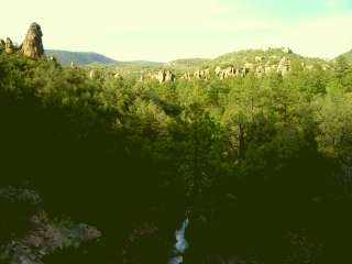 Inset: Devils Garden.) Ok, here we go again, s#@%, f&%@!, d!@&. There, done. There was a good amount water flowing along here, and the map shows the trail up a hundred feet or so from the canyon bottom. I approached a creekbed, and followed it up. I reached a small amphitheater with water cascading off the top, and found a way around. The terrain was a little more open this time, and I had a really good feeling about this. The map shows the tread as an old jeep track. I soon passed what looked like a faint trail. I followed it down a little ways, and saw something special—a cairn. I have been waiting all day for this! I threw my pack down, hopped on one foot, clapped my hands, did the dance of joy, and hooped and hollered. At 7:45pm, almost twelve hours later, I was back on the trail. I felt great. Ten minutes later, I found a nice place to camp, a soft, grassy spot—something I haven't had before on this trip. I stared at the inky black sky as I reminisced about today's hike.
My feet were torn up a little from all the rock hopping in the dry creekbeds, but the issue was minor, and very manageable. I followed my way up the trail this morning, overgrown in places, barely noticeable in others. As it started up towards Tadpole Ridge, I noticed soot on the trunks of the larger trees, evidence of a forest fire in the past several years. The "trail" disappeared quite often, and I started pacing left and right trying to find the next cairn often knocked over or buried in overgrowth. I crested the top of hill a mile or two up from the valley floor, and saw one last cairn. It was surrounded by dense overgrowth I'm now all to familiar with.
)
( Inset: A cairn, but where's the trail?) Great, here we go again. I wish I could have brought armored chainmail clothing through here. This is getting ridiculous. My goal is to be at the Canadian border in September. I'm starting to wonder if I'll make it out of New Mexico by then. After more bushwhacking, I found the trail again. No tread, just a few cairns here and there. I topped on Tadpole Ridge this afternoon, and sighted the Gila River I'd follow far below. I intersected a jeep road and took my pack off to investigate where I was. There were no signs, and the map showed a dotted line headed north. "Could this dirt road be a single dotted line on the map?" Not likely, but it headed north, and that's where I want to go. I'm following it—Screw it!
The last several miles of trail were some of the longest switchbacks I've ever been on. As I'd round the corner of one, I would follow the next for half a mile, very slowly and gently snaking my way downhill.
Inset: A cairn, but where's the trail?) Great, here we go again. I wish I could have brought armored chainmail clothing through here. This is getting ridiculous. My goal is to be at the Canadian border in September. I'm starting to wonder if I'll make it out of New Mexico by then. After more bushwhacking, I found the trail again. No tread, just a few cairns here and there. I topped on Tadpole Ridge this afternoon, and sighted the Gila River I'd follow far below. I intersected a jeep road and took my pack off to investigate where I was. There were no signs, and the map showed a dotted line headed north. "Could this dirt road be a single dotted line on the map?" Not likely, but it headed north, and that's where I want to go. I'm following it—Screw it!
The last several miles of trail were some of the longest switchbacks I've ever been on. As I'd round the corner of one, I would follow the next for half a mile, very slowly and gently snaking my way downhill.
As I reached the river bottom three thousand feet below Tadpole Ridge, I felt really good. I've heard the Gila River section is one of the highlights of the trail in New Mexico. I continued on up river and found a place to camp at dusk. As I was getting into my bag for the night, camped on a cliff jetting out above the river, I looked at the western edge of the sky and noticed the bright stars that were painted across the
heavens above me were now quickly disappearing. As much as I wanted to just bury myself deeper into my sleeping bag, I threw my camp back into my backpack, and tried to find a flat spot on the side of the hill above the river. Although it took some effort to use my extra gear to make the area flat, it worked. I'm glad I moved. Not more than ten minutes later, I started to hear the pitter patter of raindrops splashing against my single walled
shelter. Tomorrow's trek up river should be exciting.
I can't even begin to describe how good it feels to be out here. Our daily lives are run by the morning buzz of the alarm clock, fluorescent lights that stare down at us from above, and the constant hum of traffic that envelops us everywhere we go. Our collective nerves are rubbed raw by what we see on the news every day smacking us upside the head—the school shootings, the hostage standoffs, the terrorist threats. I'm unable to witness any of that. Out here, the air is heavy with silence, only the twitter of a bird, the whisper of a breeze through the trees, or the gurgle of a rambling stream.
The rains last night weren't much, but it sure would have made a mess out of my down bag. The first thing I did when I started hiking was cross the river. (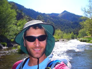 Inset: Crossing the river again.)
I brought sandals for this stretch of trail, and was happy with the way my feet quickly dried after each crossing. The trail cliffs out every so often, requiring a crossing to the other side. After a few minutes of searching above the river bank, a trail usually becomes visible. As I followed the sandy river bank later that morning, I noticed two round bodies of shallow water. I slowed my pace, and investigated. I saw steam swirling into the air as the breeze blew across the river. I think I've found the first hot spring. I took of my pack and everything else and slipped in. It was only a foot deep, and I sank into the mucky bottom another several inches, churning up the waters into a muddy mess. The water bubbling up was very hot, requiring me to constantly move around. After a good twenty minutes or so, I started to get bored. My upper body was exposed to the wind, and I was getting cold. With no room to lay down, I decided to leave. As I jumped out to run into the river and clean off the slimy muck that had coated my legs, I pulled my foot out of the pool and broke one of the straps on my sandal. Great, this is what one calls "suck mud." I've been on river trips with friends, and seen plenty a pair of sandals disappear into the great grey abyss as one pulls their foot out of this stuff, and whatever was on their foot disappears several feet underneath them. After a quick fix with a needle and tooth floss, I'm on my way. After a slow eleven miles, and forty river crossings later, every single strap on my sandals has disintegrated, replaced with parachute cord wrapped around my feet like spaghetti twirled all over a fork. (
Inset: Crossing the river again.)
I brought sandals for this stretch of trail, and was happy with the way my feet quickly dried after each crossing. The trail cliffs out every so often, requiring a crossing to the other side. After a few minutes of searching above the river bank, a trail usually becomes visible. As I followed the sandy river bank later that morning, I noticed two round bodies of shallow water. I slowed my pace, and investigated. I saw steam swirling into the air as the breeze blew across the river. I think I've found the first hot spring. I took of my pack and everything else and slipped in. It was only a foot deep, and I sank into the mucky bottom another several inches, churning up the waters into a muddy mess. The water bubbling up was very hot, requiring me to constantly move around. After a good twenty minutes or so, I started to get bored. My upper body was exposed to the wind, and I was getting cold. With no room to lay down, I decided to leave. As I jumped out to run into the river and clean off the slimy muck that had coated my legs, I pulled my foot out of the pool and broke one of the straps on my sandal. Great, this is what one calls "suck mud." I've been on river trips with friends, and seen plenty a pair of sandals disappear into the great grey abyss as one pulls their foot out of this stuff, and whatever was on their foot disappears several feet underneath them. After a quick fix with a needle and tooth floss, I'm on my way. After a slow eleven miles, and forty river crossings later, every single strap on my sandals has disintegrated, replaced with parachute cord wrapped around my feet like spaghetti twirled all over a fork. (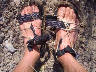 Inset: The quick, torturous death of my $3 sandals.)
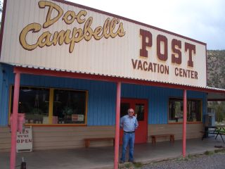
Last night was cold, and I didn't sleep very well. I woke up to frost covering all my gear, and looked at my map. As I glanced over today's route, a sudden gust of wind blew across the river valley and my map was ripped out of my hands. I helplessly gazed as it skipped over the sandbar and right into the middle of the river. Wonderful. I guess I'll just Use the Force (we all remember that term, don't we) to get out of here. I was lucky, I knew there was a bridge ahead, and Gila Hot Springs and Doc Campbell's Post was downhill from there. I made five more river crossings, spotted several wild turkeys, and made the several mile roadwalk into town.
Gila Hot Springs
( Right Inset: The metropolis of Gila Hot Springs.) Nothing more than a souvenir shop and campground, It was a welcome stop after crossing the river forty-five times, usually knee deep, for over ten miles. I downed two quarts of homemade ice cream, and spent way too much time messing with this PDA trying to charge batteries, resize pictures, and do the worthless task of reviewing the map I lost on the tiny screen. Paul, the owner of the store, and a local patron
suggested another route when I raised the concern about being tight on food. They're not exactly sure what the trail junctions are called. Without a map, an I going to get lost again? I planned this maildrop over a month ago. It's my first one. I didn't know how much food to send off at the time. I haven't done a thru hike in ten years. I became ravenous two days ago and ate everything I had with me. The extra day of food disappeared this morning. I'm not feeling good about the next ninety miles. The resupply option I have here is very limited, and the low mileage and the constant slogs back and fourth across the river wearing wet shoes are starting to get to me. Actually, these river crossings are really starting to annoy me. I don't want to wake up in the morning, don frozen socks, and ford the river in forty degree temps. I want a different route. I heard there's an outfitter on horseback that headed down to Jordan Hot Springs this morning. I don't want to share the small pool with a half dozen other people. So I'll miss it—who cares. I have a ton of these available to me back at home. What about the beautiful river scenery. Blah, I go on river trips in my kayak with friends every year, and they're all just as scenic. I'm going to run out of food if I need to cross the river another hundred times. The Gila Cliff Dwellings just closed, I missed that too. I'm getting pissed. I wasted half the day trying to resize my camera's pictures so I could put-them-on-this-thing-to-upload-to-my-website, and now I'm paying the price.
Right Inset: The metropolis of Gila Hot Springs.) Nothing more than a souvenir shop and campground, It was a welcome stop after crossing the river forty-five times, usually knee deep, for over ten miles. I downed two quarts of homemade ice cream, and spent way too much time messing with this PDA trying to charge batteries, resize pictures, and do the worthless task of reviewing the map I lost on the tiny screen. Paul, the owner of the store, and a local patron
suggested another route when I raised the concern about being tight on food. They're not exactly sure what the trail junctions are called. Without a map, an I going to get lost again? I planned this maildrop over a month ago. It's my first one. I didn't know how much food to send off at the time. I haven't done a thru hike in ten years. I became ravenous two days ago and ate everything I had with me. The extra day of food disappeared this morning. I'm not feeling good about the next ninety miles. The resupply option I have here is very limited, and the low mileage and the constant slogs back and fourth across the river wearing wet shoes are starting to get to me. Actually, these river crossings are really starting to annoy me. I don't want to wake up in the morning, don frozen socks, and ford the river in forty degree temps. I want a different route. I heard there's an outfitter on horseback that headed down to Jordan Hot Springs this morning. I don't want to share the small pool with a half dozen other people. So I'll miss it—who cares. I have a ton of these available to me back at home. What about the beautiful river scenery. Blah, I go on river trips in my kayak with friends every year, and they're all just as scenic. I'm going to run out of food if I need to cross the river another hundred times. The Gila Cliff Dwellings just closed, I missed that too. I'm getting pissed. I wasted half the day trying to resize my camera's pictures so I could put-them-on-this-thing-to-upload-to-my-website, and now I'm paying the price.
At 10pm, I was night hiking with my headlamp, climbing a hill for over an hour now in the dark. Where am I? I guess I'll find out tomorrow.
At noon it was in the low sixties, and the skies were full of billowing cumulus clouds. I reached Prior Cabin where I had lunch and refilled my water bottles. It was located on a mesa densely dotted with pine trees and very little undergrowth. I headed on an hour later, and came across two horseman. These are the first trail users I've seen (other than Hannas & Stretch) since I started! I noticed my energy level starting to whittle away. My pace has deteriorated down to a slow crawl. I've been eating enough, haven't I? An hour later, I could hear thunder off in the distance, slowly getting closer. A light rain started, and I threw on my jacket. I saw eight elk grazing ahead of me who noticed my presence and quickly darted off. Kaboom! I saw a flash of light, and a fraction of a second later, the roar of the thunder pulverized my ears.
This afternoon, I totally hit the wall, I have zero energy left. I don't feel like moving, but I'm nowhere near any water, and if I stop, I'll get cold. My watch is reading 44 degrees at 3pm, with a steady rain falling. As I continued down the trail for what seemed like an eternity, I noticed something different. There's a tent over there. I proceeded a little further. What's this? I was greeted by three people, who saw my tired, worn body slowly shuffle towards them. You look exhausted, where are you coming from? I told them my story, and they invited me to dinner. I cannot think of a better time for a Trail Magic experience than right now. The fourteen of them are building new trail nearby for the New Mexico Volunteers for the Outdoors. The camp was in a large meadow near the Middle Fork of the Gila River. We shared stories, they demanded I get a second helping of chicken curry, and I gathered near the fire to warm up. Similar to many trail building trips I've been on, food is provided, there is a privy, a common area for the kitchen, complete with tables, gas stoves, pots and pans, etc. All of it in this case was brought in by mule.
The skies were bright blue this morning. I donned my frozen, wet socks and put on my soaked shoes. I had three thru-hikers come up from the river, getting word from one of the crew there's a thru-hiker here. "What's your name?" they asked. "Andy—I mean Skygod." If I have this trailname, I might as well use it. Yeah, it's been ten years, and I don't know how much I'll use it, but from now on, I'm Skygod out here. "I'm Crazy Horse, this is Puff and Snappy" they responded, happy to see their first other thru-hiker. They were soon on their way, and I wondered If I'd see them again. A couple hours later, I had some breakfast with the crew, thanked everyone for their generosity, and was on my way. My pace was still a little sluggish, but at least I felt better than yesterday. Towards the end of the day, I started to feel tired—really tired. Everything I did was a struggle, taking my pack off, setting up camp, and eating—especially eating. Consuming food took effort, I had to force myself to snack on something. If I don't, I'll stop dead in my tracks. As the sun slowly dipped below the walls of T Bar canyon, I squirmed into my sleeping bag, and fell asleep.
As I filled up my water containers from a small creek on this bluebird sky morning, I watched some of the little critters that call it home fulfill their daily duties. There was a waterbug that zipped back and fourth along the surface, chasing bubbles or specks floating on the surface for potential food. In the water there were tadpoles, a frog or two, beetles climbing along the bottom, and countless other species that rely on this small stream for their existence. I've seen more life in the last ten minutes than I've seen in all my town stops. I'm getting cold, so it's time to move on.
As I headed up the road a bit, I came across something off to the side. What is that? As I got closer, it appeared to move. Oh, it's a person. It must be a hiker—but who? "Thru-Hiker?" I blurted out. "Yes, The Onion (He based his trailname on the satirical newspaper of the same name found in some college towns)." He was taking a quick food break, and was surprised to see me. He's a "yo-yo hiker", meaning he will hike the CDT from Mexico to Canada, and then hike back to Mexico—all by the end of the year. I asked myself why someone would want to do a trail twice in a year. The daily mileage needs to be insane to complete a trek like that. But then again, people say the same thing about a thru-hike. Do what you want to do in life. That's the bottom line. We hiked together for several hours, road walking through mountain range to open valley floor, and back into the next range, repeating this process a few times today. In one valley, we saw a pronghorn darting across the dusty meadow in front of us. We stopped at the only water source for ten or fifteen miles, a shallow, mucky spring that was difficult to get anything out of. As I started the process of filtering water. we said our good-byes, and he blazed ahead at his blistering average pace of thirty miles a day.
On this twelfth day of May, the skies are once again growing darker and more angry with each passing hour. I can hear the dull roar of thunder out in the distance, and the vertical development of cumulous clouds all around me. most of the afternoon I was surrounded by rain, but hit with maybe only a sprinkle or two. As evening approached, I neared Aragon well, just a windmill that fills a tank full of green water. I noticed a truck barreling towards me on this seldom used dirt road. It was a newer model pickup with Colorado plates. "Hi, you a thru-hiker?" they asked. It was a couple from Denver scouting out some water sources as they prepared to section hike from Pie Town to Silver City. They gave me a gallon of water, which saved me a good twenty minutes of fumbling with my filter for the next dry stretch.
(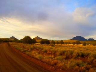 Inset: The all day roadwalk into Pie Town.)
There's a chance we'll cross paths again as they head southbound from Pie Town.
My feet have become a little better, a little more trail hardened each mile. They are covered in dust and dirt at the end of of each day, something that's never happened with my full grain leather boots, or any of my lightweight boots for that matter. It's just dusty out here. My feet still aren't capable of continuous twenty mile days. I added a cushioning insole under my custom insoles a few days ago for all the roadwalking. While it solves some issues, it always brings up others. There are now sore spots on the heels, ball, arch, you name it. I need to try more sock/insole combinations. It's usually the slightest, most miniscule thing that can make or break the feet. Maybe the sock is 1/16 of an inch too thin, the insoles are 1/8" too thick, or the shoe is a quarter size too small. Add a piece of moleskin, attach a bandage, or usually just deal with it.
Pie Town
Continue to Northern
New Mexico
Back to CDT 2007