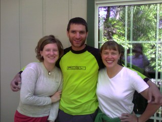
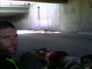
Blah, blah, blah, let me talk about my first day. The four of us got a ride to the border around 11am, and it started to hit me—I'm here, I'm really doing this! Another wonderful Trail Angel, Girlscout, drove us the sixty three or so miles to the southern terminus of the 2,650 mile Pacific Crest trail. Shawn, Rain Dog, Kelly, and I excitedly hopped out and took several pictures at the Monument.
 At the Mexican Border! |
I don't know how far I'll make it today, but my goal is Lake Morena Campground, where I was almost two weeks ago for the ADZPCTKO. It's a twenty mile waterless stretch from the Border to the campground (only six by car) that wraps around drainages, climbs over rocky hillsides, and descends into canyons. The almost full moon will gaze down from the heavens tonight, and it will be a good opportunity to night hike in the cool, crisp air.
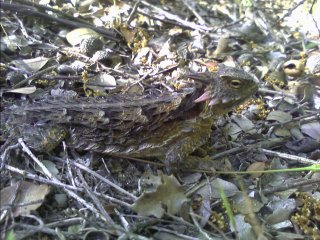 Great Horned Lizard |
My ab area is still a bit sore, and it will be a good idea to take it easy again.
Our intrepid PCT hero, Grizzly, is sitting at home and is in between football games on the tube. So, he starts to watch the CSI TV program. He turns to his trail partner/wife, Trail Dust, and says, "I never want to live in a vegetative state and dependent on some machine and fluids from a bottle to keep me alive. That would be no quality of life at all. If that ever happens to me, just pull the plug." So Trail Dust got up, unplugged the TV and threw out his beer. —Switchback the Trail Pirate |
I passed a couple horsepackers from the area this morning, and they mentioned a military helicopter going down last night. Around midnight, after arriving at camp at 930, setting up camp, eating dinner, and using the shower at the campground, I was still up, and heard a gigantic boom off on the horizon somewhere. I glanced over in the direction, not knowing what happened. a tanker truck on the interstate? The horse riders go on to tell me that unfortunately two pilots were killed in that crash. When I reached Kitchen Creek Road, I was greeted by two Forest Service trucks redirecting hikers off the trail. They were a couple seasonal workers, new to the area, and not quite sure themselves how far the closure extended. I detoured up the long, winding road into the night. The road was closed by several gates, apparently done to thwart human and drug smuggling along the road, and because of the crash. I was greeted by sheriff's vehicles, Forest Service trucks, a bomb disposal team, and Border Patrol. The chopper went down very near the Trail, spilling its classified contents of rockets and other weapons all over the trail corridor. The road turned into a narrow, one and a half lane path, and the night sky splashed above my head. The deep shadows cast by the bright moon made the hike very pleasant. I came across an SUV stopped to close the gate. He was the "owl guy", conducting surveys of the Spotted Owls in the area. Hours later, a little before 10pm, I set up camp at the end of the road next to the Sunrise Highway.
It was difficult to sleep last night, with mosquitoes buzzing around my head and landing on my face all night long. I headed down the Sunrise Highway and met up with Rain Dog, Kelly, and Julian. I've hiked with them individually on and off the last few days, and we were looking forward to reaching the small town (actually, the town isn't much more than the general store) for food and water.
Mt. Laguna, CA
 Life is good. |
Last night, towards the end of the three thousand foot climb out of the valley below, I started to see pine trees. They cast dark shadows on the floor below as the bright moon bathes them in a dim white light. As I leave the town, the trail wraps around peaks, and follows ridgelines that quickly lose their tree cover. As quickly as they appeared yesterday, they are now long gone. I reached the Pioneer Mail picnic area, and struggled to find my headlamp buried deep in my pack to look at the water report. I'll try to do several more miles to the Sunrise Trailhead area where there is a well. I continued on, following an old road bed, complete with concrete retaining walls. At 11:30pm, I called it quits and found a small, flat area to set up camp.
Ok, so water isn't so easy to find anymore. The Sunrise Highway—along with its occasional campground or rest stop with a horse trough or, if I'm lucky, a water
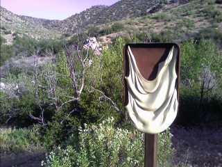
 The last reliable water source for?? |
 |
I glanced down at my shoe, and something didn't look right; there was gap showing above the sole, and the shoe's insole fell through. Great, these shoes—yes, they're twenty one years old, but they have less than fifty miles of use—looked like they've the end of their life. Ok, I have a razor blade (never carried a knife on a long distance hike), and some parachute cord. Now what do I do? I removed my orthotics and flipped the shoe around several times, looking at the ground through the what's left of the inside of the shoe. I cut some small holes in the plastic heel cup, fed through some cord, and looped it around the sole. It looks like I should make it somewhere before the whole thin explodes.
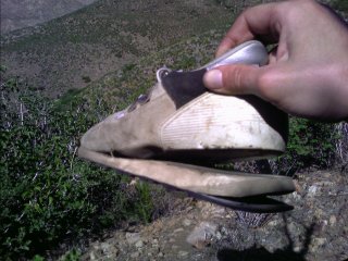 Hmm. This isn't good. |
I met Rain Dog yesterday evening at the fire tank near Rodriguez Spur. We treated our water from this concrete tank used by the fire department for wildfire mitigation. At the Kickoff, it was reported to have dead rats and black slime lining the walls. I didn't bother to look inside, and gathered the clear looking water it into my bottles. Rain Dog stayed behind, and I decided to head on. I used my headlamp until 9:30pm, with the moon shrouded behind Granite Mountain.
The sun slowly turned the peak a dull orange as I worked my way out of my sleeping bag. I'm feeling pretty good this morning. I've had the usual abdominal soreness hit me every now and then since I started. I'd either take a break, or slowly work my way along the dusty trail. There is some minor soreness in my posterior tibial tendon in my right foot—the area that caused me so many problems for the last twelve hundred miles on the CDT. I used what's left of my razor blade and cut up a piece of moleskin and adhered it to the bottom of the heel on my orthotic. This should help. I tromped on to Scissors Crossing, where there was a large water cache stocked by trail angels.
 Wow. |
 The dry, dusty trail that winds its way in and out of the many small canyons that line the San Felipe Hills |
 Smoke coming in (maybe from the fires in Sacramento) |
I was on the trail a little after six this morning, with the sun already beating down on me. Yesterday I saw my first rattlesnake, which was quite small in size, last night I saw my first tarantula, and today I saw probably close to a dozen other snakes. All different shades of grey, some long, most small.
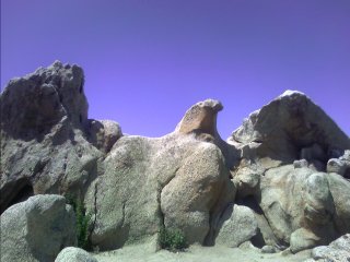 Eagle Rock |
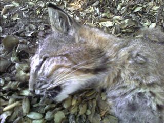 It might be roadkill, but is it still considered my first bobcat sighting? |
Warner Springs, CA
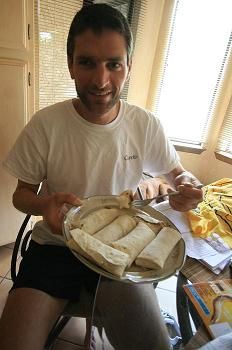
I arrived at the small mini mart, where I met up with Jamie again. We gorged on some ice cream bars and relaxed in the shade for a couple hours. Not much later, Blackfoot, Shane, and two hikers randomly hitting different sections of trail and are raising funds to build homes for Disabled Veterans showed up. Shane has a uncle with a timeshare here, and we piled into two different cabins. We headed for the two pools that lie at the edge of the resort. One was 105°, and the other at 80°. Dinner was next, where I scarfed down a couple soups, a salad, two sides, and the half chicken. Where's the half ribs that was supposed to come with that? The waitress, from Thailand, had some difficulty with English and we chuckled frequently with her as she repeated the wrong information. Instead of bringing out the half rack of ribs, I got another dinner. Complete with another half chicken, half rack of ribs, fries, and large sides of rice and spinach.
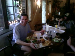 The four thousand calorie dinner |
A handful of other hikers are heading in today, including Colorblind, Rain Dog, Julian, and Kelly. I finished the last of my afternoon chores, including heading over to the golf course maintenance shop and drilling some holes in my shoes so I can tie together whatever's next to fall apart. I jumped in the shower next the pool fully clothed, and the temperature instantly dropped thirty degrees. I tromped my way out of the resort to the highway and hitched a ride back to Agua Caliente Creek. As I continued my journey north, I spotted my first deer on the trail, lazily eating the grasses nourished by the small meandering creek. I had a big fat smile on my face as I gleefully made my way past the large trees shading the trail. It was almost a magical experience, after baking in the San Felipe Hills. Unfortunately, I know I'm going to climb out of this cool, pleasant creek sometime soon, returning to the oven like temperatures that will test my soul. Warner Springs Ranch reminds me of Ghost Ranch on the CDT in New Mexico. It's isolated, surrounded by a dry, dusty landscape, and attracts people from all walks of life. I continued along the winding trail and dropped back into the creek drainage. The water is still flowing strong as I veered off into a side canyon. There are piles of wood debris ten feet high tangled above some trees. It is a good reminder of how powerful flash floods can be in such dry areas. I hiked until ten thirty in the crisp air until I was able to find a flat spot comfortable for camping.
The temperatures only reached the low to mid 90s today, refreshing after what I've been through the last several days. I filled up my water from a rainwater catch tank, dubbed a "guzzler", and pulled out five quarts of the yellow stuff teeming with small insects and moss. I managed to build camp near the Palms to Pines highway just before dark, doing my longest day at just over twenty six miles. This is the first time I haven't night hiked, and it feels great to be in camp before 9pm. I have been on the trail for a week now, and I... well, I need to say what's on my mind right now. There's something that just doesn't feel right. I don't know whether I should be concerned or downright scared. I... I feel great! Why in the world am I feeling great hiking in one hundred degree heat, no water for miles on end, enough dirt that's blown around to turn my skin brown, and a relentless sun that has turned me into a six foot tall leathered prune. Did the soles of my shoes finally disintegrate, hurtling me head first into a rock? Did a pack of killer bees get mad at me? Maybe a rattlesnake or scorpion bit an artery. Is my brain in it's last few minutes of existence, organizing all my life experiences into one euphoric thought? I'll see if I'm around tomorrow.
Great, I'm still here! There were coyotes barking and yapping nearby, with their sounds echoing off the nearby hills. I still have a nasty aftertaste in my mouth from that water I pulled from the "Guzzler" tank yesterday. I'm going to hike to the Paradise Cafe, and wash away the aftertaste with a Jose Burger or two. I hiked from near the highway to the Paradise Cafe a couple hours before they opened, and the waitress brought me a couple huge glasses of ice water, a trail register, and menu. I looked at the grainy, black and white maps I printed a month ago, and noticed something very important. For the first time in twenty one days, I'm leaving San Diego County! What a great feeling.
As I wait for the Cafe to open, I'm busy typing away my journals, cleaning my dirty, dusty, blackened socks with the garden hose, and anxiously waiting to calm the growling stomach churning within. Rain dog shows up a little while later, followed by Shane.
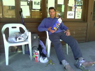
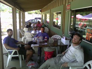 Shane, me, and Rain dog in food coma mode |
I don't know why, but I feel sluggish today, and struggle to maintain a two mile per hour pace. The temperature on my watch hasn't even hit eighty degrees yet as I tromp along at 8,000ft in elevation. The trail follows the ridgeline, continuing to head uphill on the mostly treeless route. The sun is relentless, sapping my energy level with every step. It's mid afternoon already, and I've given up on hitting the post office before they close. The trail eventually starts to follow the cooler north slopes, teeming with pine trees and shade, and my spirits are looking better with every step. As I continued on, my heart started pounding from excitement instead of stress. There are small drifts of snow everywhere, and every now and then I grab a handful and plop it under my hat, instantly dropping my body temperature from 212° to something more normal. I followed the Devil's Slide Trail down towards Idyllwild, and got a ride into town from one of the many dayhikers that struggled to make it up to the ridge and back today.
Idyllwild, CA
Ok, the post office is closed, now what do I do? I headed over to the small grocery, and walked out with almost a half gallon of ice cream.
 Walking around town with food in hand—hiker trash style |
Coyote has been dreaming about the CDT for some time now, so I show her my slideshow of my 2007 adventure.
 Colorblind, me, and Coyote |
After picking up my new shoes at the PO (YES—new shoes!), I got a ride to the trailhead. If I had to walk that several mile climb on hot concrete, I would be completely miserable for the rest of the day. Yesterday, as I descended the Devil's Slide Trail, I dreaded climbing back up to the PCT on that trail. The sun was unremitting, and I was really beat up by the time I reached the trailhead. Today as I head up, I feel great.
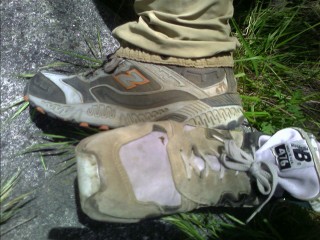 The New Balance 476 shoes; mine 21 years old, Kelly's: 21 days old. |
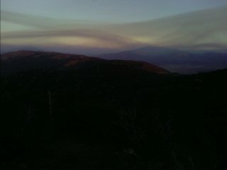
Yesterday was another fine example of a mental game. Like most long distance hikers say, a thru-hike is just a mind game. There are days where I don't feel like heading on, days where I never want to leave town, and days where I just want to sit down and not get up. Ok, I've climbed back into the San Jacinto Wilderness, and continue my way towards Fuller Ridge. Suddenly, the entire ground turned to shades of gray. I panicked, not knowing what to do. I looked up into the sky and saw a small, wispy cloud covering the sun. Oh yeah, a cloud, the first one I've seen. Many locals consider this area the "Mini Sierras", with it's high elevation, forested slopes, and cool temperatures. I've reached 9,000ft elevation, and peer over the edge to the oven like valley floor 7,000 feet below me. The terrain becomes dotted with patches of snow, and eventually starts the long, winding descent to Interstate 10 over a mile below me. I can feel the temperature rise as I drop several thousand feet in elevation. It's time to call it quits at 1030pm as I find a small area of flat terrain on the steep, desert hills.
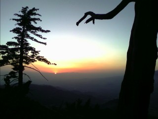 Sunset from the San Jacintos |
I'm on the trail by 6:30am, and continue along, with overgrown vegetation constantly grabbing me and pushing me around. I dread the thought of hiking any lower in elevation, with the valley floor still a ways down. By 7am, the temperatures are in the mid 80s, and I feel like the sun is burning a hole into my hat—and head. I continue down to the valley floor, out of water, with temperatures easily into the 90s by now. I see Colorblind curled within a small shadow next a rock, and a water fountain. In the middle of nowhere, there's a water fountain, installed by the Desert Water Agency above their aqueduct for PCT hikers. She was in a semi comatose daze when I arrived, half dead from the wicked sun beating its several septillion watts of energy onto our dehydrated bodies.
 Water, courtesy of the Desert Water Agency! |
 Noisy, dusty, and dirty—But shade. Paradise! |
The trail winds its way over to Mission Creek, with the landscape again devoid of trees and shade. As the trail crosses it for the first time, I take off my shoes and slowly immerse myself in the churning waters. First the feet; ohhh, then the legs, ehhh; then I completely lie down in it; with a loud gasp! Some backpackers nearby head over to see what all the commotion is about. "Oh, the water's a bit cold." They let out a smile, talk about our trail experiences, and we head our opposite directions. I'm completely doused, fully clothed, and it feels great. At 9am, my watch is reading 97° in the sun, and this is just what I need for the long climb ahead. Within fifteen minutes, I'm dry again, sending all my precious water evaporating into the sky, headed to Nevada and beyond—sorry California. I've been following Mission Creek most of the day, and I'm trying to figure out where I am. The Data Book, jokingly called The Book of Lies since the information it contains is several years old, reports old roads in the area. Where? I'm in a Wilderness Area. There was a large fire in the area three years ago, followed by flooding. Maybe that obliterated what was left of the old roads. Not knowing where to tank up on water for the climb ahead, I see a few trees to my left and find the creek flowing in that area. After dropping down to near I-10 yesterday at an elevation of 1,195ft, now I'm back up to over 8,600ft. I kept the ninety plus degree temperatures from frying my brain earlier today by dousing myself with water, and now I hope the simple change in elevation will solve that problem. I tanked up and took a rest at a spring before a fourteen mile dry stretch. On the CDT, finding a water source like this could take hours, using my map and compass to carefully find the location, often bushwhacking through impenetrable brush as the skies overhead angrily darken with an approaching lightning storm. Out here, there's usually a sign, or something well labeled showing the landmark.
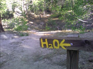 No pulling out the map, or endlessly searching for water. Just follow the signs! |
I was awakened by clouds spitting out the occasional raindrop at 3am. I looked into the sky and saw stars poke through every now and then. I was tired, and decided against setting up my tent. I hope I don't regret this. A little before 6am, the brief light rain started again, and I was on the trail fifteen minutes later. The rain stopped, and I continued a mile or so to what's just described as "Animal Cages" on my map. I spot a lion, tiger, and as I follow around the heavily gated facility, warning of attack dogs and an armed response for would be trespassers, see a black bear and grizzly. Maybe they're used in movies and TV commercials, but it's an interesting way to start my day. I come across Elise, anxious to get into Big Bear to tend to foot problems. We pass a soda cache in the middle of nowhere, and relax in the recliner chair across the trail.
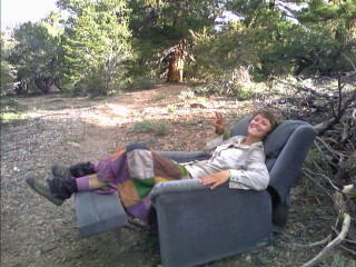 Elise kicking back. |
Big Bear Lake, CA
We struggle to climb out way out of the back of the shiny, red pickup truck, with sore feet now numbed and cold. We work our way to the town hostel, and stuff ourselves with donuts on the way to the post office. NITRO, a Triple Crowner offered me a room at her place a while back. She lives in the Apple Valley less than hour away, and instantly spots me in the post office parking lot with shoes and socks off, and my pack contents sprawled across the shady side of the building. I meet Splash, who is also staying with her after suffering a foot injury on her descent from Fuller Ridge. She hiked the Trail southbound in '05, and decided to tackle it again this year from the other direction. The three of us head along the hot desert floor, stock up on groceries, and head home. I'm greeted by her dad Heinz (yes, that's a trailname), and their four dogs teeming for attention. We enjoyed a steak dinner together, which seemed to take me forever after downing a half gallon of orange juice and a pound of broccoli and dip. NITRO and I shared the usual CDT war stories, and like all other CDTers, said the trail ahead was in comparison, easy.
I've decided to take the morning off, and wait for the afternoon heat to subside before trudging northward. I still have my two pair of custom orthotics in my pack, and mail the hard plastic $495 set back home. The others, ComfortFit's, seem to be working well, and it will be nice to shave a half pound from my pack. It's a little before noon as I busily catch up typing my journals in the comfort of the great indoors (did I just say Great Indoors??).
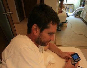 Typing these journals on the old, beat up three year old HTC XV6700 |
 The second plate of the 3200 calorie power lunch |
A 160lb. hiker burns about 500 calories an hour, covering about 2.5-3 miles. Long distance hikers hike about 10-12 hours a day (25-35 miles). A 5000 calorie meal would be like eating 11 KFC chicken breasts, or 7 Macdonald's Big Mac with Cheese, 1 entire large Pizza Hut Meat Lover's® Stuffed Crust Pizza, or drinking 1 1/4 gallons of Baskin Robbins Chocolate Blast w/Whipped Cream. That would be daily consumption. Food is the topic of hikers as the price of gas and fuel economy is to commuters. We need to fuel our bodies as efficiently (calories) and economically (weight) as possible. —ALDHA West website |
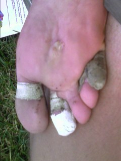
I passed Square Peg early this afternoon, who is suffering from sore toes from a frostbite injury years ago. She's moving slowly, wincing with every step. She hopes to find a ride at the next town to take her to the nearest outfitter, where she can try hiking in sandals. I work my way into the Deep Creek Valley,
 The plastic sign, melted to oblivion. |
 Getting ready to depart after spending the warm afternoon jumping into swimming holes, and relaxing in the hot springs. |
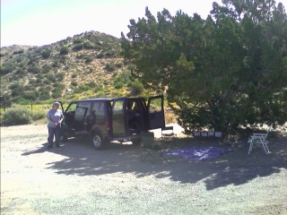
As I leave the Deep Creek valley in mid morning, I come across the Mojave River Forks Reservoir Dam. There's no water behind it, which baffles many hikers, and it's used for flood control Marlene tells me every twenty five years or so, a flood will reach the spillway a good hundred feet or so above the valley floor, and slowly dissipate the raging waters, as opposed to obliterating everything in its path. Speaking of Marlene, I come to a small, seldom used highway and notice a minivan, rear doors wide open, and a blanket on the ground with a couple chairs. As I approach, a lady comes out from behind her van. "Hi, I'm Marlene, would you like a root beer float?" Wow, another trail angel.
 Today's Hiker Trash Headquarters! |
The morning sliver of moon has disappeared, meaning the New Moon is here, and it will start to fill the night sky again over the next two weeks. Last night I slept really well for probably the first time. I built camp while there was the tiniest bit of light available at dusk. For the second time, I'm not night hiking, and it feels great. No dark tunnel of light to contend with.
It was another ten miles to the Interstate and its busy gas station convenience stores and attached fast food restaurants. I scarf down an 1150 calorie Big Breakfast at McDonald's, and by the time I finish, it's lunch. Peter Pan walks in, as I'm working on my large chocolate shake. We stumble one half mile further to a Subway, and I down a footlong, and get another for later. I head back across the overpass, with the busy seven lanes of I-15 racing in opposite directions below me. I scarf down the second footlong sub as the nice, shady spot I'm enjoying quickly draws attention. Wanka and Ben show up, followed by Ladybug and Grasshopper, No Pain, Snakecharmer, Dirk, and Laura. Poppa Smurf arrives a short while later, struggling with his shin splints.
 Today's Hiker Trash Central! |
 Ouch, that's gotta hurt. |
We're on the trail at 7am, and continue the almost two thousand foot climb to the ridge above. As I look towards the dense smog covering the valley below, I can clearly see where I've been over the last several days. I can see part of Silverwood Reservoir, and beyond that a high ridge with Deep Creek behind it. To the right, behind the smog is probably Mt. Jacinto. What's that? another bear? Sure enough, there's a bear, oblivious to the fact that I'm approaching. I yell at it, and it glances at me briefly before continuing to clean up a recently used campsite.
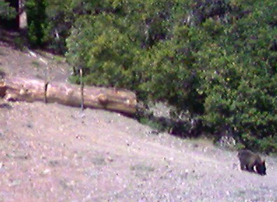 I've seen just as many black bears in the last week as I spotted on the entire CDT. |
Wrightwood, CA
I get dropped off at the local grocery, and purchase my next four days of food, a large premade salad, half a gallon of apple and orange juice, and large sub sandwich. I sit out at one of the picnic tables out front, shaded by umbrellas, and chat with the tourists as they finish their lunch that is being smoked next to us in the BBQ pit. A while later, five other hikers yell out my name, telling me they have a house to stay in courtesy of a local Trail Angel. We head on over, in the small car, with Blackfoot crammed in the child car seat. I shower, do laundry, and we all stroll over to a local pub for some live blues, and the usual too much dinner, including the gigantic Double Yodeler burger. Not thinking it would be enough, a couple of us shared a large pizza.
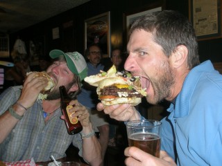 Enjoying the Double Yodeler |
We all reached the trail again, and started up the trail as Team HardCore Caboose—Caboose as in we're at the back of the pack. The "herd" started about ten days before us after ADZPCTKO. We all have different reasons for starting late, such as appendectomies, graduating school, caring for parents, or saving up money. We wound our way up the twelve hundred foot climb towards the Mt. Williamson Summit Trail, and dropped back down to the Angeles Crest Highway just as quickly. After an exhausting last few miles, we continue along the trail back down to the highway again and are greeted with a trail closure. The endangered Mountain Yellow-Legged Frog has critical habitat along the river ahead, and the trail detours along the highway and through a campground. The others call it for the night near a picnic area, and I trudge on to get the highway walking over with. I finish up my day at the end of the detour with the noisy rush of creeks all around me.
The trail climbs back up to the highway, and I continue on with the loud roar and whine of motorcycles barreling along the road. I stop to work on a foot problem that started bothering me this morning. As I walk, the top rear of my shoe places pressure on my achilles tendon. I carefully cut away the foam on the top of the shoe, and the issue that had bothered me for the last day has pleasantly disappeared. I reach an area on the trail with pinecones laid out below me to read "400 miles". Huh, I've done four hundred miles already. I can't get over how different this from the CDT, or hiking in Colorado in general. The trail is in great shape, I don't need to pull a map and compass out every half hour, and I'm not hiking straight uphill to climb over 12,000ft passes. I see why people on the CDT told me not to worry about the PCT. "The miles will come, don't worry about it."
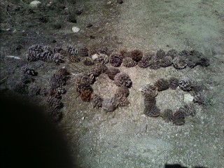 400 miles done! |
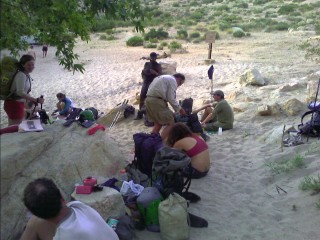
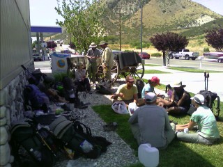
The five of us all leave for the trail at different times, and hike the over seventeen miles by a little after noon to our next water source at the North Fork Ranger Station.
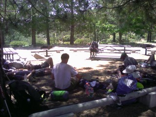 Enjoying the shade and each other's company at the first water source in almost 18 miles |