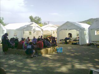
 Wonderful, shady accommodations |
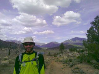
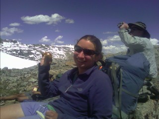
The next day was spent lazily finishing up chores and resting. It was in the 80s by 9am, and getting out on the trail in the late morning is about is smart as jumping into an almost frozen lake on January 1st with one of the many Polar Bear Clubs around the country. After spending almost a hundred dollars on five days of food at the local grocery, four of us took up an offer to head to a community a half hour away for some shopping at the large grocery stores. I need eleven days of food for the Sierras in less than a week, and thanks to one of the Saufley's neighbors, Susie, who was headed into town for some shopping, invited four of us along. We piled into her SUV to stock up on food to mail ahead two hundred and fifty miles to Kennedy Meadows—the infamous start of the High Sierras. I gasped when I weighed my two boxes.
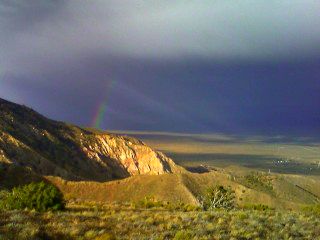
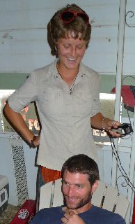 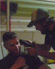 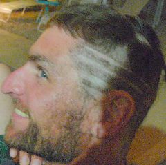  Uh, is this really a good idea? Going, going, gone! What did you do to my hair Elise and Blackfoot? |
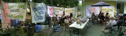 Casa de Luna - The Anderson's |
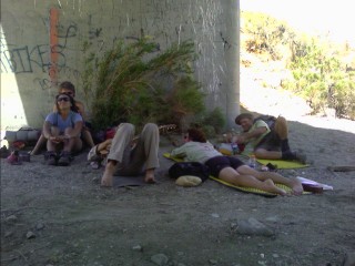
I continued on the next seven miles to the road, and soon was at Casa de Luna. There were probably thirty people spread out around their property when I arrived. I met the, should we say, 24 Club, happily resting on chairs sprawled out on the driveway. Despite drinking a case of beer and no sleep over the last 24 miles, they're still feeling strong.
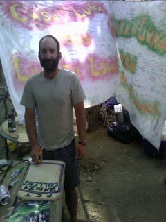 Fix-it making a plaque—24 in 24. |
FRIENDS: Never ask for food. BACKPACKER FRIENDS: Always bring the food. FRIENDS: Will say 'hello'. BACKPACKER FRIENDS: Will give you a big hug & a kiss. FRIENDS: Call your parents Mr. & Mrs. BACKPACKER FRIENDS: Call your parents Mom & Dad. FRIENDS: Have never seen you cry. BACKPACKER FRIENDS: Cry with you. FRIENDS: Will eat at your dinner table & leave. BACKPACKER FRIENDS: Will spend hours there, talking, laughing, & just being together. FRIENDS: Know a few things about you. BACKPACKER FRIENDS: Could write a book with direct quotes from you. FRIENDS: Will leave you behind if that's what the crowd is doing. BACKPACKER FRIENDS: Will kick the whole crowds' back-ends that left you. FRIENDS: Would knock on your door.... BACKPACKER FRIENDS: Walk right in & say, 'I'm home!' FRIENDS: Will visit you in jail BACKPACKER FRIENDS: Will spend the night in jail with you, since they were probably arrested at the saloon fight with you. FRIENDS: Will visit you in the hospital when you're sick BACKPACKER FRIENDS: Will cut your grass & clean your house then come spend the night with you in the hospital & cook for you when you come home. FRIENDS: Have you on speed dial. BACKPACKER FRIENDS: Have your number memorized. FRIENDS: Are for a while. BACKPACKER FRIENDS: Are for life. —The Switchback |
Today, I've had more beer than the rest of the trail combined. I'm not worried about the heat as much, since the trail is now often above a mile in elevation. I hang around for the hot dog lunch, with other hikers slowly dribbling in and out from the trail, or off on a shuttle ride to a nearby town. I've gotten a bit fatter over the last twenty four hours, and it feels great. A little after 4pm, several other hikers were ready to hit the trail, and Joe and Terrie took us in their cars the two miles up to the trail, with the skies shrouded in a thin veil of clouds. The climb out of the valley was pleasantly uneventful, and I was able to easily do miles as the sun disappeared behind the horizon, and the half moon taking its time across the starry sky. City lights cast an eerie glow at the bottom of the valley floor several miles away as I followed the trail along the top of the ridge. I eventually dropped into the trees, and donned my headlamp as the moon hid behind the hillside. Around 10:30pm, I found a flat area above the trail on the ridge I've been paralleling for the last few miles. There was still a bit of a breeze, blowing the plants around like rag dolls as I found a sheltered spot for my camp.
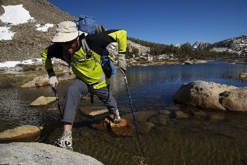
The valley floor to my left was shrouded in thick clouds, and to my right, the landscape is covered in a thick smog coming from L.A. I cross below another of the dozens of gigantic powerlines that are strewn above many of the ridgetops to feed the large cities to the west. As I crossed a road this morning, I walked past a collection of pinecones spelling out "500". Five hundred miles already! It's hard to believe, but I'm slowly working my northward through the 1723 mile long state. Continuing along through the shaded trail, I passed Hawkeye, who I met at the Anderson's yesterday, and on the CDT two years ago. He was breaking camp this morning as I passed by on my way to today's first water source. A few miles later, I reached a concrete water tank in the middle of nowhere. I filled up at the rainwater catch tank for the next fifteen dry miles until I reach Hiker Town. As I descend into the Mojave Desert, I approach a good sized dark colored rattlesnake. It looks at me in anger, suddenly coils up and starts rattling. Its head rises, and carefully peers at me with its slender eyes. I stop in my tracks, back up, and watch it noisily escape into the surrounding brush. I head on several miles, crossing the San Andreas Fault somewhere around here, trekking up, down, and around reach the highway and cross the street to the Hiker Town hostel. Thirty or so hikers have left several hours ago, and there's three left. I fill up my water bottles, take a break, and continue on into the Mojave Desert as the sun slowly slides below the horizon. I soon reach the Los Angeles Aqueduct with the half moon shining brightly above. My first images of the trail in Southern California were of the Aqueduct, and the seemingly endless roadwalk through here burned into my mind. The large structure makes a right turn and disappears underground encased in concrete. I peer into a noisy manhole with my headlamp and see the churning waters race into another iron pipe headed for the big city. As I follow the lonely, dark concrete covered aqueduct, I glance upward towards the constellation Vega to see a satellite lazily dancing across the bright sky. After over thirty miles today, I call it quits a little after 10pm in a area surrounded by tight Joshua Trees protecting me from the strong gusts blowing through the area.
The temperatures were in the 70s as I went to sleep around midnight, and now they're not much cooler. I was on the trail a bit after 5am, and at 6:30, I'm already starting to get warm. There are hikers everywhere breaking camp and coming out of the brush onto the road. I soon meet a good half dozen others, and we make our way to Cottonwood Creek Bridge. There is a water spigot here, courtesy of the LA Water Authority, and we fill our bottles and hang out under the bridge for the next seven or so hours, waiting for the temperature to dip below 120° in the sun.
 Resting under the Aqueduct's Cottonwood Creek Bridge |
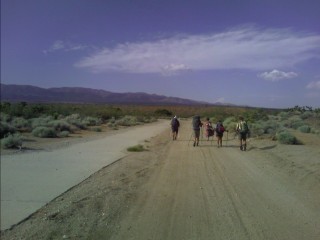 Trekking through the Mojave alongside the LA Aqueduct |
Ladybug, Grasshopper, Elise, Warren, Dawson, and I reach the highway near Tehachapi Pass dehydrated, and find a freshly stocked cache with water and sodas.
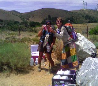 Another badly needed roadside water cache! |
Tehachapi, CA
Ladybug, Grasshopper, and I check into a local motel room, and after the usual shower and laundry, we hung around trying to take a nap, watch TV, rest the feet, and not much else. We thru-hikers are the most free, healthiest, and fittest individuals in the world. In town, we're some of the laziest, dumbest, and uncoordinated people on earth. The plan of watching a movie at the theater down the block, having a few too many beers, and terrorizing the town never materialized. The heat, excessive amounts of dust and sand blowing in our sun-leathered faces, and long miles has us in a semi comatose mental state, and physically handicapped. Late in the morning, a local offered me a ride the one and a half miles to the grocery stores and fast food joints. I downed a footlong sub, headed next door for a large chocolate shake, and stumbled through the grocery store for a week's worth of groceries. I got another footlong sub for the fridge, and a patron offered me a ride back to the motel room. That afternoon, Luna's (formerly known as Elise) mom met us to pick up her daughter for a family reunion for a few days. She took the six of us to the local Taco Bell for dinner, where everyone else wanted to go, where I scarfed down a Mexican pizza, and combination of ten tacos and bean burritos. My original plan was to cruise out of town this evening, but why? Sure, I'm itching to take advantage of the moonlight for night hiking before it disappears for two weeks, but the daytime temperatures aren't scalding any more—so I'm staying put.
The next morning is more of the same; do nothing. I downed the sub in the fridge, took advantage of some OJ and cereal at the continental breakfast, and gave up my bed for Warren and Dawson, who were in the small town of Mojave last night to pick up their maildrop at the post office. I packed up my gear, while the four others wisely take a Zero Day. I stuck my thumb out, an looked behind me to see dark clouds and rain covering the Tehachapi Pass area. I started to have second thoughts, but I'll gladly take this over 90+° temps. Within ten minutes of my thumb out, I found a ride. We headed up the four lane highway to avoid a stop at the occupied railroad tracks, and headed along the narrow, winding Cameron Road back to where I left the trail. He tells me about the fire that swept through the area years ago, and shows me the shells of old buildings are still visible on the ranches that dot the small valley. There are dark clouds above spitting out rain onto the windshield, and he happily offers to take me back to town if I desire. I refuse with an authoritative voice, excited to see clouds in the sky.
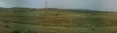 The Tehachapi Wind Farm |
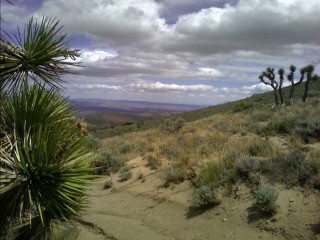
 High above the Mojave Desert |
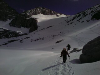
I'm on the trail early the next morning, reaching my first water source for twenty five miles. There are several others here, sharing stories about a bear and mountain lion sighting last night, or excitedly talking about the High Sierras that lie over a hundred miles up the trail. I continue on, spotting a pile of bear scat on the trail at one point, and pass below many more wind turbines that are spread above the trail on the ridge like scattered lawn darts. The terrain is still open and relatively treeless as the sun beats down on me. The High Sierras, with its snowy summits, peeks above the horizon every now and then. As the afternoon progresses, large trees start to become the norm, maybe pinion pine, soon giving way to a more diverse assortment of dense forest. I pass my last spring for fifteen or twenty miles and fill my bottles with a couple other hikers. Hike On reports seeing two bears today. One alive, and the other decomposing off the side of the trail, with its sharp, white canines pointing towards the sky. I hike until dusk, finishing my day in a strangely quiet place with no wind, crickets, or other animals making even the slightest twitter or squeak.
I'm greeted this morning with a few errant raindrops landing on my face, and dense fog covering everything around me. I'm on my way a bit after 6am, and patiently wait for the fog to burn off on this second cold 38° morning. The sky starts to clear, and suddenly darkens again. The surrounding peaks are covered in clouds, and I walk quickly to stay warm, soon beginning a long descent into the desert again. There are illegal motorbike trails everywhere, crisscrossing the landscape like a checkerboard. I cross a road this morning, and suddenly a military chopper buzzes me as it flies over the nearby pass close to the ground. That storm that came through yesterday was probably a cold front, with its strong, gusty northwest winds blowing me around like a windsock. At 11am it's still in the 50s, and as the day progresses, never even reaches past the 60s. This area is known to be ferociously hot, and today I'm lucky—really lucky.
 No man's land |
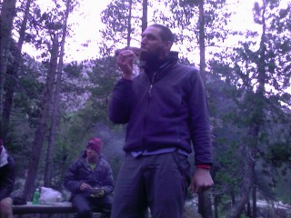
Annie, Kickstep, and I wake up this morning to strong winds again, and a dense cloud cap over the high ridge we're camped on—better known as fog. We all wake up a bit later than normal, and rush to get moving down to a lower elevation. As early afternoon arrives, I reach the campground near Walker Pass, and something looks different. "Meadow Ed, is that you?" I haven't seen him since the Kickoff, and he's here with a picnic table covered with everything a hiker could want: salad, chips, cold beverages, you name it. He came in yesterday, and served up grilled chicken. Later today there will be brats, and all the fixin's. Halfmile's here (I use his maps), giving hikers rides into town, and I also see Colorblind, Luigi, and Lint—all familiar faces. There's about a dozen others here, kicking back and resting the feet. Splash, who I met at Nitro's a while back recovering from a foot injury, is here with a removable cast while a hairline fracture in her foot heals. The miles I've been doing, and five to six thousand plus calories I'm burning each day has left a severe shortage of snacks in my food bag. I wanted to "starve" myself the last two or so days into Kennedy Meadows so I could start eating those 57,260 calories I have for the next eleven days or so. Forget about it. I took up an offer from some locals dropping off another hiker, and headed into Onyx with Rockstar. Onyx is a sleepy town consisting of a gas station convenience store on the main strip, and not much else. Kickstep, Annie, Splash, Buck-30, Rockstar, and I enjoyed some time on the front porch eating, and staying warm. Up on the Pass, it's considerably cooler, and quite windy. Down here in the shade, it's still cold! Usually it's in the 90s around here this time of year. I struggle to down a half gallon of ice cream, which I haven't done since the Colorado Trail in 1998.
 My first half gallon of ice cream (double chocolate fudge) in quite some time |
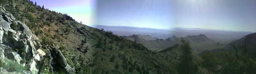
There are mountains surrounding us in every direction, where before we traveled from desert floor, over a mountain ridge, and across another desert floor, to skirt private property.
 |
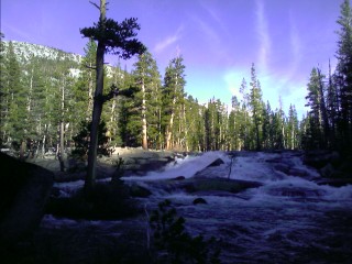
We left Chimney Rock Campground this morning, consisting of us and a high school group headed north on the PCT, and traveled through a large human-started burn area as we neared our first river on the trail—the Kern River. Not very big, but more volume than anything else we've seen on the trail.
 Along the Kern River |
Kennedy Meadows / The High Sierras
Will today be my first Zero Day, or will I leave early this evening? It's late morning, and the fair weather cumulus clouds have swollen into large, dark, angry masses of gray and black. A few chilly hours later, there is the rumble of thunder, a spattering of rain, and an errant gust of wind.
We are talking about the High Sierra with the gray granite..."The sky-scraping Sierra Nevada, John Muir's "Range of Light" which has no equals". You know, the one with "eight national forests and three national parks". You know, the one where "eleven peaks top 14,000 feet and some five hundred top 12,000 feet". You know, the one who is "home to sixty glaciers". You know, the one who is four hundred thirty miles long and is the "largest continuous block of granite on the planet". —PCT-L listserve |
The air is crisp this morning as I get up a little before 8am. Tuna Helper's uncle is here, and serves us some eggs from his camper in the parking lot. The southbound hikers I met yesterday are driving out this morning, and offer me a ride almost a mile back to the trail. I pass through dusty meadows full of sage for the first several miles, then the trail starts to work its way into forest as it ambles along the Kern River. The weather is mostly cloudy, with comfortable temps in the 70s, and creeks spilling across the trail every few miles. As noon comes and goes, I reach a bridge over the South Fork of the Kern River, and spot Blackfoot on a sandbar sunning himself. I take a break on some grassy ground nearby, drying off my groundcloth, and eating down a small fraction of my almost 35 pounds of food. A while later, we're joined by Root Canal, Lint, Colorblind, Luigi, Princess Leia, and Tuna Helper. Annie, Kickstep, and Buck-30 soon follow, and we split up into a few different groups. We head on to Cow Creek, which we follow for several miles before reaching its headwaters and building camp. One starts a campfire, and we all eventually congregate around the warmth emanating from the glowing pile of branches.
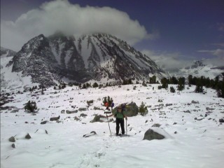
We continue to climb consistently, eventually reaching 10,000 feet in elevation with low clouds closing in from all around us. There is fog tightly wrapped around the windward side of the lofty peak above like a blanket, as we trek our way towards some of the highest peaks in the state. Kickstep, Annie, Buck-30, and I run into the group we camped with last night several times, as the sun slowly slides into the cloudy western sky. The weather is a bit chilly, with peeks of the sun here and there. The high peaks to the north slowly work their way closer as we build our camp after a little over twenty miles today.
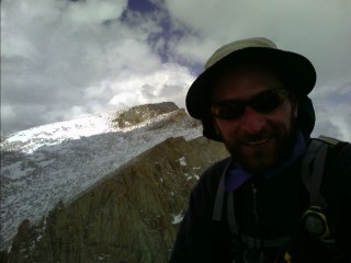
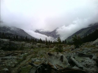
We leave the Inyo National Forest, and enter Sequoia National Park as the morning progresses. Temperatures never climb above the mid 60s, and the cirrus clouds continue to dominate the sky. The nearby peaks are shrouded in clouds as we pass Chicken Spring Lake; our first tarn, or high alpine lake, on the trail. We tire more easily now, with our small, lightweight packs that were never designed to carry forty five pounds rubbing our shoulders raw. The eleven days of food we packed in at Kennedy Meadows has now been reduced to a little over a week's worth, making our hike more tolerable each day as we eat away our food weight. We arrive at Crabtree Meadows, where several other thrus are anxious for tomorrow's adventure—a side trip to climb the Lower 48's highest peak, Mt. Whitney.
It's 5:30 in the morning, and there's not even the slightest whisper of wind in the air. At 6am, we are on our way up the 8.5 mile trail to the summit. As we climb our 4,000+ feet of vertical, we witness sheer granite cliffs everywhere, often hiding behind a bank of clouds hovering all around us. The bitter cold morning we were expecting never happened, and we warm up quickly on the long trail up to timberline. We pass lakes as smooth as glass, reflecting the surrounding high peaks drenched in alpenglow, and pink clouds blowing up all around us like a smoke machine.
 Atop the highest peak in the Lower 48. |
 Another 14er today—Mt. Muir |
After another night in the mid 20s, we take our time getting up. The deer are back in Crabtree Meadow, and the sun quickly raises the chilly temperatures above freezing. We pass several other thru-hikers taking a zero day, or breaking camp as we cross the creek and join the infamous John Muir Trail (JMT) for the next two hundred or so miles. The trail passes in and out of several drainages as it climbs its way to Forester Pass. I trek over Bighorn Plateau, with its endless views in every direction of high alpine lakes and craggy peaks, and through the first ford, or river crossing, I can't skip across over the logs or rocks—Tyndall Creek. We rise above treeline again for the long slog up to Forester Pass.
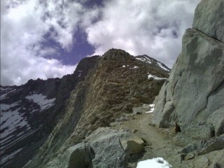 On approach to Forester Pass |
 Slogging through the snow on the north side of Forester Pass |
Today's plan is to travel about sixteen or eighteen miles, depending on the weather, terrain, and amount of snow we walk through. The sky is crystal clear as I look at the frosty ground on this bright morning. With the chill in the air, we don't get going until 9am. Not being a morning person, it feels great. We descend Bubbs Creek, a wide valley teeming with granite cliffs and cascading waterfalls. The trail takes us on another long climb up to 11,978ft Glen Pass. The descent is through steep snow, and if it was early in the day, the hard snow would leave little room for error. It's mid afternoon, and the snow is just firm enough for me to standing glissade the several hundred feet down to the rocky ground below. A moderate drizzle develops as we descend our way down to Woods Creek. I'm dumbfounded by the sudden change in tree variety over the last mile as I approach camp. I saw my first aspen tree a couple miles ago, and from what another hiker showed me from his PCT Guidebook, I've also seen, or will by tomorrow, mountain hemlock, western white pine, red fir, jeffrey pine, and white fir. There are several other hikers here, some weekenders following the Rae Lakes Loop, and thrus just returning to the trail after a resupply in town or seeking refuge from the threatening dark skies that have been spitting out occasional light rain and snow for most of the afternoon.
 |
Late last night, I heard the pitter patter of raindrops splashing onto my tent. As the morning light penetrated our camp, there was still a light rain falling from the dull, gray sky. There was debate this morning whether to head on, or wait it out. As we tried to come up with a decision, the dark sky suddenly cleared into a magnificent blue canopy, with the high peaks bathed in fresh snow. We quickly broke camp at the crack of 9am as the sun bumped its way into the sky and warmed our tents. Our day started with by crossing a large suspension bridge over Woods Creek. There was a long ascent up to the 12,130ft Pinchot Pass, with the thunderous roar of the creek at our side. I'd gaze over towards the churning waters to watch its violent drop over the many waterfalls and rock ledges diving into the abyss below. We approached ten thousand feet in elevation during the late morning, and the snow that was once two thousand feet above us was now crunching under our footsteps. The trail became difficult to follow as the one inch of snow on the ground quickly became several as we gained elevation. It was a long climb up to Pinchot pass, with the new snow now turned into wet cement, slowing our progress to a crawl.
 Up to Pinchot pass |
The morning was overcast again as I slowly hit the trail after 9am. I'm the last one here as I take down my rain soaked tent. My down sleeping bag has become noticeably flatter from the damp air, and last night was uncomfortably cold.
 Airing out the sleeping bag |
 Annie's got a new trailname—Lunchable |
 |
We're all up early this morning for the long climb up to 11,955ft Muir Pass. The sky is bright blue, and we slowly make our way to timberline. The trees gradually disappear on the way through the krummholz to the land of white. The long climb continues as we pass Helen Lake, and begin the final push to the Pass.
 Ugh, that's not good |
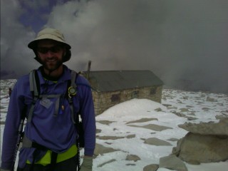
It's difficult hiking in these conditions, with virtually all of us in running shoes with treads torn up from the rocky trail. The snow has softened as the strong sun beats it into mush. Our pace has slowed as we near Muir Pass, and the stone hut built by the Sierra Club in the 1930s soon comes into view. We take a good break at the 11,955ft pass with a half dozen other thrus as clouds slowly envelop the surrounding high peaks and glaciers. To the north, the snow looks endless. It feels like mid May, not June around here. The snow is too soft and terrain too flat to glissade, so we're forced to slowly hike down through the bottomless snow for the next two hours. The lakes we follow are still encased in ice as timberline nears, and the snow eventually disappears from the wide open, exposed landscape. As the trail drops to 9,210ft, we cross Evolution Creek, which is one of the most difficult river crossings on the PCT due to its swiftness and large volume. Despite the fact it's late in the day, the sun's been out, we've had recent new snow and rain, the river ford was straightforward. We all made it safely across the thigh to waist deep waters without creating any new adventurous experiences. The trail continued its steep dive to the valley below, following Evolution Creek all the way from its source to what has now become a raging torrent.
 The violent, tumbling waters of Evolution Creek |
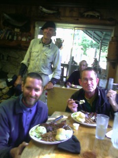
 Steak!! Trail Magic, dozens of miles from nowhere |
As the morning progressed, I left Kings Canyon National Park and entered the John Muir Wilderness as I crossed the South Fork of the San Joaquin River for the third time this morning. This area also marks the halfway mark on the trail through California! I hiked along as it rose above the river valley, listening to the mating call of a grouse, and the whisper of the wind blowing through the trees. The trail wound it's way up to 10,900ft Selden Pass, and descended through large patches of snow strewn on the ground below. The descent was slow, and my energy level dropped to near zero as I postholed and stumbled my way through the difficult trail conditions. This descent off the pass is easier than the others, but after ten days of eating candybars, poptarts, and Lipton noodles, I'm feeling the effects of my diet. My feet are also starting to feel the effects of being wet for over a week now, with calluses peeling away, and sore skin under my big toe. Kickstep, Lunchable, and I arrive at what's known as the most difficult ford on the trail—Bear Creek. The three of us head across together without problems, with the churning waters nipping at Lunchable's waist, and I use their stove to warm some water for the last of my noodles. I trekked ahead, and finished my day atop Bear Ridge.
There was the dull roar of thunder under clear skies around 2am, and I threw up my tent stakes and poles just in case, ready to throw up the tent at a moment's notice. The roar grew louder with each passing minute, and then suddenly stopped. I could see dark skies behind me, but still crystal clear above, with the Big Dipper clearly visible through the dense tree cover. Today is day eleven since I last resupplied my pack with food, saw a road, a single light, car, or any other unpleasant site, sound and smell of industrial despoilment. We are destroying out precious heritage with the mini-malls, mega malls, and the need to have everything now. I haven't tuned into the news for quite some time now, reporting what people want to hear, and often not the full story. I've been on many backpacking trips, and other than climbing Denali, never traveled this long or far without these annoyances. I took my time getting up this morning, with Kickstep and Lunchable passing me a little before 7am, and reporting a bear sighting a half mile back. I was on the trail a little after eight, and took my time on the less than five mile day to the Vermillion Valley Resort's ferry ride across Edison Lake, which delivers us to their lodge. Their usual pontoon boat is being repaired, so we're on a small aluminum boat being splashed by the waves crashing into the bow of the small craft. Even with Princess Leia's umbrella I hold out in front of us, this is the wettest I've gotten on the trail, and fortunately we'll be on the warm shore after the four mile or so ride. I deboard the small craft, with it rocking precariously back and fourth as I hop off with her, Kickstep and Lunchable.
Vermillion Valley Resort
The talk today is about exhaustion, with everyone excited to be done with the unsettled weather, cold, wet feet, and endless climbing over the high passes. There's even a couple hikers here that have developed a fever and weakness this evening. We gather in the small restaurant as the temperatures outside start to chill. It's a Saturday night, and tonight is BBQ night. We all excitedly fill up the seats inside and decide what we want for dinner. I decide on the Combo Plate, with a huge portion including a couple sides.
 The chicken, ribs, and tri-tip combo plate—exactly what I need right now! |
I was off on the ferry to the other end of the lake at 9am, and began my long day towards the end of my 13 days without a shower, laundry, or resupply (other than the one day of food I picked up at VVR). The long string of subfreezing nights are mostly done, and the thought of some real food, fun, and sharing stories with other hikers in town tomorrow has everyone excited. I meet Too Obtuse and Princess Leia at the top of 10,900ft Silver Pass late this morning, and we slog our way down through the snow to the trees below. Now that I'm out of the wind, I remove a top layer of clothing, and... oh yeah, and it's the first day of summer today, thru hiker Hike Naked Day!
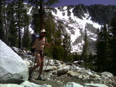 It's that day again—Hike Naked Day |
I was up at 6am for the several mile hike into Red's Meadow. There was a small store and restaurant, horse corral and rustic cabins. There's also a bus that run
|
|