Side Trip to Mountain Rescue Association (MRA) Conference in Juneau
BC Ferries / Alaska Marine Highway System - Bella Bella, BC to Juneau, AK
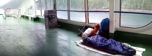
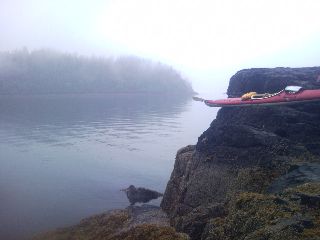
I gaze back at the small terminal, watching it grow ever smaller as we steam north into the wild unknown. The ferry rolls side to side as it makes an endless number of quick, sharp turns, carefully negotiating the narrow channels choked with reefs, whales, and strong currents. I head up to the top deck and decide to risk it all. I throw down my sleeping bag and tear open the bag of earplugs buried at the bottom of my drybag. I'm in between the deafeningly loud exhaust ports rumbling several decks above the ship's large engines. I stare down at the her stern, and the white ribbon of propeller wash stretching out into the cold, dark seas. Later this morning, I'm suddenly awakened by a light rain splashing onto my face. Being a bit indolent at this early hour, I pull the drawstring on the bag's hood tight and roll over back to bed. As 4am quietly creeps closer, the drizzle grows to a steady rain, and I roll up my gear and tromp down the stairs to the covered poop deck and try it again.
 |
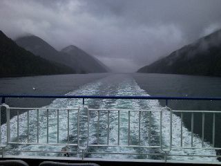 Steaming thru Grenville Channel |
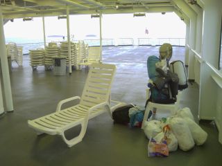
I board the next redneck cruise ship, better known as the Alaska Marine Highway Ferry Taku. It was built in the early 1960s, and refurbished twenty years later. I grab a plastic lounge chair in the solarium on the top deck and lay down my sleeping bag and Thermarest.
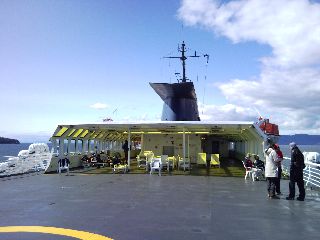 The solarium on the AK ferry Taku |
There's a brief stop in Wrangell, Petersburg, Kake, and Sitka along the way as sunny skies bathe us in warmth. I jump in for a quick shower, wash a couple clothing items, and rinse the caked on salt off the drysuit. I return back to the solarium to find grey skies overhead. The wind helps dry out the dripping gear, but rain soon ensues. The beard is going to go in the next few days, so I do it now, leaving the shorn hairs stacked like logs on a paper towel. The beard's been great as a SPF/UPF for my face, but with the quotidian overcast skies, I don't need the protection anymore, nor do I want to take vitamin D pills. I sit here in the darkened theater room, electrical cords sprawled out from one of the few outlets around here. I have batteries charging, and thoughts rushing through my mind as I catch up on journals for the last few days.
2010 Mountain Rescue Association (MRA) Conference - Juneau, AK
I give my last goodbyes to everyone I've met over the last few days, and Pauline from Juneau Mountain Rescue picks me up from the ferry terminal. We head the several miles into town, and I gaze at the half dozen large cruise ships forming a seemingly impenetrable wall at the side of Gastineau Channel. I've been to Alaska only once before, for the MRA Conference in Anchorage in 2004, and a climb of Denali. This time I've paddled halfway here, and after the ferry rides to and from the conference, will hop back in my boat waiting for me in Bella Bella, BC and continue my trek north. If I kayaked here without the ferry rides, it would have meant 30+ mile days with no time off; no time off for resupply, or bad weather, and no Squirrel Cove Seafood Festival—no thank you. I meet Cachet, Rich, and Vino (who I met on the Couchsurfing.org website) for dinner this evening, and am offered a place to stay.
The first day of the conference were classroom sessions, and I chose avalanche science and hypothermia treatment in the backcountry. A fifteen thousand dollar thermal camera was used to measure snowpack temperature as it heats up on its hundred plus mile an hour descent to the valley floor. I asked a few questions during a talk on new avalanche search techniques, and learned how to find very specific weather information through the National Weather Service when planning for a major search.
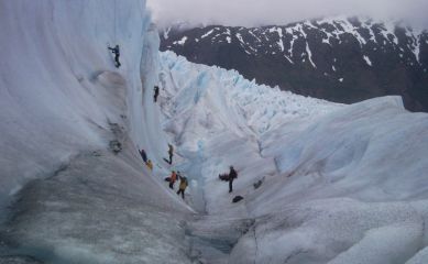 Ice climbing on the Mendenhall Glacier |
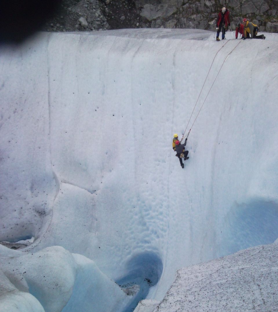 Practicing rescue techniques |
As Saturday rolls around, we all board busses for the Eaglecrest Ski Area. I amble through wet bogs for a field session on search clues, and since I don't use GPS devices, I tried my hand at using one to find hidden caches. The evening was followed with a dinner, a spectacular Indian ceremony, and silent auction.
 |
 |
After Sunday's business meeting, the conference is over. The fellow members I've met over the last four days from around the Country part ways, and I find myself all alone in the Conference Hall. I head to the other side of the city—which takes less than fifteen minutes by foot—and use my tram pass to gain a ridge and climb Mt. Roberts as late afternoon sneaks in.
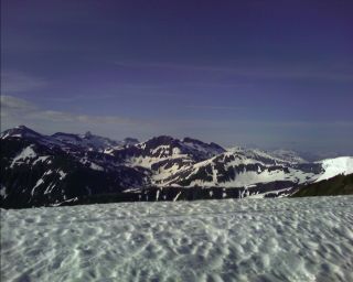
 The view from Roberts Peak towards the Juneau Icefield |
As the 25th of the month rolls around, and the summer solstice come and gone, I wish Rich, and roommates Dylan and Adrian a great summer, and Pauline offers me a ride back to the ferry terminal on the way to run some errands. After seven days on ferries, four at the Conference, a week in town, and two weeks of low mileage paddling days to avoid arriving at the Bella Bella ferry terminal a week early, I'm growing antsy—Juneau was great, but I'm out here to kayak. My indefatigable thirst for adventure is growing stronger with each passing hour. I pass through Customs, watching the Border Agent stare at visitors intently, looking for the slightest sign of uneasiness. His eyes fixated on people as they answer the standard battery of questions. I board the Taku ferry, (I was on her on the way up too) and my fretful mind is tamed a bit as the ship steams through strong headwinds, heavy rains, and chilly air—but I'm ready for more paddling adventure.
I share the solarium with a dozen Boy Scouts, returning early from bad weather, as we make stops in Sitka, Kake, Petersburg, Wrangell, and Ketchikan. The novelty of the ferry ride has worn off, and I grow restless. I head outside at midnight to the lonely bow of the ship and brave the brisk winds chilling my body. The water shimmers like broken glass as the full moon peeks through the thick jumble of clouds. Behind me is a whisper of twilight as we slowly steam away from the Land of the Midnight Sun. I crawl into my bag as the gentle roll of the boat, and hum of 8,000 horsepower six decks below puts me to sleep. There's the occasional bump or yell from one of the Boy Scouts packing up for their arrival into Ketchikan at 3am, and then silence.
The Taku leaves the dock a bit after six in the morning, and I stare at another Alaska Ferry—The Columbia. On its way up from Bellingham, WA, it's teeming with people. The solarium is full of tents fluttering in the wind, full of adventurers from the mainland eager to start summer jobs in Alaska, or headed off on their own adventures.
 having the whole solarium to myself |
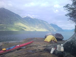
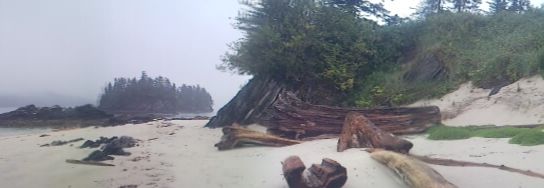
Five of us are up and out the door by 6am for a taxi ride to the ferry terminal to board the Northern Exposure, barely a year old. If I would have missed this ferry, the next one with a stop in Bella Bella would be July 12 That would not be good. Getting here is not easy. The last ferry to make a stop here was June 14—the one I took to get towards Juneau. As for the Northern Exposure, it lacks the intimate, old feel of the Taku, with artificial wood paneling covering the guts of the ship, and sterile looking drop down ceilings. I feel like I'm in a waiting room. There's several different lounges, or seating areas, aboard with seats facing fore and aft, or towards the water. I try playing with the GPS on my phone, which often works great, and others it doesn't. I reset the device, rerun software, and turn the phone on and off (even though there's no service out here—which it doesn't need). If I really need it at some point, and I haven't come close yet, I'll get it to work. As the lazy afternoon wanes, we arrive into Bella Bella. I debark, and within a few seconds, my gear is wet for the first time in half a month. I walk to the end of the ramp, and—Bunny! Is that you? Her family hosted me in town last month as I waited for my departure day. I answer her questions about my epic side trip to Juneau over the last half a month, and politely decline her offer to stay another night in her home as the rain intensifies. My heartbeat races as I ask myself a question that's been bothering me for two weeks now—is my boat still here? I round the corner of the old fish processing plant, eyes intently focused on the far end of the building. Is my boat locked up inside? Is it where I left it? Without any way to contact the new part time caretaker, I've been a bit anxious. What if there's no sign? Then what? The nearest kayak outfitter is two hundred miles away. Oh no, what if it... I glance around the corner, nervous with fear—good, it's exactly where I left it. I carry it down to the water and begin loading it with over one hundred pounds of stuff—food, water, and gear. The pitter patter of rain noisily splashes on my boat's deck as I hop in and set off for the second half of this one-of-a-kind adventure. Despite the conditions, there's a big fat smile on my face as I stomp out a flat spot in some tall grasses, ending the short day at Kynumpt Harbor as the rain continues.
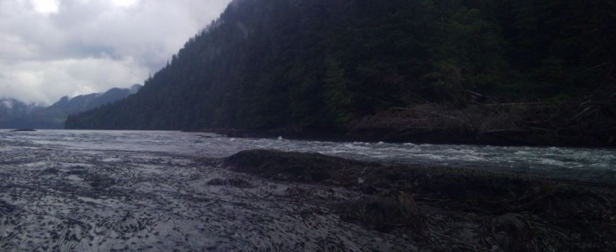
I wait for a lull in the rain to break camp on this gray morning. The the dull crackle of thunder roars at seven thirty as I mosey along Seaforth Channel. There's a line of a half dozen fishing boats headed in every direction, and some large pleasure craft headed north. I peer in the distance at the edge of Milbanke Sound to see a yellow dot grow ever larger with each paddle stroke. I see the outline of a person, with paddle in hand. Wow, another paddler! Justin's on his way towards Port Hardy after paddling with a group for several days. We're both surprised to see others out here, and wish each other luck as we disappear into the abyss. The endless maze of short, narrow passages continue with a traverse through Baldony Pass, Reid Passage Lady Trutch Passage, and Mathieson Channel. I hop out of my boat a couple times looking for a flat place to camp as I enter Rescue Bay at the edge of Jackson Channel. I hear a distant hum grow louder, soon spotting a large motor yacht anchoring on the other side of the bay. Two men dressed in bright orange jump into the tender with fishing gear in hand. They motor to shallow waters, soon yelling expletives as a dark curtain of rain wraps itself around Rescue Bay.
Today I've decided to take the uncharted route through Griffin Passage. There's a rapid or two, shoreline teeming with bears, and large, bright red sea urchins I spot for the first time in these shallow waters. I see a small white line dashing across the passage as I approach the tidal rapid. The noise grows deafening as I stare at the class III rapid in front of me. Ok, how am I going to get above this?
 The class III tidal rapids in Griffin Passage |
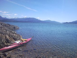
The waters the last few days have been relatively calm since returning to Bella Bella. I enter the narrow Princess Royal Channel this morning and Graham Reach within. The sky is bright and sunny for the first time in I don't know how long. I struggle with a fifteen to twenty knot headwind for most of the day, pausing for a break at the old cannery in Swanson Bay. What were once buildings reaching over the water are now nothing more than old rotted piers poking through the wet ground. Old, broken lumber litters the beach, and rusted iron pipes and machinery dot the shore. I try to find a trail through the thicket of rainforest to the old smokestack that stands sentinel above the site. Not wanting to shred my clothing, I return to my boat floating around the pier it's tied to as the tide grows ever higher.
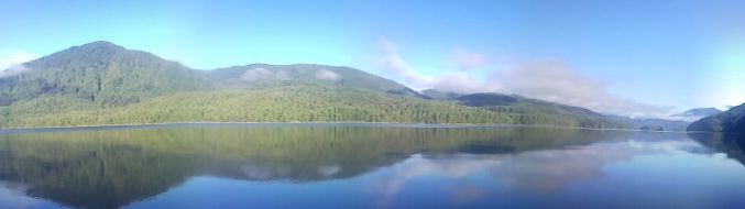 The most sun I've seen in over a month |
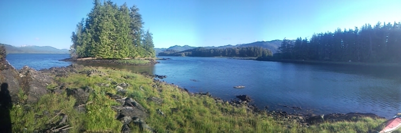
There are tall peaks three thousand feet high, choked with snow and thin ribbons of wispy clouds. Dizzying waterfalls pierce the thick rainforest and crash into the sea. I listen to the noisy rumble of the Canoona River on the other side of Princess Royal Channel as I break camp on this not-so-cloudy morning. The BC Ferry Northern Expedition makes a brief appearance is it dashes by, which I should see every couple days for the next week as it steams between Port Hardy and Prince Rupert. There's a harbor seal and pup nervously glancing at me as I pass by, and a mountain goat perched on a narrow shelf off on a distant peak. I land at a small creek to fill up some waterbags. A large private motor yacht passes in the distance and I think nothing of it. A few minutes later, I see a set of several very large wakes hurtling to shore from that boat. I try and stable my kayak, but it's too late. The boat's flung upside down and I hold it in place to keep the fragile fiberglass cockpit cowling off the sharp barnacles and granite rock. There's a half dozen items floating away as I right my swamped boat. I sponge out the water and head off to retrieve my waterbags and plastic food jars. Fortunately the Ursack bags with fifty plus pounds of food are still well secured, and nothing is lost—except for some missing gelcoat here and there. With the deep waters and steep shore, it was like a mini tsunami. The water appeared calm until the last few seconds. I reach the old 'town' of Butedale and dock my boat to have a look around.
 Butedale |
 |
I enter Wright Sound, with a maze of over half a dozen different channels merging together. A thick grey swag of fog slowly envelops Douglas Channel, and Mt. Jenkinson, thrusting thirty five hundred feet above the sea, is slowly consumed by an army of clouds.
"There's "normal", then there's "crazy", followed by "insane". Then way beyond all those categories is "Linger" —Rhodes Carter |
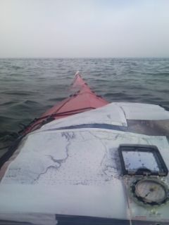
I'm in the water a little before 6am on this Fourth of July with calm seas that erupt into a whirlwind of waves coming at me from different directions. Tugboats pulling barges, a cruise ship, and pleasure craft throw off wakes that bounce off the steep walls, head a quarter mile to the other side, and hurtle back towards me. I paddle against the current with a stiff headwind and rough chop—Uhoh, what was that noise? Did I just break a rudder footpeg? My right foot slips forward as I brace against the rudder footpeg I use for steering and bracing in chop, or for extra power in my paddle stroke. Well, it looks like I'm not using that anymore. As late afternoon arrives, my shoulders are screaming for a break, and my body soaked from two days of wet weather. I pass Evening Point, where the tides meet in Grenville Channel from either side as they flow in from the open ocean and rush around Pitt Island. As I do that, tides reverse, a flood tide flows in, and I travel against the current again. I have a campsite on the other side of the channel up Kxngeal Inlet circled on my chart, but don't feel like crossing back over for a two mile detour. I spot what looks like a flat spot and check it out. No thanks, I don't want to wear the lifejacket in my tent if the rain gets any worse. A local on his way home to Hartley Bay, motoring in from Prince Rupert pulls up, curious to hear my story. I tell him my route, what I've seen for wildlife and weather the last several days, and everything else exciting. He's a tour guide specializing in wildlife excursions—the rare white bears and whales, and this summer will take a National Geographic crew out to film a documentary. We part ways and the winds only continue to blow me in the wrong direction. My map shows another small divot along the shore, so I'll see if that's anything that will work. I struggle through the chop and round the next point. I glance around the corner to a small sliver of land next to a creek. It's grassy, and several feet above the waterline (and high tide is in less than two hours). Is it full of rocks and mud, maybe too uneven ground; bear tracks? There's got to be a catch. I hop out of the boat and take a quick look. This works. I don't bother with cooking again, which would require an epic bushwack into the rainforest to avoid the steady breeze. As for the broken footpedal, I use a couple sticks and some p-cord (parachute cord—the ubiquitous name for all purpose lightweight cord in the backcountry) to lash the broken aluminum footpeg to the rail, which might do the trick for a while.
The winds pick up considerably a little after seven this morning as I paddle with the current. It's been a struggle today, even before the current runs against me later this morning. I stop in a small, grassy cove this afternoon to wait out the winds. I've only managed to average a mile an hour as I battle the headwinds racing up the straight-as-an-arrow channel. I spot an old, abandoned wooden pier the size of a dump truck washed up into the forest, made from five foot diameter old growth trees as I stretch the shriveled legs stuffed in the cockpit for too long. I lie down and take a brief nap, eager to rest up for early morning starts to beat the winds.
 |
The air screams early this morning, and I anxiously check the latest weather. Gale warnings today through the next four days. I sleep in and wait for high tide to nudge my boat now a hundred feet from water. I head out of my protected cove and power upwind. I spend most calm days going without the boat's rudder, avoiding the extra drag; although now slightly more challenging in these conditions. The chop grows to several foot high waves as Telegraph and Arthur Passages throw everything they have at me. The bow of the boat porpoises up and down like a see-saw on a busy playground. I inch my way ever closer to Bloxam Island as waves continue to toss me around. The water in front of me suddenly looks less chaotic as I near shore. I reach Gibson Island in mid afternoon and stare at a world of untamed whitecaps filling the horizon. I start looking for a campsite sheltered from the menaceing Telegraph Passage. With a high pressure ridge sitting on top of Hecate Strait, the weather should stay dry, so I decide to sleep under the stars tonight. This is the only crystal clear sky I've seen this summer, and I take off my shirt for a little sun and some vitamin D.
 The changing landscape as high tide slowly staggers in |
With the threat of being skunked again from strong winds, I'm up a little after 4am and on the water at five. I gentle breeze starts to blow as I drag the boat over the slimy rockweed to the water's edge. There's a fog bank slowly building to the west as I push off and head to Marrack Island. A blanket of white throws itself all over me as I start the crossing to Kennedy Island. I take a compass bearing and follow it for the mile to the other side.
 This morning's fog |
The channel is busy with shipping traffic, and strung out in front of me are the BC Ferries Northern Expedition and Northern Adventure, and the Alaska Ferry Taku, all of which I rode for the roundtrip to Juneau from Bella Bella. I squeeze past a large container ship with a tugboat at hand spinning it in a hundred eighty degree turn. Nearby, another container ship is unloaded by the giant cranes moving its cargo to the waiting freight train. There's another four grain ships in queue for their turn as I inch my way along the crowded channel. There's not another port (that I'm aware of) along the BC coast, other than Vancouver, that has a rail line out to the sea. The dizzying, unbroken chain of the Coast Mountains makes transportation to the interior a challenge, with the wide Skeena River Valley a rare exception.
Prince Rupert, BC
I land at a small public dock down the street from the hostel I'll stay in tonight. I stare at the four kayaks crowding the end of the dock as I unload the seven drybags from my boat and squeeze most of them into my backpack. Are these thru-paddlers? Back in Butedale, Phillip told me about the four he met paddling to Alaska. Maybe it's them. I amble my way to the hostel, passing a couple machine shops and aluminum welting fabricators. I meet the hostel owner Christy and and begin waterboarding my salt encrusted gear. I dunk the drysuit, give the backpack a good rinse, and wipe down gear that has inhaled inordinate amounts of saltwater from a leaky drybag. The weather is warm and sunny, and I throw much of my gear onto the clothesline hanging off the second story. I head back down to the aluminum fabricators and end up with new bombproof footpegs
riveted to the rudder track. I still have thirty pounds of food leftover from the Costco run in Juneau, and pick up the few remaining items I need at the grocery.
The clouds are back in town this morning as I pack up and head down to Cow Bay. I set out across the harbor and follow narrow, twisting Venn Passage. There are kelp choking the shallow waters I've never seen before. They look similar to bull kelp, attached to the seafloor, and might have something to do with the nutrients found in the Skeena river. I maneuver around the many shoals jetting out from the stark shore like fine, narrow fingers. There's a whale noisily slapping its tail around as light rain comes and goes. There's a yellow dot I spot across the kelp field growing ever larger with each paddle stroke. I notice a narrow object slowly pass up and down like a see-saw—a paddle! I meet Lance, who biked from Seattle to Haines, Climbed Mt. Logan, and now on his way back, by kayak. We're both surprised to see other paddlers, share stories about our routes, and head off in opposite directions into the grey abyss. I pass the Indian fishing village of Port Simpson as dusk comes and goes and finish at Dudevoir Channel as small ribbons of light are all that remain.
Setting up camp on some rock outcrop in the dark wasn't fun, but I was determined to do some miles yesterday despite leaving town at the crack of 2pm.
 Getting that thing down from last night's high tide to this morning's low tide should be exciting |
 Getting that thing down from last night's high tide to this morning's low tide should be exciting |
 Continue to
Southern Alaska
Continue to
Southern Alaska