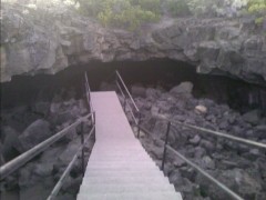
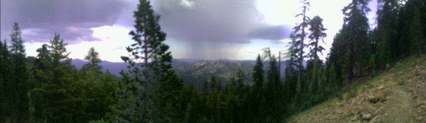
Belden, CA
The trail descends to Belden Town, which is nothing more than a small restaurant and store, and a few RV sites. The place is in the middle of a substantial renovation, doubling its size and adding a large wrap around deck. Steve and Bethany are on their way out, and they give me a bag of extra food from their maildrop to add to the hiker box at the Braaten's.
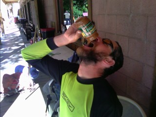 Mmmm, baking-in-the-sun hot, liquid peanut butter! |
Most of the morning was spent climbing up to the ridge, with temperatures rising quite quickly.
 |
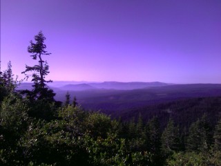
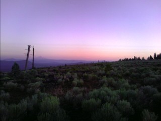
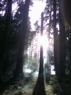
I heard the crashing and thrashing of deer nearby as the sun started to cast its dull glow onto the surrounding valley this morning.
 |
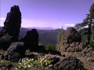
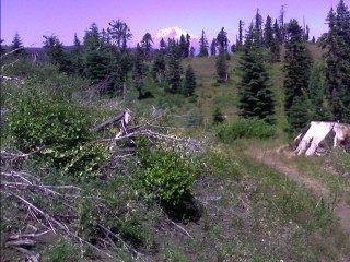
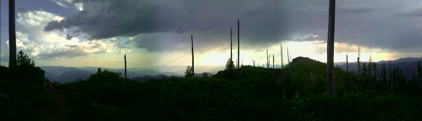
 Halfway to Canada! |
Chester, CA
A couple bananas, a half gallon of OJ, a half pound burger with the works,
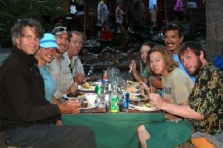
a quart sized milkshake, complete with pineapple, chocolate chunks, raspberry, and coconut, and I feel great. An older individual invites me to join him at his table. "Did you see someone on a motorbike heading down the road at Cold Springs yesterday?" he asks, with a curious look on his face. "Yes, was that you?" I respond. Wow, I saw him in the middle of nowhere, and now we're sitting at the same table dozens of miles away. The thermometer at the bank nearby is reading in the low 90s, and the shade under this umbrella here at the Pine Shack Frosty's picnic table makes this the perfect place to rest on this warm day. Twelve Percent shows up, and we struggle to down the plentiful portions of food. I get a call back from Kickstep and Annie, and the two of us are invited to stay in their motel room. As I start to digest, we meet Bonanza Jellbean and Abear, and head over to a pizza joint next door. I planned maybe an appetizer, and end up settling for a medium pizza and all-you-can-eat salad bar. As I desperately struggle to finish my eating feat, I get call from Bonanza Jellbean. We're celebrating the Trail's halfway point—we're going bowling. The game was fun, a bit frightening witnessing a trip and fall, or a throwing of the ball after a mad dash to the foul line. Nate, a friend Bonanza met working at a restaurant in Sierra City is here too, and gave us a ride back to the trailhead at 11pm. There was some arguing, and some words exchanged when Twelve Percent found a heavy steel padlock attached to the outside of his backpack. He refused to carry it to the next town, and ended up cutting a strap after the perpetrator refused to unlock it. Just another of the many jokes played on fellow hikers.
I was on the trail a little before 6am today, and entered Lassen National Park. I met I Spy and Booty shortly before heading down to Terminal Geyser.
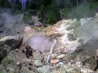 Terminal Geyser (actually a fumerole) |
 Mmmm! Pic courtesy of Bonanza Jellybean |
We're joined by Bonanza Jellbean and Abear, who camped nearby at the Warner Valley Campground, and blew off the idea of an early start. We down some quiche for breakfast, and hit up the breakfast bar inside for the oatmeal and fruit. We begin the journey to the end of the Park, on the flat, smooth trail to Twin Lake.
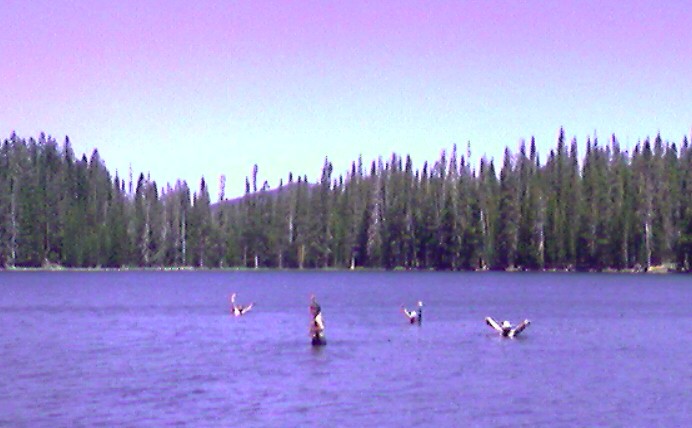 Near 100 degree heat, and 60 degree water. |
Old Station, CA
Wasn't I just in town? They keep coming by so fast! I see Kickstep as we head out to the highway and the small Hat Creek Store and order up the Trail Burger, complete with potato salad, milkshake, and all the fixins'. Trail Angel Firefly calls the store at closing time to see who's still here. We have a ride to their home in the country a few miles away, and arrive to see a good dozen or so others readying for dinner. Known as Hiker Hideaway, the Heitman's have been hosting hikers for years. I even saw Firefly at the Kickoff Party back in April. We struggle through another large meal, and hang out in the shop at the back of the garage, everyone sharing their exciting stories about their thru-hike with their horse, or section hike.
It's a lazy morning, catching up on sleep, typing the last several days of journals, doing laundry, and enjoying a hefty breakfast. I peer at the new faces that have arrived today, and listen to the stories. I ask a hiker what year he did the AT and Colorado Trail. Before he has a chance to complete his sentence, I blurt out "Foxtrot, is that you?" "Yes it is" he responds with a friendly smirk. Wow, I briefly hiked with him on the Colorado Trail eleven years ago. It's in the 90s a little before noon, and the next trail segment is the infamous Hat Creek Rim. The temperature is a good fifteen degrees warmer up there, and there's no water for over thirty miles. I decide to get rid of the overgrown beard, which I had originally planned on whacking off at the Oregon border. But wait, we're all still celebrating the halfway point, and there's a trimmer here; I know, I'll shave half of it until I reach the next town in a couple days.
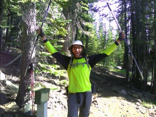
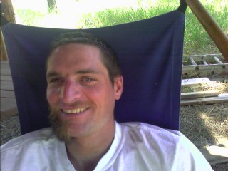 Uh oh, now what did I do? |
 The Subway Cave entrance |
I wake up early this morning for the over twenty mile waterless stretch. For the first time, I see Mt. Shasta, bathed in a dull alpenglow, commanding the northern horizon. The sun pokes its way up into the sky, and Mt. Lassen glows brightly behind me.
 Mt. Shasta on the horizon, seen from the Hat Creek Rim |
Burney, CA
It was eighty degrees when I decided to camp last night, and I feared it would be too warm to sleep comfortably. The temperatures dropped quickly as I devoured the rest of my food, and slept quite well. It's known as a tough hitch to get into town from here, with traffic racing down highway 299 at over fifty miles an hour. Within ten minutes, I have a ride from a local. A cabinetmaker, he did some work on the Heitman's place at Hiker Hideaway in Old Station many years ago. I stock up on groceries for the next four days, and down a premade salad and gigantic sub sandwich from the deli, a half gallon of OJ, and some bananas. There are several trucks headed down the highway, full of freshly cut logs headed to the mill. Moving in the opposite direction are finished wood products, nicely wrapped in shiny plastic, destined for markets around the country. I cross the busy highway at the crosswalk, and throw out my thumb; I've heard this isn't an easy hitch either. The light turns green, and the second car pulls over. Wow, a ride in less than five minutes! Don't forget I still have that ridiculous half shaved beard from celebrating the Trail's halfway point. Hitchhiking is like finding wildlife on the trail. The hiker a quarter mile further than me could see all sorts of wild creatures—a bear, mountain lion, maybe even a bobcat, while easily getting a ride to town that evening, while I see nothing but a couple birds, and wait four hours for my ride. It's all about being in the right place at the right time. As the temperature climbs, and my body gets zapped by the sun, my throat is starting to feel like it's coated with sandpaper. It's in the mid 90s at noon, and
everything I ate in Burney is commanding more water. My pack is loaded with almost a dozen pounds of food for the next stretch, and I didn't feel like hauling another seven pounds of water. I down the last of my quart, and struggle to survive the last few miles to Burney Falls State Park. I'm surprised when I find a water spigot at some trailside campsites, and quickly devour a half gallon. Down in the bone dry creekbed nearby, I suddenly hear the rush of water as it flows out of the ground and abruptly turns into a raging creek. I head to the Park's Visitor's Center, and sit at a shaded picnic table under an awning gently swaying back and fourth in the breeze. I fill up my water bottles and busily type away my journal as tourists shuffle around between the falls, campground, and visitors center. I slowly pack up after a nice break in the midday sun, dump a quart of water over my head, and trek on. I can again feel the several septillion watts of sun melting my brain when there's little shade. The locals say there's no end in sight for a definitive end to the heat wave that usually strikes for a week or two each year. I've been fortunate to have cool weather for so long, and just need to take midday breaks again that were required in Southern California. I soon approach a small, two inch long neon colored snake that quickly slides across the trail as it senses my presence. I reach a set of switchbacks, and descend down to Lake Britton. I cross the road over the dam to a construction crew busily cleaning up rockslides that have damaged the road and taken out some powerlines. I reach Rock Creek under the bright sun, and throw my fully clothed, overheated body into the cool waters. I sit there until I feel the chill within. I can feel my body's core getting colder as I start shivering uncontrollably as my watch reads ninety degrees in the shade. My soggy clothing quickly dries as I continue to the next water source almost ten miles away. I find a place to camp at dark, and struggle to fall asleep. It's still in the mid 60s at midnight, and whatever part of me isn't in my bag is swarmed by mosquitoes.
 Mt. Shasta again |
Alright, the breeze disappeared late last night, the bugs found me, and the temperature never dropped below 65 degrees. It wasn't the most pleasant of nights. I break camp as the sun starts to bathe Mt. Shasta in a dull red alpenglow, and hike my way around Grizzly Peak. I spot Mt. Lassen on the horizon to my south, bathed in bright sun, for maybe the last time, and work my way to the McCloud River. The water is ice cold, coming from the bottom of the dam upstream, but I still manage to take a quick dip. I meet I Spy and Booty, desperate to cool off on this ninety plus degree day. Pasta Alfredo and Sailor, who I last saw over a month ago at Vermillion Valley Resort, soon show up, and as evening approaches, we all push on several more miles up the ridge.
 |
Castella, CA
Regrettably, just before I got into the car with Pasta Alfredo and Sailor, I blew right by the Sacramento River, with a nice swimming hole directly below me under the bridge, eager to get into some shade and figure out what I'm going to do next. To compensate, I down a half gallon of ice cream to cool off. I start asking motorists filling up for gas if I can get a ride into Dunsmuir, or the town of Mt. Shasta.
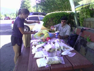 Pasta Alfredo and Sailor sorting food maildrops for the hundred miles to Etna |
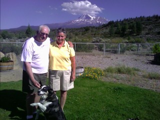 Emory and JoAnn, and Mt. Shasta again |
I'm not going anywhere this morning. By the time I get on the trail, I'll be climbing the forty five hundred feet of vertical to the ridge in 90 degree heat. No thanks. I slept in this morning, something I don't think I've done in ages, and caught up on emails on their home computer. As I backed up my files and viewed a video I shot on my PDA phone, something bad happened. My camera application crashed, and I lost this file, and the last few days of journals. Sigh, I guess I know what I get to do now. As early evening quickly rolled around, they asked me what I wanted to do. The were eager to have me around another day, show me the town, and the area around the Fourteener Mt. Shasta. I wanted to stay, and continue to rest the sore soles of my feet, and the PTT Tendon, but I also have to push myself to move on. I get a ride back to the trail at 7pm, and head up into Castle Crags State Park.
It's JoAnn from the miserably hot Lake Shastina (102 at 6:30). This is the longest, hottest spell I can remember in the 30 years I've lived in Siskiyou County. I am so sorry for you hikers :( —JoAnn and Emory |
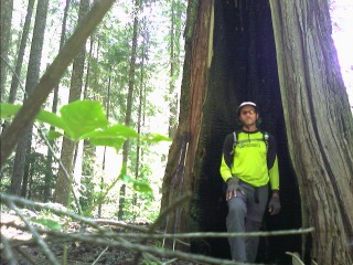
I'm in the Trinity Alps now, following the winding trail that smoothly contours through the many drainages and ridges of the popular area. I gaze at the distant Mt. Lassen, barely poking above the hazy horizon, and see a pile of bear scat covering trail every mile or two. With a few hikers a half day or more ahead, and tons more behind, I'm going to stop. It's that time again, 6pm, and I've found a nice camping spot perched in this wide, treeless saddle. As I write this with a gentle breeze blowing through my hair, under a cloudless sky, Mt. Shasta is looming directly ahead of me, many miles away. As darkness approaches, I can see the flash of lights as climbers build camp on the lower flanks of the fourteen thousand foot peak. A meteor burns up high in the earth's atmosphere as I see the shooting star streak across the starry sky. The Summer Triangle is directly above, with Vega, Deneb (the Northern Cross), and Altair burning brightly millions of miles away. It's a but cooler tonight, and I hope for a good night's rest.
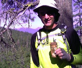 Olympia Beer - in the steel can (I passed an old can dump) |
Mt. Shasta is surrounded by a sea of red and orange as the earth rotates towards the sun at a thousand miles an hour. I leave camp as the sun pokes above the horizon, and again traverse along the often sparsely treed forests. Views are everywhere, with the town of Mt. Shasta coming into view every now and then as a small dot on the valley floor many miles away. I've been sitting in a shaded spot just above the trail for a couple hours now. My watch reads a pleasant 70 degrees as noon approaches. There are ants and flies everywhere; some the size of a head of a pin, others the size of one of those huge oval vitamins. I just had to get a few out of my pants, and many more are crawling or flying into my food bag. I finish the day on another lofty overlook watching the sun casually slide below the jagged horizon. It was another hot afternoon, but it's become pleasant, with a gentle breeze to boot. As I sit here under these bright blue skies, I'm starting to wonder what kind of miles need to be done to finish this trail by the end of September. Let me do some calculations on this thing... I have 1094 miles left, and 60 days to finish before the last week of September. That comes out to a little more than 18 miles a day. Yeah, that makes sense. I hadn't put any thought into that yet. Not long ago, being barely more than halfway done, I thought I really had to keep moving to finish before October, when the snow starts to fly. Forget it! If I don't feel like leaving town, then I'm not leaving town. If I only want to do seventeen miles, I'm only gonna do seventeen miles. This is great. I've only done five Zero Days—I'm doing one in Etna.
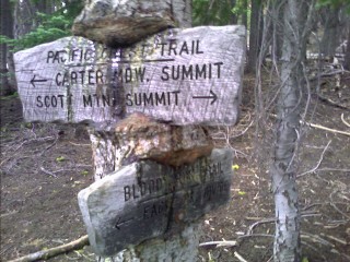 |
The ants seem to be getting bigger around here, I feel like enough of them could easily carry me away, with my remnants never to be seen again. At dusk last night, there was the nearby "Moo", as several cattle climbed over the ridge to the next meadow. As late morning approached, I reached the seldom used highway at Scott Summit. There were logging trucks turning off the dirt road every twenty minutes or so as Trouble and I sat and had lunch under a nice shady tree at the end of the parking lot.
I was lacking enough water for the ten mile stretch (there's a lot of these around here), and stopped for a long break at the first creek. I downed a gallon of water in an hour... who is that? "Abear, I haven't seen you in a few days" I blurted out with a mouth full of food. He's also taking his time, waiting for a couple of hikers to catch up. What the—is that... Kickstep? "What are you doing back here? There was a wide grin on his face when he saw me, expecting me to be days ahead. "Yeah, Annie and I took a couple Zeros in the town of Mt. Shasta". They have a wedding in mid September, and are planning on almost no Zero Days and consistent miles to finish on time. I figured they were in Ashland, OR by now, partying with Buck-30, who is several days ahead. We head on, with clouds, which I haven't seen in ages, building above.
 Clouds? Rain? Haven't seen that in over a month! |
I'm on the trail a little before 7am, but first make a few shoe modifications to accommodate a bone spur rubbing against the dirt choked inside of my shoe. I reach Scott Summit late morning, and see section hiker Trouble thinking about a change of plans. He doesn't fly back home for a few days, and wants to hitch a ride into Etna and slackpack the next twenty miles. Not paying attention to my Data Book, which contains water source information, I unknowingly pass by the last water source for the next ten miles. I've been drinking a half quart at every water source this morning, which were spaced every couple miles or so. I'm not too concerned, with the early morning sun still too low in the sky to create any heat problems. I take a break in the afternoon, and Kickstep and Annie pass by. The dull chatter of thunder is in the air again, and it's soon followed by a dousing of rain and hail here in the Russian Wilderness. I throw up my umbrella on my pack, which I've only used once before in the High Sierras after Woods Creek, and enjoy the cool temperatures I haven't seen for so long. My pants are quickly soaked from passing small creeks densely packed with wet alder bushes choking the narrow trail corridor. I hope this doesn't mark the beginning of a long fire season, with closed sections of trail and a sky choked with smoke and haze. I had m share of that on the CDT. I turn around at the sound of a yelp, and its... Twelve Percent. We catch up on each other's hiking adventures, and soon reach Disco and Skipper taking a break. I change socks again, hoping to alleviate the sore, red hotspots forming on my feet—forming from the constant pressure and chafing of my shoes pounding onto the dusty trail over thirty thousand times a day. A few miles from the highway, it gets worse, much worse. A new one forming on my heel has made it almost impossible to move without a limp. In just the last thirty minutes, it has gone from a nuisance to a throbbing pain with every step. If I don't deal with it now, it's going to take almost a week to heal. The friction of walking simply tears away the moleskin I have carefully padded around the problem spot, and Disco catches up and offers me some bombproof tape that should keep things together. The damage is done, and I need to take any and all pressure off the offending piece of wattled, ruddy skin. I have extra socks; what happens if I stick them under my heel? I give it a try, and the problem area is now above the heel cup, and free from banging against the back of my shoe. While definitely not comfortable, I'll at least make it to the highway. I recently drank the last of my water for the two mile descent to the seldom used road, and need to hitch a ride into town before darkness approaches. I limp my way to the pavement, and see Pasta Alfredo and Sailor returning to the trail after a several hour long break in town. I missed their ride headed back into Etna, and wonder if I'm going to make it. She gives me the rest of their ice cream they enjoyed, and I down it as I wait for the hum of a car headed up the road. I see the shimmer of light reflecting off the brightly painted metal heading in this direction, and quickly run up to the side of the road and throw out my thumb. The old beat up pickup truck pulls over, and I'm relieved. Emily's headed back to work as a firefighter for the Forest Service, and happily gives me a ride. I have no idea where anyone is in the small town, but have her take me to the local brewery—I'm sure I'll find hikertrash there.
Etna, CA
I cautiously limp my way inside, and see Abear and Twelve Percent, and town local Eric that gave them the ride into town. Eric shows us the two ounces of gold he's collected over the last week, and I hold the two thousand dollars worth in the palm of my hand, feeling the soft metal press against my trail hardened flesh. As they finish off the last of their dinner, I quickly order up today's special before the kitchen closes, slam down a couple glasses of water, and enjoy a tasty malted beverage—a strong malted beverage they won't serve in a large glass. We limp over to the "Hiker Hut", a bed and breakfast that has converted an old barn into a hostel, and don't see anyone we know. I car passes by, and Ido waves at us, just getting into town. Another local pulls over to see if we need anything. We take the offer of a ride, and I head to the local park to set up camp. I don't feel like dropping $20+ for just a bed tonight. I'll check in early tomorrow somewhere.
I get up early this morning and slowly limp my way the short distance into town. A good day off my feet should help me recover. I head over to a bench on Main Street and start catching up on my journals. As 8am approaches, the activity around town starts to pick up; storefronts open, traffic increases, and USFS fire and hotshot crews start to pass through town to the nearby facility. I call the post office in Seiad Valley to have my package of Oregon maps held at the store, since I'll likely be there on a Sunday. Kickstep and Annie show up, and have a ride back to the trail before we even get to talk—and the ride is from Eric the Red's mom, hanging out in town waiting for him to show up in the next few days. After almost three hours on this bench, I stumble across the street and check out the small town. I meet Ido and Trouble, and one tells me the Hiker Hut is great, and the other says the training center dorm is the place to stay. Drake Travis, the owner of a local store overhears us and tells me I can stay in his parent's home down the street. Before I have a chance to make up my mind, I'm in his truck headed to their home. Like most locals, he's amazed with what we're doing out here, and gives me a quick tour of the home; the upstairs, fridge, hot tub, etc. I've been pretty lazy today, napping, resting, and looking through the maze of files I have on this PDA. I'm sorting through resupply information for Oregon and Washington, seeing where I can buy groceries, and where I need to send maildrops. I get a call from Abear, with the playful scream of children in the background. There's a few of them at the town pool, trying to stay comfortable in the 100 degree heat. As evening rolls around, Drake's father Urban heads home from work. The dusty clothes make it evident he doesn't have a desk job. He's been a logger, and preacher, for the last few decades, traveling the world giving talks, and now traveling the backcountry trucking logs to nearby sawmills. A couple hours later, I head off to the local brewery to meet some hikers for dinner. Twelve Percent, Abear, and Bonanza Jellybean—Jellybean? She's caught up after her climb of Mt. Shasta. They're in the middle of a game of Scrabble they brought in from the dorm they're staying at. I Spy and Booty arrive, Ido and Bob Dole show up, and here comes Trouble (yes, literally). Everyone is ready to leave the forever lasting state of California. Some are quite anxious, talking about it every day, and others are just ready knowing it will be August, with cooler weather. There is the usual laughter in the air, and we even have our waitress in tears—from laughing too hard. There's talk of the southbound thru hiker (who I'd just missed) with his mule, traveling 19th century style, complete with old cookware and moccasins as footwear. There is also the talk from southbound section hikers about the pair of mountain lions that have been supposedly stalking hikers up near Etna Summit.
 This is about the closest I've come to a PCT cougar sighting |
I head out this morning and walk to the other side of town. I find a shady place to put out my thumb, and sit on the edge of the road. There's a house right across the street, and I see a man open the front door and head towards me. Is he unhappy with me hitching in front of his home? He approaches me and asks me the usual questions—where did I start, where am I from, etc. If he wasn't headed to Medford this morning, he'd take me up to the trail. Fifteen minutes later, a car races up the road and blows right by me. I hear the squeal of brakes, and it turns around. A couple of high schoolers poke their head out the window, and ask if I'm a PCT hiker. "Get in" they reply, as they point their thumbs to the back seat. They drop me off the ten long miles up the road to Etna Summit, and head off to their fishing destination. My feet are still store, but better. It's warm again today, and the air is stagnant and hazy. I pass over a saddle, and gaze down at Man Eaten Lake nestled down in the basin. At 6,300 feet, there are still patches of snow clinging to the water's edge. I see smoke rising from a ridge in the distance, and figure it's a smoldering trunk coming to life after being hit by lightning in the last few days. I approach the burn area over the next several miles with a bit of caution, and surprisingly, pass right through the prescribed burn. There's a cleared out area for the helicopter landing zone, large bags of fifty to one hundred gallons of water, and miscellaneous gear strewn about.
 Fire! |
for the first time in several days, it was cool last night, cool enough to sleep comfortably. I glance down at my ground cloth, and there are ants everywhere, dozens, maybe hundreds of the small things. I carefully shake them off of everything I own as I put the contents into my pack. I arrive at a water source this morning and see Mike and Naomi stopped for a break. We catch up on each other's adventures as we reach the last high point on the way down to the Klammath River on this first of August. I do most of the almost 5,500 foot descent into the hot Seid Valley this afternoon, and at the second bridge crossing over Grider Creek, I reach a milestone—1,000 miles left on the PCT. I celebrate, and cool down, in the ninety something degree heat by dunking myself in the creek. There's the usual loud yelp ad gasp as I get in the chilly waters. Not wanting to overheat again any time soon, I sit there until I feel my body start to shiver. The first couple miles are a bit cold, and it feels great. I reach the small Grider Creek Campground, not much more than a few flat areas, picnic tables, and an outhouse. Other hikers come in every twenty minutes or so, including I Spy and Booty, Bams, Bob Dole, Ido, Donuts, Man Down, and Mike and Naomi. The temperature never dips below the mid 70s, and the mosquitoes are out in force. I'm never able to feel comfortable tonight, and to make things worse, I hear the dull crash of thunder getting closer with every boom. I throw my tent up at 11pm, and soon hear the pitter patter of rain splashing against my single walled shelter. Today is the first day of August, and I reflect on everything July has meant to me. Unfortunately its most noticeably the bugs and heat. That should slowly fade away now, as they subside, and we soon pass into Oregon and mentally enter a new state of mind.
I catch up to I Spy and Booty, and we follow the half dozen miles of roadwalking to the highway bridge and across the Klammath River. We've been munching on plenty of blackberries growing like weeds on the side of the road for the last several miles as we approach the small store.
Seiad, CA
So here we are, the last town stop in California—or as the locals call their Northern part of the state, the State of Jefferson. Man Down, I Spy and Booty, and I head inside for some breakfast. This place was featured on the Travel Channel as one of the best places to pig out. And pig out means one thing; the Pancake Challenge. The challenge consists of five pancakes, each one a pound.
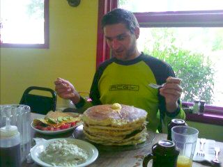 Warning! Successful completion of the Pancake Challenge will result in severe internal injuries! |
 |
It's another day of stop-and-fix-the-feet-every-two-hours.
 |
I set up my tent late last night after feeling the splash of raindrops on my face. It was all but impossible to see what the clouds were doing, but played it safe. Not long after starting this morning, I reach a small piece of recklessly torn in half plywood, the tattered piece nailed to a tree. "Welcome to Oregon" is scribbled across the front, along with mileage figures to Washington and Canada. On the bottom, it states this is temporary; the official sign has been vandalized, and will be replaced by the PCTA. "Well, that sucks!" I think to myself. In pen, there is a note about the trail register being up the hill a hundred feet. That's strange; a border crossing and register in different places? I take a self portrait and head on. I reach the trail register, in it's fixed metal weatherproof container, and... there's the "official" state line crossing! It looks like someone's playing a little game with us! Clever. I page through several years of hikers signing their thoughts and names into the notebook, and many pages, or parts of pages jotted on and scattered about in the container. Unfortunately I've been too slow to keep up with others, and I'm here by myself, but the real celebration occurs in Ashland—how, I have no idea, but this town stop will be fun. I look back and reflect on the last seventeen hundred miles of hiking. Wow. I'm in Oregon, is there a chance I'm still in Southern California dreaming all of this up as my brain goes into shock from extreme heat and lack of water? No, I peer up at the treetops, listen to the twitter of birds, and feel the gentle breeze blowing in my face—I'm here. I pass along the backside of Mt Ashland, and soon find myself limping again—this time from a different issue. The modifications I've made to my disintegrating orthotics seem to be working for my PTTD. I fill up my old boxed wine gallon water bag at a spring, and continue along to a nice shaded spot. I pour copious amounts on my salt and dirt encrusted feet and rub them, chafed and rubbed raw, clean. I throw on a fresh pair of liner socks and head on. This time I cruise along much faster than before. I turn off the flight mode of my PDA and retrieve my phone messages. Kickstep and Annie are headed to dinner in thirty minutes, and I can crash on the floor of their motel room, but I still have a half dozen miles to go. I head on further than I'd originally planned, until I find a flat place to camp. I traverse along the steep slope and settle on a small spot with the whine of Interstate 5 below me.