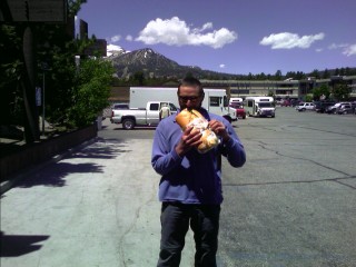
Fulfilling my gastronomic whim
Mammoth Lakes, CA
The first thing I did was take the town trolley to the grocery store for resupply, and to refill by body's energy reserves—drained by thirteen days of no new food and rationed intake.
Fulfilling my gastronomic whim |
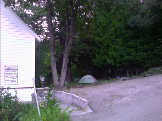
Today was a recovery day, with the movie theater playing something no one was interested in, and my food was already purchased for the next leg of my journey. I spent most of the morning trying to nap, since I was tossing and turning most of last night. I pulled out the PDA phone, and started looking at thirteen days of pictures. I busily moved them from my PDA to the MiniSD Memory Card, resized those that you see here on my website, spell checked my typing, and caught up on a few days of journaling. I spent a good amount of time on the phone with Verizon, seeing if I could find a newer phone to replace this one with the bad keyboard. After a good hour or so, with no progress, other than the option of spending close to four hundred dollars for a new model, I gave up and politely ended the call. I played with this one and created a few workarounds for the nonworking keyboard keys. I've also reminisced about the last two weeks in the woods. I've only crossed one road since Walker Pass a half-month ago (the trail doesn't cross the road heading to Vermillion Valley Resort or Mammoth Lakes, they're on side trails), I never really broke out into a sweat—there were always cool temperatures or a breeze in my face. The change in trail from hot, dry desert to endless snow, raging rivers, difficult trail conditions, fickle weather, cold, and everything else thrown out at us has left me with a dichotomy of emotions. Every day brings something new, something different. Usually I can't even begin to describe what was so special about the day, even though I know it's changed me in a certain small way. Today is that day to reflect on those last two weeks, to realize why I'm still out here, what I've learned, and why its been so special. Now that I've had the time to excogitate about my adventure, it's time for Happy Hour.
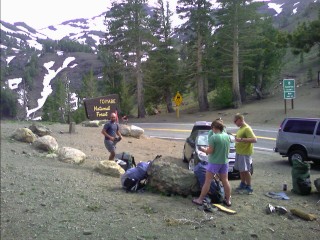
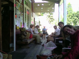
Buck-30 and I head over to the Whiskey Creek and are soon greeted by another twenty hikers.
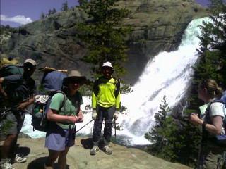
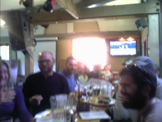 Ahh, food, fun, and beverages |
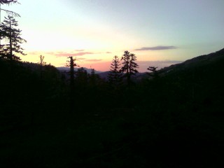
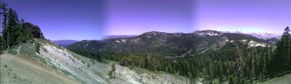
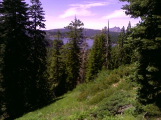
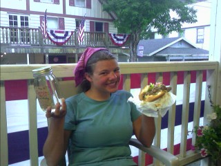
The sun is shining brightly on this twenty-fourth of June, and Buck-30 and I put down a footlong sub, and I throw another one in my pack as we slowly work our way out of town. We wait in line for the shuttle to Red's Meadow, chock full of tourists on their way to Devil's Postpile National Monument. We arrive back to Red's Meadow early this afternoon, and there are several hikers stocking up on calories; eating ice cream bars and cones as we get ready to head into Yosemite National Park tomorrow. I down my sub and head on my way. Buck-30 follows the JMT route, since he's done the trail before (his wife is hiking the AT right now) which diverges from the PCT for the next fifteen miles. With heavy treecover, and zero chance of sunburned legs, I decide to wear shorts for first time on this hike. Heck, I was hiking naked three days ago, I don't need long pants. The mosquitoes were the worst yet, and stopping to get water was a excruciating experience. I reattach the legs to the zip-off shorts and continue on. I meet Princess Leia later in the day at Thousand Island Lakes where the two trails converge. She finishes up her dinner and we try to head to a suitable campsite as the sun drops behind the jagged horizon. There is a light sprinkle as a cloud develops and then quickly disappears at our 10,000ft elevation.
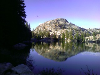
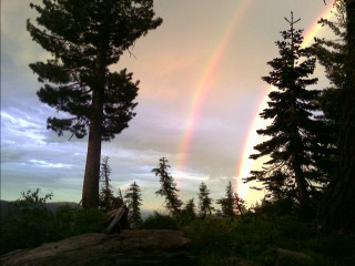
 Rainbow above Emerald Lake |
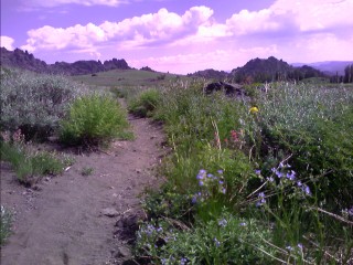
We're all breaking camp a little after 6am, and a few minutes later the sun strikes our camp and starts to warm our chilled bodies. We start the long climb up to 11,056ft Donohue Pass, and enter Yosemite National Park, passing over the usual wet ground
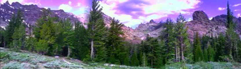
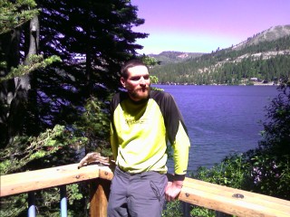
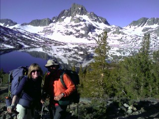 Mike and Naomi, and Banner Peak towering in the background |
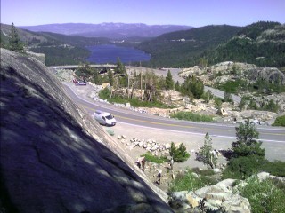
We all lazily wake up this morning and head over to the Park store at 9am. I stock up on a week's worth of food, and a bottle of 100 percent DEET, for the long stretch to Lake Tahoe, charge my PDA in an electrical outlet, and start feasting on whatever else looks good. I join almost a dozen other thrus at the picnic tables, full of ice cream, sandwiches, cookies, and sodas strewn about for breakfast. I continue to feast on some cheap microwave meals I find in the small freezer, a half gallon of OJ, and a few oatmeal packets. It's well after 11am already, and I decide to leave the fun and excitement of sharing stories with the other hikers, and slowly pack up my belongings. I cross Highway 120, the Park road, and this is the first time the trail has crossed a road since Kennedy Meadows, almost two hundred forty miles ago.
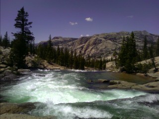 Tuolumne Falls |
 Tuolumne Falls again |
The morning started out with a ford across Virginia Creek, and the trail continued its wild ride up a thousand feet or more to the top of a ridge, and back down a thousand feet to a creek. There are just enough bits of snow to make the hike slow going and a bit annoying. The terrain is breathtaking, but it's all starting to look the same—big granite mountains and trees. I see the shimmering Benson Lake below me, and head to th valley floor. The last quarter mile of trail has been in dense forest, and the mosquito larve have hatched. The bugs were tolerable until I forded the waist deep Piute Creek, and my pleasant walk has turned into a fight for survival. I bought some 100% DEET at the Tuolumne Meadows store, but figure once I climb a few hundred feet out of the valley, I'll stop donating blood against my will—not to mention this not-so-safe compound will be getting into my skin for the next five days. I start to jog my way up to Seavey Pass with the black cloud still all over me. I reach the top of the 1,620 foot climb, and things improve. There's only a handful of skeeters on me as I wind my way around some small lakes.
 |
The rough trail continues, likely from heavy horse use, with its ups and downs heading over the ridges and down to the creeks. There is a crossing of Kerrick Creek, which is known to be a bit challenging. I wade in, and quickly realize this PDA, and the PCT camera could easily get wet from what looks like waist deep water. I head back to shore, and put the electronic gadgets and paper maps in the top of my pack. Birdnut and True arrive, and True is quickly up to her thighs, and can't proceed an further. Birdnut heads upstream, and finds a newly fallen tree across the creek. We trudge up to the large, dead trunk and easily cross above the churning waters a few inches from our feet.
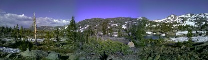 Heading towards the volcanic peaks on the left, and leaving the granite, tectonic peaks on the right |
Journaling last night was impossible, and cooking? Forget it. Lunchable and Kickstep decided to starve, and Naomi and Mike ate by stuffing food under their headnets. I've used my tent a few times, so why now? Let's just say that was a mistake. I was nicely tucked in my bag, headnet draped over my face, and the half block of cheese I had earlier has put my digestive system into overdrive. Ten minutes later, I was uncomfortably warm. I wiggled my bag down to my waist, with my layers of fleece keeping them off my chest, and tucked my hands into my fleece top. My hands were only exposed for a few minutes, and they were covered with the darn things. I constantly swatted at them, and a half dozen would fall to the ground each time. This has been the warmest night on the trail, and unzipping my sleeping bag is not an option, with the loud eerie buzz right next to my head.
There are dozens and dozens of dead mosquitoes all over my groundcloth. There is a mad dash to leave camp before bugs get an worse. after several miles, I turn up the West Fork of the West Walker River Valley into the Emigrant Wilderness and begin the long climb up towards the jagged, volcanic peaks that lie ahead to above ten thousand feet. I stop to apply sunscreen late in the morning, and glance off to my right. There's a bear feeding on the rich vegetation that lines the creek in the meadows below. The trail begins the long climb up to the crest of the Sierras, and stays at its loft heights for the next several miles.
 |
Bridgeport, CA
I feel like we're a bunch of clowns as the seven of us struggle to get out of the car, with the packs and bulky bear canisters falling out as the doors are opened. We hand out packs that are piled high in the backseat with us, and slowly struggle to get out of the car with numb legs and
already fatigued bodies. Naomi and Mike head off to find their parents visiting them in town, and the rest of us find a place to stay for the night. We find a room in the small town, and gaze at the historic buildings, with prisoners busy hanging banners for the Fourth of July celebrations in less than a week.
There is a case of Giardia, or other water borne illness in our group, and thanks to Naomi's dad, a medical doctor, prescriptions are in hand for treatment... but there's no pharmacy for fifty miles around, and the nearest is in Mammoth Lakes. It looks like there's a road trip to Mammoth. I'm a bit anxious to get back on the trail, but there's a few things I could get done in town, so why not? We begin the hour long journey past the road heading to Yosemite National Park, and past the large Mono Lake. We continue through the rolling hills and reach Mammoth Lakes. Gee, this place looks familiar, I think we were here a week ago. Prescriptions are filled, we hit the grocery store, and of course, hit a couple fast food joints. It is mid afternoon, and we head back out of town. The sky has been overcast most of the day, and there is a quick dribble of light rain ever now and then. We head back up towards the top of Sonora Pass, and follow the twisting, narrow road up and down its twenty five plus percent grades and reach the top.
 Packing up for the next stretch to Lake Tahoe |
I was up early this morning, on the first day of July, with pleasant temperatures and no wind. The terrain is so different than before, with mountain ridges the trail weaves in and out of on the way through the Carson-Iceberg Wilderness. Kickstep and Lunchable catch up to me this evening, with no sign of Buck-30 yet.
 |
I catch up to Kickstep and Lunchable as we pass below heaping outcrops thrusting into the bright blue skies. There's still no sign of Buck-30—did his wife convince him to hike with her on the Appalachian Trail she's on right now? Did he perish in his tent from a mosquito giving him the West Nile Virus? Did the mosquitoes carry him away? I stop to air out my blackened feet and have some lunch under the towering volcanic peaks with snowmelt fed streams rushing all around me.
 |
We were up early this morning for the hike into town.
 |
South Lake Tahoe, CA
Buck-30 headed on, not wanting to deal with such a spread out town; he was here on his last thru hike. I saw a note on a message board about some hikers that wanted to share a room in town, with prices triple or more for this busy holiday weekend. The small road heading down from the lake to the highway is deserted, with the store closed, and tourists gone. There was an older couple returning from a hike, and I asked them if they were headed to town. They were headed in the opposite direction, but I asked if I could yogi a ride out to the main road. They weren't overly enthusiastic about taking me to the highway, probably never picked up a hitchhiker before, until I told them about my trek. They dropped me off at the busy highway, excited to have heard my story. I shared a small room on this 3rd of July with Bonanza Jellybean, Censored, Lucky Larry, and Avo. I didn't exactly want to be up until well after 2am, but at least I had a place to stay in town.
I don't seem to be alone with what my body is going through. Avo has been smearing petroleum jelly on his feet and placing them in a plastic grocery bag to keep his feet hydrated. Zero days seem frequent around here, and everyone seems to be having some sort of issue their dealing with. I left the motel room around 9am and started taking care of my list of chores. I headed across the street to a shopping complex and looked for a shoe store. There were two sporting goods stores, one selling a limited selection of footwear, and I headed on. The next one had the same model I have waiting for me in Belden, but I didn't feel like shelling out $90. I heard there was a factory outlet strip mall on the other side of town, and added that to my to-do list. I downed a footlong sub for breakfast, met Iceaxe wandering around town after spending time with his parents, and wanted to say I was in Nevada this summer. Being stuck in only three states for almost five months, I had to set foot I anther. I walked into Nevada, and quickly turned around after looking at the monstrous casinos towering on either side of me. I bought a $6 bus pass to wander around town, and headed to the outlet stores on the local's side of town near the "Y". My shoes are shot, and the fact I hiked over six hundred miles on a pair of New Balance running shoes isn't bad. With missing tread, and broken down EVA foam soles, my feet are out of alignment, giving me a minor case of tendonitis in the right foot. If not taken care of now, I will be continuing to Canada with crutches instead of trekking poles. Another hiker mentioned an Adidas Outlet here, and I noticed a large tent set up next to the store. The place was packed, with shirts, and pants flying around as people rummaged through the large bins of clothing... and shoes! I was a but dumbfounded at the strange assortment of shoes. Some looked more like soft ski boots, complete with removable liners and flashy colors. Others looked like something from a Dr. Seuss book. Despite the wild selection of strange shoes, I managed to find several pair of runners. Some had those springy looking contraptions under the heel, which would probably last a couple weeks on the PCT, others were size 14+, and there were a few I had to try on. This one's too narrow, too tight on the top of the foot, the flex isn't right... wait a minute, let me walk around the tent in these, carefully trying not to bump into the wall to wall mass of bargain shoppers. Ok, I've found what I'm looking for. I paid my $25 and headed off to do my next chore.
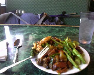 Plate number three |
I can't leave a town with an all-you-can-eat buffet. I haven't been to one yet, and I've told myself I can't leave town without consuming 10,000 calories—which I'll burn in less than two days. I'm sure the ones at the casinos are good, but at $30 a pop, along with the 4th of July crowds, no thanks. I head down the road and start my eating adventure at the Chinese buffet. In a little more than an hour, I finished my three huge plates. Since it didn't take three hours this time, there was no waitress eyeing me with a dark look, or wildly waving her finger, telling me you've been here for three hour, you must leave!. I need to take it easy, let my stomach settle for a bit... Hey, there's a laundromat. I washed my clothes, and put on all my damp layers to dry them during the mid day heat. There's a grocery store a block away, and I stocked up for the three day jaunt to I-80/Donner Pass, and downed a half gallon of OJ, quart of ice cream, and some bananas. I'm done with my errands, the phone calls, I still need to pay off medical bills piling up at home, but I only seem to have cell service during the weekends when I'm in town. I left some messages, and decided to stick around for the fireworks. Why not relax down here instead of trying to do miles when I should be resting? I get a new battery for my watch, get invited to spend the night in a backyard if the need arises, and work my way to Nevada Beach for the fireworks.
The fireworks were nothing special last night, and I found a ride to the bus terminal, where I waited a good hour for the bus to the "Y" on the other side of town. After trying to hitch a ride towards Echo Lake, I called it at 1:15am, and camped next to a tent at some art and craft fair across the street. My body seems slow to repair itself. I felt like I had one huge, itchy rash all over me, and was painfully annoying, a nightmare bothering me for hours at a time. It was from the hundreds of mosquito bites I've gotten since Mammoth Lakes—and they've never bothered me until now. I got back up to Echo Lake, and again followed the Tahoe Rim Trail I've been mostly on for the last ten miles or so. I've been on the trail for two months as of today, and today feels slow.
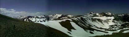
 Lake Tahoe, and the Deslation Wilderness to the right |
This morning I cut out some pieces of moleskin to get my orthotics to fit these new shoes better, creating a heel post on one side. I camped in an exposed area last night to get away from the seemingly deadly bugs hiding in the dark forest below. The wind picked up late in the night, coating everything in fine layer of dust and grit. I blew my nose, only to have that black too. I don't want to know what it did to my lungs. Most of the several lakes I pass have freshly hatched mosquitoes flying in circles above the trail. I reach camp, and as I type this, there is some large beast breaking branches and huffing in the distance. I can hear its hooves striking the ground when it runs.
I push the eighteen miles to the old Highway 40, with high winds blowing me around like a shredded windsock.
 The Person's home |
Truckee, CA
Bill takes a few of us into Truckee this morning for some grocery shopping and post office duties,
telling me about the dozen plus ski areas the lie in and around the basin. He has been a part of Ski Patrol for years, still doing it occasionally. I send ahead a box of food to Belden, and return to finish the last of my errands. A hiker calls for a ride in this afternoon, and that's my cue to get ready. My pack is in the car, and we head up Old Hwy 40 to the pass. Its in the mid 60s at noon, and continues to be breezy on the higher ridges.
 I-80, Truckee, Donner Lake, Old Highway 40, rock climbers, tourists, and the old railroad. |
The ground was frozen this morning as I woke up and traversed along the cold, shady north slopes.
 Jackson Meadow Reservoir, and Sierra Buttes in the background |
Sierra City, CA
It's a little before 7pm, and I limp my way out to the highway. I have a ride within a few minutes on the lightly traveled road, and get dropped off at the town church. There are a handful of other hikers setting up camp on the grass lawn the church lets us use.
 Camping in town |
Ok, pack up camp, get something to eat, and get outta here. That was the plan, but it's 7pm, and I'm still here. Steve and Bethany, and Day Late have departed, and another dozen or so have arrived.
 Sierra City hiker headquarters |
 Bonanza Jellybean with a little Moonshine, and the Triple Gut Buster Burger |
I'm up early this morning, and quickly find a ride to the trailhead as the streets become busy with mountain bikes. I start the long climb up towards Sierra Buttes as the morning sun starts striking the cold ground. I can see the town a good two thousand feet below me as trek around the base of the volcanic plug. There are old mining roads I cross, old holes blown in the ground from mining prospects over a hundred years ago, and a stiff breeze blowing up here. I can see Mt. Lassen on the horizon, with its snow covered peaks poking into the sky. I descend to a small paved road to find the tail end of the bike race still in progress. Cow bells are ringing, people are cheering, and racers are struggling to make it to the town of Downieville.
 Looking back at Sierra Buttes |
 |
I was greeted to the dull roar of thunder early this morning, with the southern sky filled with angry, dark clouds hovering overhead. I was on the trail early, eager to get out of the wind, which never did subside last night. There was a quick shower here and there as the bank of clouds grew above me. As quickly as they appeared, they were gone, replaced with blue skies, and the stubborn wind that's so prevalent around here.
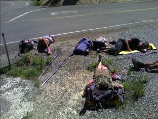 Taking naps in the gravel—although 'massage beads' sounds better |
There's a long climb up from the river through the forested hillsides to the ridge. The heavy treecover has made hiking under the sunny skies quite pleasant, but every step through the fine dirt creates a cloud of the stuff that coats everything. My feet are almost solid black from the amazing amount of dirt being kicked up, and I don't want to know what hiking behind others has done to my lungs. Most have taken the roadwalk into the Bucks Lake area, and I decided to follow the trail and avoid the temptation to visit more restaurants, which quickly raises the cost of my hike higher than what I care for. I peer back at the distant Sierra Buttes, now just a small hump on the horizon. The bugs have gotten quite bad again, now that I'm traveling along creeks and ponds. I push further then I originally planned, and finish my day on a breezy outcrop with a few less bugs.
I begin the day with a long five mile, four thousand foot descent to the town of Belden, which consists of a small post office, and a small general store/restaurant within a mile of each other. Besides that, the only thing else is the Braaten's.